TopoQuest Logo
Do you find TopoQuest useful?
Help keep TopoQuest running and adding new maps/features by donating!
Bitcoin:  19c7KJd3qBynnjoSw5npx9KScwjBe4ifkT
Litecoin:  LXs6TkuXGGXo1vDsWCkWVdjQX94eUKd6ui
Home View Maps Find Maps Find Places Resources & Links


Fremont West, Ohio Topographic Map

USGS Map Title: Fremont West, OH
USGS Map MRC: 41083C2
DRG (GeoTIFF) Download: o41083c2.tif


Neighboring USGS Topographic Map Quads:


  Elmore, OH  
41083D3
 

  Lindsey, OH  
41083D2
 

  Wightmans Grove, OH  
41083D1
 

  Helena, OH  
41083C3
 

  Fremont West, OH  
41083C2
 

  Fremont East, OH  
41083C1
 

  Bascom, OH  
41083B3
 

  Tiffin North, OH  
41083B2
 

  Watson, OH  
41083B1


Map MRC Location:

N42°
W84°
N42°
W83°
H8 H7 H6 H5 H4 H3 H2 H1
G8 G7 G6 G5 G4 G3 G2 G1
F8 F7 F6 F5 F4 F3 F2 F1
E8 E7 E6 E5 E4 E3 E2 E1
D8 D7 D6 D5 D4 D3 D2 D1
C8 C7 C6 C5 C4 C3 C2 C1
B8 B7 B6 B5 B4 B3 B2 B1
A8 A7 A6 A5 A4 A3 A2 A1
N41°
W84°
N41°
W83°

Fremont West, OH USGS 1:24K Topographic Map Preview:
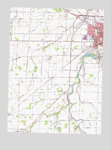
Fremont West, OH USGS Topographic Map
Click on map above to begin viewing in our Map Viewer.

This topographic map contains these locations and features:
Feature Name Type Latitude Longitude GNIS ID View Map
Anderson FieldParkN41.3612°W83.1358°1056089View Map
BallvillePopulated PlaceN41.3278°W83.1321°1064376View Map
Ballville Census Designated PlaceCensusN41.3269°W83.1368°2393326View Map
Ballville Township HouseBuildingN41.3120°W83.1302°1056090View Map
Ballville Township Volunteer Fire DepartmentBuildingN41.3211°W83.1309°2549305View Map
Birchard ParkParkN41.3451°W83.1280°1038053View Map
Bowlus CemeteryCemeteryN41.3713°W83.1490°1963233View Map
Bowlus CemeteryCemeteryN41.3532°W83.1746°1038226View Map
Church of Christ Apostolic FaithChurchN41.3612°W83.1308°1067701View Map
Church of the NazareneChurchN41.3562°W83.1258°1731012View Map
Decker CemeteryCemeteryN41.2664°W83.1316°1039637View Map
East Branch Wolf CreekStreamN41.2728°W83.1796°1039951View Map
Faith ChurchChurchN41.3739°W83.1760°1068202View Map
First Baptist Church of FremontChurchN41.3676°W83.1316°1067703View Map
Fourmile House CemeteryCemeteryN41.3669°W83.1760°1040621View Map
Fourmile House CornerPopulated PlaceN41.3728°W83.1766°1048754View Map
Fremont AirportAirportN41.3349°W83.1666°1082696View Map
Fremont Baptist ChurchChurchN41.3573°W83.1433°1067698View Map
Fremont Fire Department Central StationBuildingN41.3515°W83.1251°1731013View Map
Fremont Memorial HospitalHospitalN41.3390°W83.1346°1056108View Map
Gabels CornerPopulated PlaceN41.3273°W83.1969°1048764View Map
Gillmor Airport (historical)AirportN41.2828°W83.1480°1082697View Map
Gilmore BridgeBridgeN41.2631°W83.1571°1065844View Map
Golden Gate EstatesPopulated PlaceN41.3644°W83.1306°2678410View Map
Grace Brethren ChapelChurchN41.3612°W83.1316°1067702View Map
Halters CemeteryCemeteryN41.2898°W83.1763°1041255View Map
HavensPopulated PlaceN41.3059°W83.1927°1062807View Map
Havens Post Office (historical)Post OfficeN41.3056°W83.1930°2056991View Map
Hayes CemeteryCemeteryN41.3398°W83.1302°1963238View Map
Highland Jersey FarmsLocaleN41.3569°W83.2331°2628466View Map
Hill CemeteryCemeteryN41.2634°W83.1674°1041580View Map
Hite CemeteryCemeteryN41.2684°W83.1902°1963239View Map
Indian CreekStreamN41.3001°W83.1574°1066043View Map
Lakota East Elementary SchoolSchoolN41.2976°W83.2366°1056106View Map
Ludwig CemeteryCemeteryN41.3237°W83.1966°1042830View Map
Lutz Elementary SchoolSchoolN41.3314°W83.1424°1081593View Map
Memorial Hospital HeliportAirportN41.3392°W83.1355°1082698View Map
Memorial United Methodist ChurchChurchN41.3531°W83.1255°1067699View Map
Mill Mobile Home ParkPopulated PlaceN41.3650°W83.1381°2678424View Map
Mount Pleasant Baptist ChurchChurchN41.3562°W83.1258°1067700View Map
Mull Covered BridgeBridgeN41.2606°W83.1844°1043727View Map
Oakwood CemeteryCemeteryN41.3298°W83.1385°1044067View Map
Ohio State Highway Patrol - Fremont Patrol PostBuildingN41.3680°W83.1430°2733131View Map
Otis Elementary SchoolSchoolN41.3545°W83.1480°1081739View Map
Our Lady of the Pines SchoolSchoolN41.3312°W83.1252°1056111View Map
Portage Trail ParkParkN41.3214°W83.1530°1056113View Map
Potter Village Shopping CenterLocaleN41.3592°W83.1385°1056114View Map
Ruhl RidgeRidgeN41.3701°W83.1813°1067213View Map
Rutherford B Hayes Presidential Center LibraryBuildingN41.3414°W83.1294°1056115View Map
Saint Anns CemeteryCemeteryN41.3309°W83.1305°1045377View Map
Saint Casimir Catholic ChurchChurchN41.3526°W83.1380°1067697View Map
Saint Casimir SchoolSchoolN41.3526°W83.1388°1068239View Map
Saint Josephs CemeteryCemeteryN41.3331°W83.1307°1045571View Map
Saint Marys CemeteryCemeteryN41.3245°W83.1974°1045659View Map
Sandusky CountyCivilN41.3574°W83.1439°1074084View Map
Sandusky Scenic River State Access AreaParkN41.2773°W83.1663°1056118View Map
Shawl CemeteryCemeteryN41.3325°W83.2121°1046153View Map
Spiegel Grove State ParkParkN41.3414°W83.1299°1046530View Map
Stony PrairiePopulated PlaceN41.3514°W83.1552°1867469View Map
Stony Prairie Census Designated PlaceCensusN41.3457°W83.1521°2393249View Map
Sycamore Hills Golf CourseLocaleN41.3459°W83.1888°1056119View Map
Terra Community CollegeSchoolN41.3648°W83.1258°1056121View Map
Township of BallvilleCivilN41.2971°W83.1305°1086907View Map
Township of JacksonCivilN41.2976°W83.2443°1086912View Map
Vanguard Vocational and Technical CenterLocaleN41.3648°W83.1280°1084081View Map
Washington ChapelChurchN41.3631°W83.2371°1047586View Map
Washington Chapel CemeteryCemeteryN41.3603°W83.2380°1047587View Map
Winters DitchCanalN41.2884°W83.2024°1048011View Map
Winters StationPopulated PlaceN41.2770°W83.2355°1084110View Map
Wolf CreekStreamN41.2803°W83.1680°1048028View Map
Wolf Creek ParkParkN41.2664°W83.1660°1056126View Map
Word of Faith Fellowship ChurchChurchN41.3284°W83.1327°1067696View Map
Young's Colonial AcresPopulated PlaceN41.3633°W83.1342°2678411View Map

Note: Coordinates in the location and feature list above are referenced to NAD83 datum.


Copyright (C) 2008-2025 Ryan Niemi / Sunset Dynamics ... All Rights Reserved