TopoQuest Logo
Do you find TopoQuest useful?
Help keep TopoQuest running and adding new maps/features by donating!
Bitcoin:  19c7KJd3qBynnjoSw5npx9KScwjBe4ifkT
Litecoin:  LXs6TkuXGGXo1vDsWCkWVdjQX94eUKd6ui
Home View Maps Find Maps Find Places Resources & Links


Tiffin North, Ohio Topographic Map

USGS Map Title: Tiffin North, OH
USGS Map MRC: 41083B2
DRG (GeoTIFF) Download: o41083b2.tif


Neighboring USGS Topographic Map Quads:


  Helena, OH  
41083C3
 

  Fremont West, OH  
41083C2
 

  Fremont East, OH  
41083C1
 

  Bascom, OH  
41083B3
 

  Tiffin North, OH  
41083B2
 

  Watson, OH  
41083B1
 

  New Riegel, OH  
41083A3
 

  Tiffin South, OH  
41083A2
 

  Bloomville, OH  
41083A1


Map MRC Location:

N42°
W84°
N42°
W83°
H8 H7 H6 H5 H4 H3 H2 H1
G8 G7 G6 G5 G4 G3 G2 G1
F8 F7 F6 F5 F4 F3 F2 F1
E8 E7 E6 E5 E4 E3 E2 E1
D8 D7 D6 D5 D4 D3 D2 D1
C8 C7 C6 C5 C4 C3 C2 C1
B8 B7 B6 B5 B4 B3 B2 B1
A8 A7 A6 A5 A4 A3 A2 A1
N41°
W84°
N41°
W83°

Tiffin North, OH USGS 1:24K Topographic Map Preview:
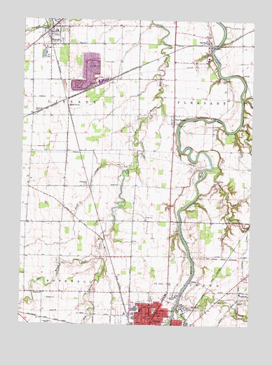
Tiffin North, OH USGS Topographic Map
Click on map above to begin viewing in our Map Viewer.

This topographic map contains these locations and features:
Feature Name Type Latitude Longitude GNIS ID View Map
Abbots BridgeBridgeN41.2098°W83.1455°1065845View Map
Abbotts IslandIslandN41.1870°W83.1519°1037301View Map
BettsvillePopulated PlaceN41.2464°W83.2358°1064434View Map
Bettsville Elementary SchoolSchoolN41.2448°W83.2333°1055674View Map
Bettsville Fire Department and Emergency Medical Services DepartmentBuildingN41.2416°W83.2347°2550529View Map
Bettsville High SchoolSchoolN41.2451°W83.2321°1055675View Map
Bettsville Police DepartmentBuildingN41.2418°W83.2348°2732697View Map
Bettsville Post OfficePost OfficeN41.2473°W83.2360°2045552View Map
CenterPopulated PlaceN41.1423°W83.1577°1048591View Map
Church of the BrethrenChurchN41.1303°W83.1755°1831869View Map
Clinton Elementary SchoolSchoolN41.1384°W83.1302°1055681View Map
Clinton Township Volunteer Fire Department Station 1BuildingN41.1355°W83.1407°2550363View Map
Crissa CemeteryCemeteryN41.2257°W83.2233°1730841View Map
CromersPopulated PlaceN41.1817°W83.2149°1056851View Map
Crum DitchCanalN41.1403°W83.2005°1060674View Map
East Branch East Branch Wolf CreekStreamN41.1528°W83.2066°1039939View Map
Eells ParkParkN41.2348°W83.2383°1040093View Map
Fairmont CemeteryCemeteryN41.1353°W83.1779°1040316View Map
Feaselburg CemeteryCemeteryN41.2123°W83.2435°1040402View Map
Fort SenecaPopulated PlaceN41.2092°W83.1688°1064666View Map
Fort Seneca BridgeBridgeN41.2070°W83.1641°1065846View Map
Fort Seneca Census Designated PlaceCensusN41.2043°W83.1680°2628892View Map
Fort Seneca Community United Church of ChristChurchN41.2064°W83.1680°1070131View Map
Fort Seneca Post OfficePost OfficeN41.2084°W83.1694°2045557View Map
Fravel CemeteryCemeteryN41.1693°W83.1819°1040659View Map
Hite CemeteryCemeteryN41.2328°W83.2175°1041625View Map
Hopewell CemeteryCemeteryN41.1356°W83.2355°1041774View Map
Hopewell ChurchChurchN41.1376°W83.2383°1056342View Map
Hull AirportAirportN41.2480°W83.1952°1082499View Map
Linden (historical)Populated PlaceN41.2173°W83.2266°1055694View Map
Maple GrovePopulated PlaceN41.2148°W83.2258°1061468View Map
Maple Grove Post OfficePost OfficeN41.2153°W83.2263°2045551View Map
Memorial ChurchChurchN41.1306°W83.1594°1831879View Map
Morrison CreekStreamN41.1378°W83.1619°1066101View Map
Mount GileadPopulated PlaceN41.1809°W83.2374°1060681View Map
Nature Trails ParkParkN41.1259°W83.1696°1055697View Map
Oakley ParkParkN41.1312°W83.1769°1044061View Map
Old FortPopulated PlaceN41.2401°W83.1499°1065473View Map
Old Fort Census Designated PlaceCensusN41.2419°W83.1514°2628948View Map
Old Fort Elementary SchoolSchoolN41.2345°W83.1494°1055699View Map
Old Fort High SchoolSchoolN41.2339°W83.1496°1055700View Map
Old Fort Post OfficePost OfficeN41.2403°W83.1499°2045563View Map
Old Fort United Methodist ChurchChurchN41.2414°W83.1649°1073221View Map
Old Fort Volunteer Fire Department Station 1BuildingN41.2406°W83.1539°2550362View Map
Old Fort Volunteer Fire Department Station 2BuildingN41.2391°W83.1500°2550316View Map
Pleasant Union CemeteryCemeteryN41.2256°W83.1427°1044583View Map
Shiloh CemeteryCemeteryN41.1823°W83.1974°1730862View Map
Shiloh ChurchChurchN41.1823°W83.1985°1046217View Map
Snuff CreekStreamN41.1892°W83.1924°1046411View Map
Spicer CreekStreamN41.1898°W83.1460°1066219View Map
Sugar CreekStreamN41.2064°W83.1321°1046796View Map
Tiffin Airport (historical)AirportN41.1420°W83.1738°1083047View Map
Tiffin Apostolic ChurchChurchN41.1295°W83.1844°1070137View Map
Tiffin CampLocaleN41.1742°W83.1566°1047058View Map
Tiffin Development CenterHospitalN41.1314°W83.1610°1055713View Map
Tiffin Drive-InLocaleN41.1819°W83.1669°2633576View Map
Tiffin Fire and Rescue Division Station 2BuildingN41.1290°W83.1790°1831872View Map
Tiffin Full Gospel Church (historical)ChurchN41.1295°W83.1844°1831888View Map
Township of LibertyCivilN41.2102°W83.2457°1086949View Map
Township of PleasantCivilN41.2120°W83.1305°1086951View Map
Village of BettsvilleCivilN41.2441°W83.2339°2398113View Map
Willow CreekStreamN41.1323°W83.1646°1047953View Map
WTTF-AM (Tiffin)TowerN41.1256°W83.2319°1083751View Map
WTTF-FM (Tiffin)TowerN41.1389°W83.2458°1083885View Map

Note: Coordinates in the location and feature list above are referenced to NAD83 datum.


Copyright (C) 2008-2024 Ryan Niemi / Sunset Dynamics ... All Rights Reserved