TopoQuest Logo
Do you find TopoQuest useful?
Help keep TopoQuest running and adding new maps/features by donating!
Bitcoin:  19c7KJd3qBynnjoSw5npx9KScwjBe4ifkT
Litecoin:  LXs6TkuXGGXo1vDsWCkWVdjQX94eUKd6ui
Home View Maps Find Maps Find Places Resources & Links


Whites City, Montana Topographic Map

USGS Map Title: Whites City, MT
USGS Map MRC: 46111F4
DRG (GeoTIFF) Download: o46111f4.tif


Neighboring USGS Topographic Map Quads:


  Snedaker Basin, MT  
46111G5
 

  Lingshire, MT  
46111G4
 

  Ellis Canyon, MT  
46111G3
 

  Hellgate Gulch, MT  
46111F5
 

  Whites City, MT  
46111F4
 

  Watson, MT  
46111F3
 

  Canyon Ferry SE, MT  
46111E5
 

  Diamond City, MT  
46111E4
 

  Boulder Baldy, MT  
46111E3


Map MRC Location:

N47°
W112°
N47°
W111°
H8 H7 H6 H5 H4 H3 H2 H1
G8 G7 G6 G5 G4 G3 G2 G1
F8 F7 F6 F5 F4 F3 F2 F1
E8 E7 E6 E5 E4 E3 E2 E1
D8 D7 D6 D5 D4 D3 D2 D1
C8 C7 C6 C5 C4 C3 C2 C1
B8 B7 B6 B5 B4 B3 B2 B1
A8 A7 A6 A5 A4 A3 A2 A1
N46°
W112°
N46°
W111°

Whites City, MT USGS 1:24K Topographic Map Preview:
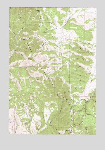
Whites City, MT USGS Topographic Map
Click on map above to begin viewing in our Map Viewer.

This topographic map contains these locations and features:
Feature Name Type Latitude Longitude GNIS ID View Map
Benton Gulch MineMineN46.6499°W111.3814°804622View Map
Bilk MountainSummitN46.6641°W111.4664°779906View Map
Campbell CreekStreamN46.7088°W111.4314°780869View Map
Cayuse MountainSummitN46.6744°W111.4516°794797View Map
Greens GulchValleyN46.7180°W111.4252°784314View Map
Hereford GulchValleyN46.7286°W111.4266°784794View Map
Horse GulchValleyN46.6274°W111.4564°785046View Map
Hour GulchValleyN46.6544°W111.3914°785097View Map
Humming Bird MineMineN46.6283°W111.4122°785152View Map
Hummingbird MineMineN46.6277°W111.4133°802667View Map
Johnnies GulchValleyN46.6349°W111.4414°785517View Map
Left Hand Fork White GulchValleyN46.6580°W111.4241°786032View Map
Lind CreekStreamN46.7297°W111.4250°786170View Map
Little Bridge CanyonValleyN46.6583°W111.3886°786253View Map
Long GulchValleyN46.6752°W111.3889°786523View Map
Nary Time GulchValleyN46.7216°W111.4902°787914View Map
Needham GulchValleyN46.7061°W111.4927°787921View Map
Needham Gulch MineMineN46.7072°W111.4925°802669View Map
Needham MountainSummitN46.6994°W111.4733°787922View Map
Ohio GulchValleyN46.6608°W111.3814°788393View Map
Park GulchValleyN46.6344°W111.4441°788641View Map
Priest GulchValleyN46.6699°W111.3925°789187View Map
Ready Cash GulchValleyN46.6366°W111.3966°789428View Map
Rocker CreekStreamN46.7149°W111.4269°789715View Map
Schabert MineMineN46.6311°W111.3914°802666View Map
Schabert MineMineN46.6313°W111.3908°790110View Map
SE SE Section 26 MineMineN46.6797°W111.4397°802664View Map
Skiddoo GulchValleyN46.6794°W111.3808°790586View Map
Spring CreekStreamN46.7288°W111.4355°791217View Map
Swede GulchValleyN46.7308°W111.4769°791804View Map
Thompson CreekStreamN46.7277°W111.4991°792085View Map
Tick GulchValleyN46.7113°W111.4886°792158View Map
Tucker GulchValleyN46.7155°W111.4877°792437View Map
Whites CityPopulated PlaceN46.6341°W111.4430°793234View Map
Whites Post Office (historical)Post OfficeN46.6341°W111.4430°1762165View Map

Note: Coordinates in the location and feature list above are referenced to NAD83 datum.


Copyright (C) 2008-2025 Ryan Niemi / Sunset Dynamics ... All Rights Reserved