TopoQuest Logo
Do you find TopoQuest useful?
Help keep TopoQuest running and adding new maps/features by donating!
Bitcoin:  19c7KJd3qBynnjoSw5npx9KScwjBe4ifkT
Litecoin:  LXs6TkuXGGXo1vDsWCkWVdjQX94eUKd6ui
Home View Maps Find Maps Find Places Resources & Links


Henderson, New York Topographic Map

USGS Map Title: Henderson, NY
USGS Map MRC: 43076G2
DRG (GeoTIFF) Download: o43076g2.tif


Neighboring USGS Topographic Map Quads:


  Point Peninsula, NY  
43076H3
 

  Henderson Bay, NY  
43076H2
 

  Sackets Harbor, NY  
43076H1
 

  Stony Point, NY  
43076G3
 

  Henderson, NY  
43076G2
 

  Adams, NY  
43076G1


  Ellisburg, NY  
43076F2
 

  Sandy Creek, NY  
43076F1


Map MRC Location:

N44°
W77°
N44°
W76°
H8 H7 H6 H5 H4 H3 H2 H1
G8 G7 G6 G5 G4 G3 G2 G1
F8 F7 F6 F5 F4 F3 F2 F1
E8 E7 E6 E5 E4 E3 E2 E1
D8 D7 D6 D5 D4 D3 D2 D1
C8 C7 C6 C5 C4 C3 C2 C1
B8 B7 B6 B5 B4 B3 B2 B1
A8 A7 A6 A5 A4 A3 A2 A1
N43°
W77°
N43°
W76°

Henderson, NY USGS 1:24K Topographic Map Preview:
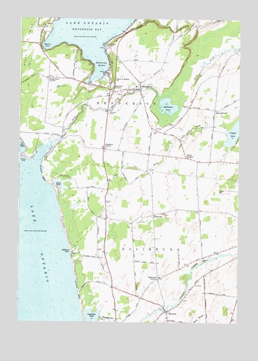
Henderson, NY USGS Topographic Map
Click on map above to begin viewing in our Map Viewer.

This topographic map contains these locations and features:
Feature Name Type Latitude Longitude GNIS ID View Map
Alexander CornersLocaleN43.8212°W76.2021°942303View Map
Aspinwall CornersLocaleN43.8470°W76.1963°942649View Map
Bigelow CemeteryCemeteryN43.7758°W76.1451°943964View Map
Bishop CemeteryCemeteryN43.8389°W76.1537°944042View Map
Bishop StreetLocaleN43.8378°W76.1391°944052View Map
Black PondLakeN43.8064°W76.2273°944167View Map
Carpenter CemeteryCemeteryN43.8364°W76.1993°945885View Map
Clark CemeteryCemeteryN43.8289°W76.1724°946749View Map
Cornell's MarinaHarborN43.8527°W76.2032°2615020View Map
Crystal LakeLakeN43.8290°W76.1269°970050View Map
Deer Run DairyLocaleN43.8439°W76.1394°2703580View Map
Dodge FarmsLocaleN43.7978°W76.1619°2702871View Map
El Dorado BeachBeachN43.8106°W76.2372°949445View Map
Gallea CemeteryCemeteryN43.7799°W76.2047°950852View Map
Graham Creek CanalChannelN43.8525°W76.2000°2105958View Map
Hammond CornersLocaleN43.7681°W76.1705°952123View Map
Harbor View MarinaHarborN43.8629°W76.2021°2615026View Map
Harbor's End MarinaHarborN43.8491°W76.2102°2615027View Map
HendersonPopulated PlaceN43.8470°W76.1819°952585View Map
Henderson Census Designated PlaceCensusN43.8480°W76.1850°2584266View Map
Henderson Fire District BuildingBuildingN43.8461°W76.1810°2718351View Map
Henderson HarborBayN43.8556°W76.2066°952587View Map
Henderson HarborPopulated PlaceN43.8648°W76.2019°952588View Map
Henderson PondLakeN43.8391°W76.1657°952593View Map
Henderson United Methodist ChurchChurchN43.8465°W76.1843°2616456View Map
Hungerford CornersPopulated PlaceN43.8506°W76.2335°972638View Map
Jefferson ParkPopulated PlaceN43.7784°W76.2188°953966View Map
Lake Ontario Mariners MarinaHarborN43.8507°W76.2107°2615034View Map
Little Stony CreekStreamN43.7940°W76.2269°955707View Map
North CemeteryCemeteryN43.8715°W76.2371°958739View Map
North Sandy Creek BridgeBridgeN43.7553°W76.1660°2614963View Map
Queen of Heaven ChurchChurchN43.8498°W76.1958°962079View Map
Rural HillPopulated PlaceN43.7942°W76.1733°973029View Map
Sawyer PointCapeN43.8170°W76.2455°964546View Map
Scotts CornersLocaleN43.8176°W76.1549°964691View Map
Sheland FarmsLocaleN43.7969°W76.1311°2702782View Map
Southwich BeachBeachN43.7637°W76.2160°973928View Map
Southwich Beach State ParkParkN43.7634°W76.2147°973927View Map
Stoney Creek MarinaHarborN43.8197°W76.2393°2615047View Map
Stony CreekStreamN43.8148°W76.2413°966563View Map
Stowles CemeteryCemeteryN43.8001°W76.2002°966611View Map
Town of HendersonCivilN43.8560°W76.1871°979062View Map
Whites BayBayN43.8634°W76.2363°971157View Map
Woodside CemeteryCemeteryN43.7958°W76.1484°957456View Map
WoodvillePopulated PlaceN43.7545°W76.1652°971726View Map

Note: Coordinates in the location and feature list above are referenced to NAD83 datum.


Copyright (C) 2008-2024 Ryan Niemi / Sunset Dynamics ... All Rights Reserved