TopoQuest Logo
Do you find TopoQuest useful?
Help keep TopoQuest running and adding new maps/features by donating!
Bitcoin:  19c7KJd3qBynnjoSw5npx9KScwjBe4ifkT
Litecoin:  LXs6TkuXGGXo1vDsWCkWVdjQX94eUKd6ui
Home View Maps Find Maps Find Places Resources & Links


Sandy Creek, New York Topographic Map

USGS Map Title: Sandy Creek, NY
USGS Map MRC: 43076F1
DRG (GeoTIFF) Download: o43076f1.tif


Neighboring USGS Topographic Map Quads:


  Henderson, NY  
43076G2
 

  Adams, NY  
43076G1
 

  Rodman, NY  
43075G8
 

  Ellisburg, NY  
43076F2
 

  Sandy Creek, NY  
43076F1
 

  Boylston Center, NY  
43075F8
 

  Pulaski, NY  
43076E2
 

  Richland, NY  
43076E1
 

  Orwell, NY  
43075E8


Map MRC Location:

N44°
W77°
N44°
W76°
H8 H7 H6 H5 H4 H3 H2 H1
G8 G7 G6 G5 G4 G3 G2 G1
F8 F7 F6 F5 F4 F3 F2 F1
E8 E7 E6 E5 E4 E3 E2 E1
D8 D7 D6 D5 D4 D3 D2 D1
C8 C7 C6 C5 C4 C3 C2 C1
B8 B7 B6 B5 B4 B3 B2 B1
A8 A7 A6 A5 A4 A3 A2 A1
N43°
W77°
N43°
W76°

Sandy Creek, NY USGS 1:24K Topographic Map Preview:
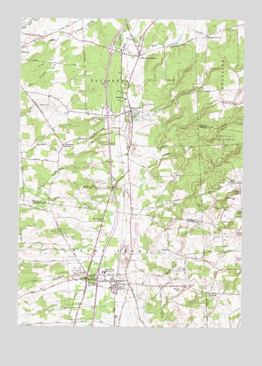
Sandy Creek, NY USGS Topographic Map
Click on map above to begin viewing in our Map Viewer.

This topographic map contains these locations and features:
Feature Name Type Latitude Longitude GNIS ID View Map
Annie Porter Ainsworth Memorial LibraryBuildingN43.6437°W76.0861°2715217View Map
Boylston Sandy Creek Wesleyan CemeteryCemeteryN43.6413°W76.0294°969068View Map
Brewster CemeteryCemeteryN43.6887°W76.1031°944700View Map
Cobblestone CornersLocaleN43.6987°W76.1002°946974View Map
CobbtownPopulated PlaceN43.7256°W76.0438°972329View Map
Cold Springs Golf CourseLocaleN43.6945°W76.0658°2615377View Map
Community ParkPopulated PlaceN43.6678°W76.0780°947237View Map
Green Haven Mobile Home CommunityPopulated PlaceN43.6529°W76.0883°2715164View Map
Haights CornersLocaleN43.7431°W76.0202°951994View Map
Hemlock Haven Tree FarmLocaleN43.6600°W76.0947°2542324View Map
Hi Hope FarmLocaleN43.7439°W76.1178°2702786View Map
Jacobs BrookStreamN43.6831°W76.1088°953905View Map
LaconaPopulated PlaceN43.6434°W76.0685°954867View Map
Lacona Post OfficePost OfficeN43.6422°W76.0702°2713525View Map
Lacona Volunteer Fire DepartmentBuildingN43.6460°W76.0674°2701338View Map
MannsvillePopulated PlaceN43.7128°W76.0627°956371View Map
Mannsville Free LibraryBuildingN43.7126°W76.0639°2617342View Map
Mannsville Manor Rescue SquadBuildingN43.7183°W76.0644°2718411View Map
Mannsville Manor Volunteer Fire Company Station 1BuildingN43.7122°W76.0628°2734734View Map
Mannsville Manor Volunteer Fire Company Station 2BuildingN43.7182°W76.0645°2734735View Map
Maplewood CemeteryCemeteryN43.7111°W76.0604°956481View Map
North BoylstonPopulated PlaceN43.6837°W76.0055°972853View Map
Pierrepont ManorPopulated PlaceN43.7351°W76.0588°960363View Map
Pierrepont Manor Census Designated PlaceCensusN43.7373°W76.0596°2584283View Map
Saint Frances Xavier Cabrini ChurchChurchN43.6409°W76.0689°2714775View Map
Sandy CreekPopulated PlaceN43.6442°W76.0860°964425View Map
Sandy Creek Central SchoolSchoolN43.6470°W76.0763°964429View Map
Sandy Creek Community ChurchChurchN43.6409°W76.0689°2714779View Map
Sandy Creek Fire DepartmentBuildingN43.6412°W76.0864°2700834View Map
Sandy Creek Post OfficePost OfficeN43.6440°W76.0867°2713534View Map
School Number 1 (historical)SchoolN43.7176°W76.0663°974927View Map
School Number 1 (historical)SchoolN43.6539°W76.0336°2369719View Map
School Number 10 (historical)SchoolN43.7431°W76.0214°2353076View Map
School Number 10 (historical)SchoolN43.6678°W76.0775°2369723View Map
School Number 17 (historical)SchoolN43.6906°W76.1231°2353077View Map
School Number 2 (historical)SchoolN43.6383°W76.0200°2369720View Map
School Number 2 (historical)SchoolN43.6836°W76.0019°2369721View Map
School Number 6 (historical)SchoolN43.7217°W76.0131°2353075View Map
School Number 7 (historical)SchoolN43.6264°W76.0942°2369722View Map
Scripture CemeteryCemeteryN43.6267°W76.0938°964709View Map
Shoecraft HillSummitN43.6784°W76.0002°965140View Map
South Branch Lindsey CreekStreamN43.6795°W76.1149°965699View Map
Torrey HillSummitN43.7320°W76.1099°967677View Map
Town of EllisburgCivilN43.7438°W76.1204°978936View Map
Town of Sandy CreekCivilN43.6365°W76.1078°979456View Map
Village of LaconaCivilN43.6434°W76.0665°2390924View Map
Village of MannsvilleCivilN43.7158°W76.0649°2390962View Map
Village of Sandy CreekCivilN43.6434°W76.0863°2391116View Map
Wesleyan ChurchChurchN43.6390°W76.0180°969072View Map
Wheat HillSummitN43.6409°W76.0327°970984View Map
Woodlawn CemeteryCemeteryN43.6449°W76.0920°2542473View Map

Note: Coordinates in the location and feature list above are referenced to NAD83 datum.


Copyright (C) 2008-2024 Ryan Niemi / Sunset Dynamics ... All Rights Reserved