TopoQuest Logo
Do you find TopoQuest useful?
Help keep TopoQuest running and adding new maps/features by donating!
Bitcoin:  19c7KJd3qBynnjoSw5npx9KScwjBe4ifkT
Litecoin:  LXs6TkuXGGXo1vDsWCkWVdjQX94eUKd6ui
Home View Maps Find Maps Find Places Resources & Links


Henderson Mountain, Montana Topographic Map

USGS Map Title: Henderson Mountain, MT
USGS Map MRC: 46113D3
DRG (GeoTIFF) Download: o46113d3.tif


Neighboring USGS Topographic Map Quads:


  Harvey Point, MT  
46113E4
 

  Nirling Hill, MT  
46113E3
 

  Hall, MT  
46113E2
 

  Black Pine Ridge, MT  
46113D4
 

  Henderson Mountain, MT  
46113D3
 

  Maxville, MT  
46113D2
 

  Antelope Creek, MT  
46113C4
 

  Philipsburg, MT  
46113C3
 

  Fred Burr Lake, MT  
46113C2


Map MRC Location:

N47°
W114°
N47°
W113°
H8 H7 H6 H5 H4 H3 H2 H1
G8 G7 G6 G5 G4 G3 G2 G1
F8 F7 F6 F5 F4 F3 F2 F1
E8 E7 E6 E5 E4 E3 E2 E1
D8 D7 D6 D5 D4 D3 D2 D1
C8 C7 C6 C5 C4 C3 C2 C1
B8 B7 B6 B5 B4 B3 B2 B1
A8 A7 A6 A5 A4 A3 A2 A1
N46°
W114°
N46°
W113°

Henderson Mountain, MT USGS 1:24K Topographic Map Preview:
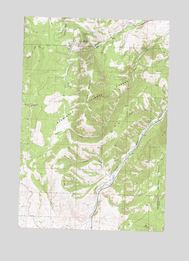
Henderson Mountain, MT USGS Topographic Map
Click on map above to begin viewing in our Map Viewer.

This topographic map contains these locations and features:
Feature Name Type Latitude Longitude GNIS ID View Map
Bennett (historical)LocaleN46.4166°W113.2876°1781865View Map
Black Pine (historical)LocaleN46.4471°W113.3676°1781862View Map
Black Pine MineMineN46.4477°W113.3665°780016View Map
Black Pine School (historical)SchoolN46.4471°W113.3676°1781863View Map
Bunker Hill MineMineN46.4819°W113.3162°803083View Map
Combination Post Office (historical)Post OfficeN46.4471°W113.3648°1781817View Map
Copper State MineMineN46.4819°W113.2565°803082View Map
Hattie MineMineN46.4824°W113.2653°803126View Map
Henderson (historical)LocaleN46.4827°W113.3148°1781880View Map
Henderson MountainSummitN46.4563°W113.3176°784774View Map
Lower Willow Creek Trail Number FourTrailN46.4813°W113.3606°786689View Map
Morse and Kennedy MineMineN46.3860°W113.3565°804832View Map
Nabbs Spur (historical)LocaleN46.4319°W113.2703°1781883View Map
North Star MineMineN46.4871°W113.2634°803074View Map
North Sunrise MineMineN46.4930°W113.3328°803084View Map
Pickett GulchValleyN46.4419°W113.2592°788831View Map
Sawmill CreekStreamN46.4063°W113.2956°790051View Map
Sawmill Creek MineMineN46.4088°W113.2967°803153View Map
SE Section 5 MineMineN46.4752°W113.2517°803214View Map
Sunrise (historical)LocaleN46.4827°W113.3273°1781889View Map
Sunrise MineMineN46.4841°W113.3295°794143View Map
Sunrise MountainSummitN46.4863°W113.3248°791706View Map
Sunrise/Queen MineMineN46.4841°W113.3356°803042View Map
Toohy (historical)LocaleN46.4249°W113.2759°1781887View Map

Note: Coordinates in the location and feature list above are referenced to NAD83 datum.


Copyright (C) 2008-2025 Ryan Niemi / Sunset Dynamics ... All Rights Reserved