TopoQuest Logo
Do you find TopoQuest useful?
Help keep TopoQuest running and adding new maps/features by donating!
Bitcoin:  19c7KJd3qBynnjoSw5npx9KScwjBe4ifkT
Litecoin:  LXs6TkuXGGXo1vDsWCkWVdjQX94eUKd6ui
Home View Maps Find Maps Find Places Resources & Links


Philipsburg, Montana Topographic Map

USGS Map Title: Philipsburg, MT
USGS Map MRC: 46113C3
DRG (GeoTIFF) Download: o46113c3.tif


Neighboring USGS Topographic Map Quads:


  Black Pine Ridge, MT  
46113D4
 

  Henderson Mountain, MT  
46113D3
 

  Maxville, MT  
46113D2
 

  Antelope Creek, MT  
46113C4
 

  Philipsburg, MT  
46113C3
 

  Fred Burr Lake, MT  
46113C2
 

  Potato Lakes, MT  
46113B4
 

  Georgetown Lake, MT  
46113B3
 

  Silver Lake, MT  
46113B2


Map MRC Location:

N47°
W114°
N47°
W113°
H8 H7 H6 H5 H4 H3 H2 H1
G8 G7 G6 G5 G4 G3 G2 G1
F8 F7 F6 F5 F4 F3 F2 F1
E8 E7 E6 E5 E4 E3 E2 E1
D8 D7 D6 D5 D4 D3 D2 D1
C8 C7 C6 C5 C4 C3 C2 C1
B8 B7 B6 B5 B4 B3 B2 B1
A8 A7 A6 A5 A4 A3 A2 A1
N46°
W114°
N46°
W113°

Philipsburg, MT USGS 1:24K Topographic Map Preview:
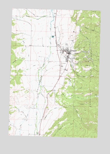
Philipsburg, MT USGS Topographic Map
Click on map above to begin viewing in our Map Viewer.

This topographic map contains these locations and features:
Feature Name Type Latitude Longitude GNIS ID View Map
Algonquin MineMineN46.3277°W113.2667°803011View Map
Allen Hospital (historical)HospitalN46.3321°W113.2942°1781833View Map
Baier MineMineN46.3194°W113.2912°803020View Map
Baptist ChurchChurchN46.3321°W113.2942°1781831View Map
Bathhouse CreekStreamN46.3269°W113.3531°779435View Map
Bayer Number 1 DamDamN46.3033°W113.2909°798443View Map
Beaverhead - Deerlodge National Forest Pintler Ranger District Philipsburg OfficeBuildingN46.3162°W113.3000°2548978View Map
Browns GulchValleyN46.3588°W113.2801°780460View Map
Camp CreekStreamN46.3313°W113.2906°780839View Map
Clark (historical)Populated PlaceN46.3185°W113.2876°1781859View Map
Cliff Gulch MineMineN46.3194°W113.2834°803080View Map
Colter GulchValleyN46.2794°W113.2859°781520View Map
Cow CreekStreamN46.3199°W113.3340°781784View Map
Derby/Elienore MineMineN46.3263°W113.2781°803115View Map
Dirty Dick CreekStreamN46.3119°W113.3020°782391View Map
Douglas CreekStreamN46.3258°W113.2928°782509View Map
Douglas Creek MineMineN46.3105°W113.2648°803009View Map
Duffy HillSummitN46.3305°W113.2987°1781786View Map
Durango MineMineN46.3341°W113.2765°803049View Map
Field/Porter MineMineN46.3444°W113.2842°803163View Map
First Presbyterian Church (historical)ChurchN46.3338°W113.2959°1781788View Map
Franklin HillSummitN46.3208°W113.2662°783689View Map
Fred Burr CreekStreamN46.2988°W113.3312°783704View Map
Frost CreekStreamN46.3238°W113.2912°783771View Map
Granite County CourthouseBuildingN46.3335°W113.2931°1781773View Map
Granite County Medical CenterHospitalN46.3300°W113.2941°1781841View Map
Granite County Memorial Hospital HeliportAirportN46.3296°W113.2959°806498View Map
Granite County Memorial Medical Assistance FacilityHospitalN46.3302°W113.2945°1781840View Map
Granite County Memorial Nursing HomeHospitalN46.3302°W113.2945°1781927View Map
Granite County Museum and Cultural CenterBuildingN46.3324°W113.2937°1781842View Map
Granite County Sheriff's OfficeBuildingN46.3338°W113.2930°1781772View Map
Hasmark (historical)LocaleN46.3333°W113.2676°1781875View Map
Hasmark Post Office (historical)Post OfficeN46.3333°W113.2676°1781809View Map
Hope HillSummitN46.3413°W113.2706°1781785View Map
Inn at PhilipsburgLocaleN46.3321°W113.2942°1781839View Map
Jesus Name Pentecostal ChurchChurchN46.3321°W113.2942°1781830View Map
Kroger PondLakeN46.3036°W113.2917°794142View Map
Little Gem MineMineN46.3285°W113.2737°803077View Map
Lower Frost Creek MineMineN46.3244°W113.2806°803112View Map
Marshall CreekStreamN46.3724°W113.3206°786863View Map
Marshall Creek CanalCanalN46.3210°W113.3495°786867View Map
Mountain Medical AssociatesHospitalN46.3321°W113.2942°1781832View Map
Parkerville (historical)LocaleN46.3271°W113.2931°1781795View Map
PhilipsburgLocaleN46.3327°W113.3037°1781803View Map
PhilipsburgPopulated PlaceN46.3321°W113.2942°788813View Map
Philipsburg CemeteryCemeteryN46.3410°W113.2978°1781838View Map
Philipsburg Community ChurchChurchN46.3377°W113.3067°1781828View Map
Philipsburg Post OfficePost OfficeN46.3315°W113.2920°1781802View Map
Philipsburg Public LibraryBuildingN46.3324°W113.2937°1781843View Map
Philipsburg SchoolsSchoolN46.3288°W113.2962°1781784View Map
Philipsburg ValleyValleyN46.3596°W113.3206°788815View Map
Philipsburg Volunteer Ambulance AssociationBuildingN46.3334°W113.2928°2637887View Map
Philipsburg Volunteer Fire CompanyBuildingN46.3319°W113.2943°2546744View Map
Porters CornerPopulated PlaceN46.2519°W113.3320°789122View Map
Puritan MineMineN46.3333°W113.2540°803114View Map
Red HillSummitN46.3535°W113.2867°789450View Map
Redemption MineMineN46.3235°W113.2773°803113View Map
Riddick FieldAirportN46.3203°W113.3037°806497View Map
Rosalind (historical)LocaleN46.3221°W113.2898°1781885View Map
RumseyPopulated PlaceN46.2919°W113.2520°789851View Map
Rumsey (historical)LocaleN46.2919°W113.2520°1781797View Map
Rumsey Post Office (historical)Post OfficeN46.2919°W113.2520°1781796View Map
Saint Andrews Episcopal ChurchChurchN46.3341°W113.2934°1781814View Map
Saint Pauls Presbyterian ChurchChurchN46.3341°W113.2940°1781789View Map
Saint Philips Catholic ChurchChurchN46.3346°W113.2967°1781787View Map
San Francisco MineMineN46.3416°W113.2759°803039View Map
Scratch All MineMineN46.3313°W113.2673°803025View Map
Shapleigh MineMineN46.3430°W113.2884°803162View Map
South Franklin Hill MineMineN46.3158°W113.2648°803211View Map
Spring CreekStreamN46.2944°W113.3326°791211View Map
Stewart GulchValleyN46.3594°W113.2795°791510View Map
Strip MineMineN46.3277°W113.2648°803028View Map
Summer GulchValleyN46.2796°W113.2842°791659View Map
The Church of Jesus Christ of Latter Day SaintsChurchN46.3321°W113.2942°1781829View Map
Thomas McKay/Hobo MineMineN46.3324°W113.2617°803045View Map
Tom Hynes/Hobo MineMineN46.3324°W113.2617°803017View Map
TowerLocaleN46.3302°W113.2670°792292View Map
Tower Post Office (historical)Post OfficeN46.3302°W113.2670°1781792View Map
Town of PhilipsburgCivilN46.3324°W113.2960°2413127View Map
Trout CreekStreamN46.2810°W113.3387°792396View Map
True Fissure MineMineN46.3310°W113.2676°803117View Map
Wenger Number 2 MineMineN46.3194°W113.2806°803079View Map
White Horse MineMineN46.3305°W113.2745°803078View Map
Young America MineMineN46.3210°W113.2570°803155View Map

Note: Coordinates in the location and feature list above are referenced to NAD83 datum.


Copyright (C) 2008-2025 Ryan Niemi / Sunset Dynamics ... All Rights Reserved