TopoQuest Logo
Do you find TopoQuest useful?
Help keep TopoQuest running and adding new maps/features by donating!
Bitcoin:  19c7KJd3qBynnjoSw5npx9KScwjBe4ifkT
Litecoin:  LXs6TkuXGGXo1vDsWCkWVdjQX94eUKd6ui
Home View Maps Find Maps Find Places Resources & Links


Tumalo Dam, Oregon Topographic Map

USGS Map Title: Tumalo Dam, OR
USGS Map MRC: 44121B4
DRG (GeoTIFF) Download: o44121b4.tif


Neighboring USGS Topographic Map Quads:


  Sisters, OR  
44121C5
 

  Henkle Butte, OR  
44121C4
 

  Cline Falls, OR  
44121C3
 

  Three Creek Butte, OR  
44121B5
 

  Tumalo Dam, OR  
44121B4
 

  Tumalo, OR  
44121B3
 

  Tumalo Falls, OR  
44121A5
 

  Shevlin Park, OR  
44121A4
 

  Bend, OR  
44121A3


Map MRC Location:

N45°
W122°
N45°
W121°
H8 H7 H6 H5 H4 H3 H2 H1
G8 G7 G6 G5 G4 G3 G2 G1
F8 F7 F6 F5 F4 F3 F2 F1
E8 E7 E6 E5 E4 E3 E2 E1
D8 D7 D6 D5 D4 D3 D2 D1
C8 C7 C6 C5 C4 C3 C2 C1
B8 B7 B6 B5 B4 B3 B2 B1
A8 A7 A6 A5 A4 A3 A2 A1
N44°
W122°
N44°
W121°

Tumalo Dam, OR USGS 1:24K Topographic Map Preview:
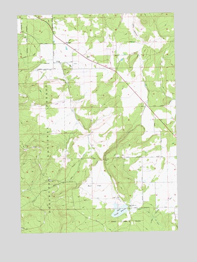
Tumalo Dam, OR USGS Topographic Map
Click on map above to begin viewing in our Map Viewer.

This topographic map contains these locations and features:
Feature Name Type Latitude Longitude GNIS ID View Map
Bridges AcademySchoolN44.2272°W121.4696°2417010View Map
Bull CreekStreamN44.1257°W121.4478°1138900View Map
Bull Creek DamDamN44.1395°W121.4151°1138903View Map
Bull FlatFlatN44.1515°W121.4414°1138904View Map
Bull Spring CreekStreamN44.1273°W121.4236°1138927View Map
Cloverdale Rural Fire Protection District Station 2BuildingN44.2417°W121.4734°2576927View Map
Columbia Southern CanalCanalN44.1387°W121.3892°1140015View Map
GistLocaleN44.2226°W121.4734°1153112View Map
Gist Post Office (historical)Post OfficeN44.2226°W121.4734°1165308View Map
PlainviewLocaleN44.2334°W121.4637°1147790View Map
Plainview DitchCanalN44.2223°W121.4748°1147791View Map
Plainview GrangeBuildingN44.2248°W121.4464°1639276View Map
Plainview School (historical)SchoolN44.2221°W121.4678°1161481View Map
Sage Ranch AirportAirportN44.2356°W121.3953°2646031View Map
Sisters Rodeo GroundsLocaleN44.2490°W121.4929°2699820View Map
Snow Creek DitchCanalN44.1429°W121.4942°1149814View Map
Tillicum Park/Chase RanchParkN44.1672°W121.4178°2070832View Map
Tumalo DamDamN44.1667°W121.4343°1151491View Map
Tumalo Feed CanalCanalN44.1862°W121.3773°1151489View Map
Upper Tumalo ReservoirReservoirN44.1370°W121.4227°1151707View Map

Note: Coordinates in the location and feature list above are referenced to NAD83 datum.


Copyright (C) 2008-2025 Ryan Niemi / Sunset Dynamics ... All Rights Reserved