TopoQuest Logo
Do you find TopoQuest useful?
Help keep TopoQuest running and adding new maps/features by donating!
Bitcoin:  19c7KJd3qBynnjoSw5npx9KScwjBe4ifkT
Litecoin:  LXs6TkuXGGXo1vDsWCkWVdjQX94eUKd6ui
Home View Maps Find Maps Find Places Resources & Links


Sisters, Oregon Topographic Map

USGS Map Title: Sisters, OR
USGS Map MRC: 44121C5
DRG (GeoTIFF) Download: o44121c5.tif


Neighboring USGS Topographic Map Quads:


  Black Butte, OR  
44121D6
 

  Little Squaw Back, OR  
44121D5
 

  Squaw Back Ridge, OR  
44121D4
 

  Black Crater, OR  
44121C6
 

  Sisters, OR  
44121C5
 

  Henkle Butte, OR  
44121C4
 

  Trout Creek Butte, OR  
44121B6
 

  Three Creek Butte, OR  
44121B5
 

  Tumalo Dam, OR  
44121B4


Map MRC Location:

N45°
W122°
N45°
W121°
H8 H7 H6 H5 H4 H3 H2 H1
G8 G7 G6 G5 G4 G3 G2 G1
F8 F7 F6 F5 F4 F3 F2 F1
E8 E7 E6 E5 E4 E3 E2 E1
D8 D7 D6 D5 D4 D3 D2 D1
C8 C7 C6 C5 C4 C3 C2 C1
B8 B7 B6 B5 B4 B3 B2 B1
A8 A7 A6 A5 A4 A3 A2 A1
N44°
W122°
N44°
W121°

Sisters, OR USGS 1:24K Topographic Map Preview:
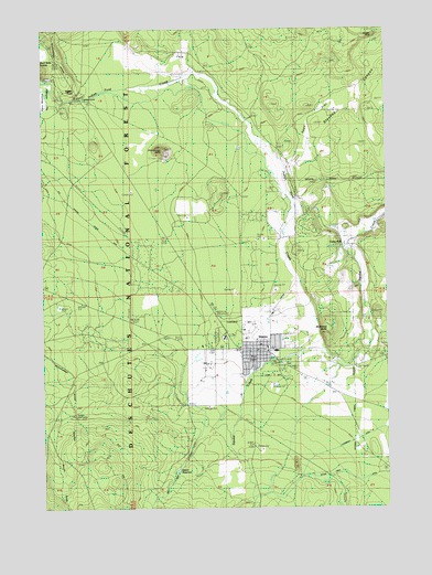
Sisters, OR USGS Topographic Map
Click on map above to begin viewing in our Map Viewer.

This topographic map contains these locations and features:
Feature Name Type Latitude Longitude GNIS ID View Map
Brush DrawValleyN44.2748°W121.6148°1138721View Map
Buck Run City ParkParkN44.2887°W121.5428°1987789View Map
Camp PolkLocaleN44.3187°W121.5156°1139263View Map
Camp Polk Post Office (historical)Post OfficeN44.3187°W121.5156°1165003View Map
Cascades East Transit Sisters Park and RideLocaleN44.2897°W121.5442°2699197View Map
City of SistersCivilN44.2921°W121.5534°2411907View Map
Cliff Clemens ParkParkN44.2968°W121.5470°2091187View Map
Cougar RockCapeN44.3726°W121.5073°1140243View Map
Creekside City ParkParkN44.2887°W121.5431°1987790View Map
Deschutes County Justice Court SistersBuildingN44.2917°W121.5442°2699031View Map
Deschutes County Sheriff's Office Sisters SubstationBuildingN44.2974°W121.5467°2737765View Map
Deschutes National Forest Sisters Ranger DistrictBuildingN44.2917°W121.5542°1638089View Map
Harold Barclay City ParkParkN44.2909°W121.5509°1987791View Map
Indian FordLocaleN44.3576°W121.6112°1144056View Map
Indian Ford CreekStreamN44.2912°W121.5228°1162595View Map
Indian Ford Recreation SiteLocaleN44.3579°W121.6109°1167289View Map
McKinney ButteSummitN44.2952°W121.5228°1146007View Map
Oregon Department of ForestryBuildingN44.2899°W121.5504°2577064View Map
Pole CreekStreamN44.2768°W121.5731°1147843View Map
Reed DitchCanalN44.2665°W121.5345°1153106View Map
Sage FlatFlatN44.3512°W121.5262°1148922View Map
SistersPopulated PlaceN44.2909°W121.5492°1127008View Map
Sisters - Camp Sherman Fire District Station 702 Tollgate StationBuildingN44.3120°W121.5849°2576929View Map
Sisters Camp Sherman Rural Fire Protection DistrictBuildingN44.2894°W121.5503°2577140View Map
Sisters CemeteryCemeteryN44.3229°W121.5150°1149548View Map
Sisters Charter Academy of Fine ArtsSchoolN44.2917°W121.5442°2417036View Map
Sisters Charter Academy of Fine ArtsSchoolN44.2915°W121.5457°2559804View Map
Sisters Christian AcademySchoolN44.2944°W121.5684°2417037View Map
Sisters City HallBuildingN44.2917°W121.5442°2699068View Map
Sisters Cow CampLocaleN44.2742°W121.6147°2563342View Map
Sisters Eagle AirAirportN44.3007°W121.5426°1154043View Map
Sisters Elementary SchoolSchoolN44.2908°W121.5415°2417018View Map
Sisters Guard Station (historical)LocaleN44.2884°W121.5600°1155871View Map
Sisters High SchoolSchoolN44.2959°W121.5759°2417020View Map
Sisters Middle SchoolSchoolN44.2928°W121.5713°2417019View Map
Sisters Post OfficePost OfficeN44.2974°W121.5459°1165954View Map
Sisters Public LibraryBuildingN44.2918°W121.5447°2699069View Map
Sisters Public Works Department HeadquartersBuildingN44.2805°W121.5385°2699070View Map
Sisters ReservoirReservoirN44.2597°W121.5774°1153107View Map
Sisters State Park (historical)ParkN44.2876°W121.5378°1149552View Map
Sisters Wastewater Treatment LagoonsLocaleN44.2786°W121.5361°2697136View Map
Smith DitchCanalN44.2901°W121.5512°1153105View Map
Squaw Creek Wild and Scenic RiverParkN44.2507°W121.5500°1983904View Map
Three Sisters Overnight City ParkParkN44.2879°W121.5423°1987792View Map
United States Forest Service Sisters Ranger DistrictBuildingN44.2917°W121.5544°2576744View Map
Village Green City ParkParkN44.2893°W121.5492°1987793View Map
Zimmerman ButteSummitN44.3431°W121.5814°1162355View Map

Note: Coordinates in the location and feature list above are referenced to NAD83 datum.


Copyright (C) 2008-2024 Ryan Niemi / Sunset Dynamics ... All Rights Reserved