TopoQuest Logo
Do you find TopoQuest useful?
Help keep TopoQuest running and adding new maps/features by donating!
Bitcoin:  19c7KJd3qBynnjoSw5npx9KScwjBe4ifkT
Litecoin:  LXs6TkuXGGXo1vDsWCkWVdjQX94eUKd6ui
Home View Maps Find Maps Find Places Resources & Links


Henrie Knolls, Utah Topographic Map

USGS Map Title: Henrie Knolls, UT
USGS Map MRC: 37112E6
DRG (GeoTIFF) Download: o37112e6.tif


Neighboring USGS Topographic Map Quads:


  Brian Head, UT  
37112F7
 

  Panguitch Lake, UT  
37112F6
 

  Haycock Mountain, UT  
37112F5
 

  Navajo Lake, UT  
37112E7
 

  Henrie Knolls, UT  
37112E6
 

  Asay Bench, UT  
37112E5
 

  Straight Canyon, UT  
37112D7
 

  Strawberry Point, UT  
37112D6
 

  Long Valley Junction, UT  
37112D5


Map MRC Location:

N38°
W113°
N38°
W112°
H8 H7 H6 H5 H4 H3 H2 H1
G8 G7 G6 G5 G4 G3 G2 G1
F8 F7 F6 F5 F4 F3 F2 F1
E8 E7 E6 E5 E4 E3 E2 E1
D8 D7 D6 D5 D4 D3 D2 D1
C8 C7 C6 C5 C4 C3 C2 C1
B8 B7 B6 B5 B4 B3 B2 B1
A8 A7 A6 A5 A4 A3 A2 A1
N37°
W113°
N37°
W112°

Henrie Knolls, UT USGS 1:24K Topographic Map Preview:
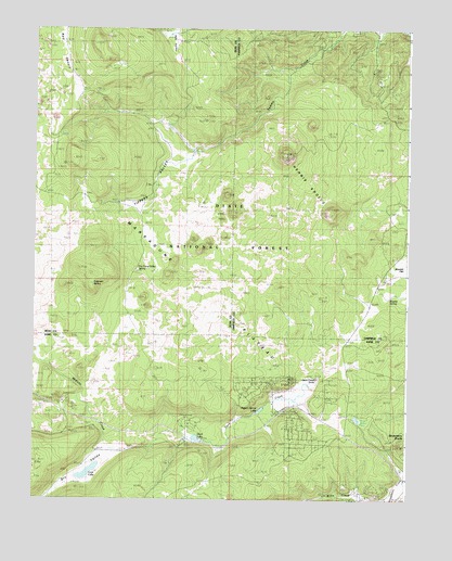
Henrie Knolls, UT USGS Topographic Map
Click on map above to begin viewing in our Map Viewer.

This topographic map contains these locations and features:
Feature Name Type Latitude Longitude GNIS ID View Map
Anderson SpringSpringN37.5573°W112.7308°1425111View Map
Aspen-Mirror LakeLakeN37.5239°W112.6742°1425192View Map
Bowers FlatFlatN37.5600°W112.6285°1439049View Map
Bowers SpringSpringN37.5537°W112.6316°1425913View Map
Cedar Mountain Fire Protection District Station 1BuildingN37.5222°W112.6444°2627436View Map
Cow LakeLakeN37.5072°W112.7316°1427008View Map
Dry Camp Valley SpringSpringN37.5612°W112.7163°1427506View Map
Dry ValleyValleyN37.5114°W112.7252°1440687View Map
Duck CreekStreamN37.5319°W112.6555°1425004View Map
Duck Creek CampgroundLocaleN37.5200°W112.6980°1454725View Map
Duck Creek Forest Service StationLocaleN37.5158°W112.6994°1454727View Map
Duck Creek SinksBasinN37.5328°W112.6555°1427607View Map
Duck Creek VillagePopulated PlaceN37.5236°W112.6630°1954629View Map
Duck Creek Village CampgroundLocaleN37.5255°W112.6627°1454726View Map
Duck Creek Work CenterLocaleN37.5153°W112.6999°1449987View Map
Duck LakeSpringN37.5164°W112.6952°1427608View Map
Henrie KnollsSummitN37.5911°W112.6669°1428662View Map
High Meadow Ranch AirportAirportN37.5289°W112.6571°2443173View Map
Houston MountainSummitN37.6214°W112.7311°1428915View Map
Ipson CreekStreamN37.5783°W112.6505°1442045View Map
Markagunt PlateauPlainN37.5539°W112.7133°1451148View Map
Midway CreekStreamN37.5158°W112.6966°1438090View Map
Red DesertPlainN37.6186°W112.7427°1444796View Map
Red ValleyValleyN37.6141°W112.7013°1436215View Map
Reed ValleyFlatN37.6203°W112.7024°1455901View Map
Strawberry KnollsSummitN37.5141°W112.6274°1446184View Map
Tippets ValleyValleyN37.5878°W112.7077°1433555View Map

Note: Coordinates in the location and feature list above are referenced to NAD83 datum.


Copyright (C) 2008-2025 Ryan Niemi / Sunset Dynamics ... All Rights Reserved