TopoQuest Logo
Do you find TopoQuest useful?
Help keep TopoQuest running and adding new maps/features by donating!
Bitcoin:  19c7KJd3qBynnjoSw5npx9KScwjBe4ifkT
Litecoin:  LXs6TkuXGGXo1vDsWCkWVdjQX94eUKd6ui
Home View Maps Find Maps Find Places Resources & Links


Strawberry Point, Utah Topographic Map

USGS Map Title: Strawberry Point, UT
USGS Map MRC: 37112D6
DRG (GeoTIFF) Download: o37112d6.tif


Neighboring USGS Topographic Map Quads:


  Navajo Lake, UT  
37112E7
 

  Henrie Knolls, UT  
37112E6
 

  Asay Bench, UT  
37112E5
 

  Straight Canyon, UT  
37112D7
 

  Strawberry Point, UT  
37112D6
 

  Long Valley Junction, UT  
37112D5
 

  Clear Creek Mountain, UT  
37112C7
 

  Orderville, UT  
37112C6
 

  Glendale, UT  
37112C5


Map MRC Location:

N38°
W113°
N38°
W112°
H8 H7 H6 H5 H4 H3 H2 H1
G8 G7 G6 G5 G4 G3 G2 G1
F8 F7 F6 F5 F4 F3 F2 F1
E8 E7 E6 E5 E4 E3 E2 E1
D8 D7 D6 D5 D4 D3 D2 D1
C8 C7 C6 C5 C4 C3 C2 C1
B8 B7 B6 B5 B4 B3 B2 B1
A8 A7 A6 A5 A4 A3 A2 A1
N37°
W113°
N37°
W112°

Strawberry Point, UT USGS 1:24K Topographic Map Preview:
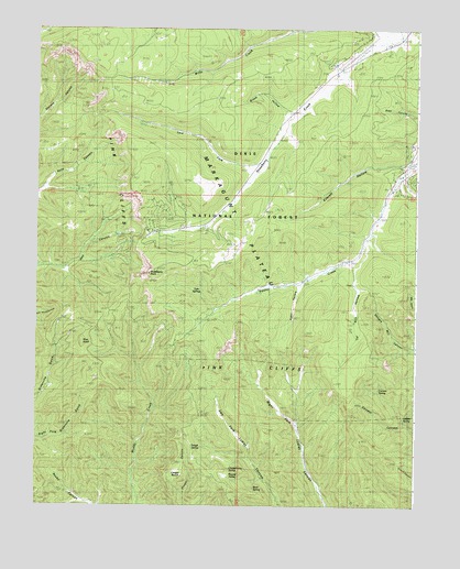
Strawberry Point, UT USGS Topographic Map
Click on map above to begin viewing in our Map Viewer.

This topographic map contains these locations and features:
Feature Name Type Latitude Longitude GNIS ID View Map
Adair HollowValleyN37.4322°W112.6630°1438122View Map
Birch SpringSpringN37.3795°W112.6783°1438800View Map
Broad HollowValleyN37.4780°W112.6677°1439133View Map
Chokecherry SpringSpringN37.3866°W112.6883°1439716View Map
Cougar BenchBenchN37.3828°W112.7044°1440050View Map
Currant SpringSpringN37.4056°W112.6374°1440204View Map
Deer SpringSpringN37.3906°W112.6254°1440395View Map
Everett HollowValleyN37.4644°W112.6313°1440970View Map
Hidden SpringSpringN37.3982°W112.6294°1441744View Map
Lars ForkStreamN37.4639°W112.6755°1442441View Map
Pine KnollSummitN37.4178°W112.7344°1444394View Map
Round ValleyBasinN37.3822°W112.6855°1445178View Map
Strawberry PointCapeN37.4355°W112.7130°1446188View Map
Strawberry Point View AreaLocaleN37.4364°W112.7108°1449077View Map
Strawberry Valley Estates AirportAirportN37.4933°W112.6455°1434546View Map
Tar Kiln HollowValleyN37.4408°W112.6416°1446338View Map
Trough SpringSpringN37.3903°W112.6956°1446733View Map
Twin SpringsSpringN37.4328°W112.6965°1446810View Map
Willis CreekStreamN37.4986°W112.6324°1447386View Map

Note: Coordinates in the location and feature list above are referenced to NAD83 datum.


Copyright (C) 2008-2024 Ryan Niemi / Sunset Dynamics ... All Rights Reserved