TopoQuest Logo
Do you find TopoQuest useful?
Help keep TopoQuest running and adding new maps/features by donating!
Bitcoin:  19c7KJd3qBynnjoSw5npx9KScwjBe4ifkT
Litecoin:  LXs6TkuXGGXo1vDsWCkWVdjQX94eUKd6ui
Home View Maps Find Maps Find Places Resources & Links


Hephzibah, Georgia Topographic Map

USGS Map Title: Hephzibah, GA
USGS Map MRC: 33082C1
DRG (GeoTIFF) Download: o33082c1.tif


Neighboring USGS Topographic Map Quads:


  Grovetown, GA  
33082D2
 

  Augusta West, GA  
33082D1
 

  Augusta East, GA  
33081D8
 

  Blythe, GA  
33082C2
 

  Hephzibah, GA  
33082C1
 

  Mechanic Hill, GA  
33081C8
 

  Keysville, GA  
33082B2
 

  Storys Millpond, GA  
33082B1
 

  McBean, GA  
33081B8


Map MRC Location:

N34°
W83°
N34°
W82°
H8 H7 H6 H5 H4 H3 H2 H1
G8 G7 G6 G5 G4 G3 G2 G1
F8 F7 F6 F5 F4 F3 F2 F1
E8 E7 E6 E5 E4 E3 E2 E1
D8 D7 D6 D5 D4 D3 D2 D1
C8 C7 C6 C5 C4 C3 C2 C1
B8 B7 B6 B5 B4 B3 B2 B1
A8 A7 A6 A5 A4 A3 A2 A1
N33°
W83°
N33°
W82°

Hephzibah, GA USGS 1:24K Topographic Map Preview:
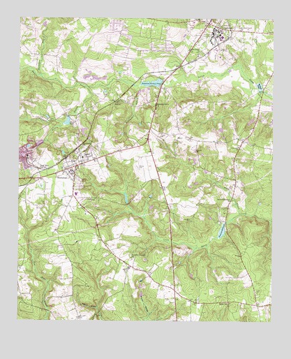
Hephzibah, GA USGS Topographic Map
Click on map above to begin viewing in our Map Viewer.

This topographic map contains these locations and features:
Feature Name Type Latitude Longitude GNIS ID View Map
Adams Grove ChurchChurchN33.3613°W82.0362°310402View Map
Atkins CemeteryCemeteryN33.2585°W82.0373°310655View Map
Augusta Fire Department Station 18BuildingN33.3678°W82.0763°2603621View Map
Augusta Fire Station 19BuildingN33.3218°W82.0052°2604635View Map
Augusta RacetrackLocaleN33.3668°W82.0815°358036View Map
Babcock Wilcox LakeReservoirN33.3235°W82.1144°339267View Map
Babcock Wilcox Lake DamDamN33.3235°W82.1132°339266View Map
Berlin ChurchChurchN33.2574°W82.0218°311106View Map
Berlin School (historical)SchoolN33.2579°W82.0221°358031View Map
Boggy BranchStreamN33.2943°W82.0160°311608View Map
Bowlmaker BranchStreamN33.3474°W82.0651°311679View Map
Brothersville CemeteryCemeteryN33.3004°W82.0868°311848View Map
Burton CemeteryCemeteryN33.3243°W82.0465°312074View Map
Butlers Creek ChurchChurchN33.3701°W82.0165°312106View Map
Bynes Chapel School (historical)SchoolN33.3651°W82.1223°358040View Map
Carrolls LakeReservoirN33.3218°W82.0932°339263View Map
Carrolls Lake DamDamN33.3218°W82.0932°339262View Map
Chalk Mine Memorial ChurchChurchN33.3132°W82.1146°312540View Map
City of HephzibahCivilN33.2907°W82.0994°2404686View Map
Clanton CemeteryCemeteryN33.3660°W82.0157°312680View Map
Consolidated Government of Augusta-Richmond CountyCivilN33.3596°W82.0736°2405077View Map
Consolidated Government of Augusta-Richmond County (Balance)Populated PlaceN33.3645°W82.0708°2405078View Map
Covenant School (historical)SchoolN33.2760°W82.0679°358101View Map
DeBrucePopulated PlaceN33.3521°W82.0501°358035View Map
East Central Regional Hospital Gracewood CampusHospitalN33.3699°W82.0273°2610997View Map
Ebenezer ChurchChurchN33.3224°W82.0932°313837View Map
Franklin Covenant ChurchChurchN33.2763°W82.0682°314348View Map
GracewoodPopulated PlaceN33.3726°W82.0321°331845View Map
Gracewood CemeteryCemeteryN33.3674°W82.0315°314757View Map
Gracewood DivisionCivilN33.3688°W82.0518°1936293View Map
Gracewood Elementary SchoolSchoolN33.3704°W82.0260°358033View Map
Gracewood State SchoolSchoolN33.3685°W82.0287°358034View Map
Graham SchoolSchoolN33.3174°W82.0932°314765View Map
Grindstone BranchStreamN33.3313°W82.1029°314924View Map
Hancock MillpondReservoirN33.2875°W82.0246°315081View Map
Hancock Millpond DamDamN33.2907°W82.0232°339264View Map
HephzibahPopulated PlaceN33.3140°W82.0968°356262View Map
Hephzibah CemeteryCemeteryN33.3160°W82.0946°315335View Map
Hephzibah Comprehensive High SchoolSchoolN33.3024°W82.0968°358043View Map
Hephzibah DivisionCivilN33.2929°W82.0413°1936312View Map
Hephzibah Elementary SchoolSchoolN33.3115°W82.0982°358041View Map
Hephzibah Fire DepartmentBuildingN33.3149°W82.0951°2603796View Map
Hephzibah Middle SchoolSchoolN33.2996°W82.0946°358042View Map
Hephzibah Police DepartmentBuildingN33.3134°W82.0975°2733738View Map
Horsepen BranchStreamN33.3510°W82.1143°315711View Map
Husher School (historical)SchoolN33.2585°W82.0971°358045View Map
Johnsons BranchStreamN33.3463°W82.0907°316187View Map
Johnsons Grove ChurchChurchN33.3382°W82.0571°316190View Map
Liberty ChurchChurchN33.3201°W82.0385°316811View Map
Malone CemeteryCemeteryN33.3129°W82.0648°317650View Map
McDade PondReservoirN33.3472°W82.0068°317887View Map
MeltonPopulated PlaceN33.3407°W82.0773°332371View Map
Mount Kingman Church (historical)ChurchN33.3538°W82.0785°358032View Map
New Hope ChurchChurchN33.2618°W82.0465°358102View Map
Pine Hill ChurchChurchN33.3218°W82.0165°320604View Map
Pine Hill School (historical)SchoolN33.3090°W82.0176°358029View Map
Rain TreePopulated PlaceN33.3732°W82.0701°358037View Map
Rhodes CemeteryCemeteryN33.3054°W82.0943°321550View Map
Rhodes PondReservoirN33.3325°W82.1010°321554View Map
Rhodes Pond DamDamN33.3324°W82.1004°339268View Map
Richmond CountyCivilN33.3596°W82.0735°358024View Map
Richmond County Correctional InstitutionBuildingN33.3735°W82.0391°2735755View Map
Richmond Factory PondReservoirN33.3482°W82.0546°321584View Map
Richmond Factory Pond DamDamN33.3482°W82.0593°337267View Map
Rober CemeteryCemeteryN33.3579°W82.0937°358039View Map
Rose Hill School (historical)SchoolN33.2999°W82.0198°358030View Map
Second Ebenezer ChurchChurchN33.2999°W82.0201°322691View Map
Tinley CemeteryCemeteryN33.3265°W82.0482°324189View Map
Town and CountryPopulated PlaceN33.3724°W82.0785°358038View Map

Note: Coordinates in the location and feature list above are referenced to NAD83 datum.


Copyright (C) 2008-2025 Ryan Niemi / Sunset Dynamics ... All Rights Reserved