TopoQuest Logo
Do you find TopoQuest useful?
Help keep TopoQuest running and adding new maps/features by donating!
Bitcoin:  19c7KJd3qBynnjoSw5npx9KScwjBe4ifkT
Litecoin:  LXs6TkuXGGXo1vDsWCkWVdjQX94eUKd6ui
Home View Maps Find Maps Find Places Resources & Links


Herbert Domain, Tennessee Topographic Map

USGS Map Title: Herbert Domain, TN
USGS Map MRC: 35085G2
DRG (GeoTIFF) Download: o35085g2.tif


Neighboring USGS Topographic Map Quads:


  De Rossett, TN  
35085H3
 

  Pleasant Hill, TN  
35085H2
 

  Crossville, TN  
35085H1
 

  Lonewood, TN  
35085G3
 

  Herbert Domain, TN  
35085G2
 

  Vandever, TN  
35085G1
 

  Sampson, TN  
35085F3
 

  Billingsley Gap, TN  
35085F2
 

  Melvine, TN  
35085F1


Map MRC Location:

N36°
W86°
N36°
W85°
H8 H7 H6 H5 H4 H3 H2 H1
G8 G7 G6 G5 G4 G3 G2 G1
F8 F7 F6 F5 F4 F3 F2 F1
E8 E7 E6 E5 E4 E3 E2 E1
D8 D7 D6 D5 D4 D3 D2 D1
C8 C7 C6 C5 C4 C3 C2 C1
B8 B7 B6 B5 B4 B3 B2 B1
A8 A7 A6 A5 A4 A3 A2 A1
N35°
W86°
N35°
W85°

Herbert Domain, TN USGS 1:24K Topographic Map Preview:
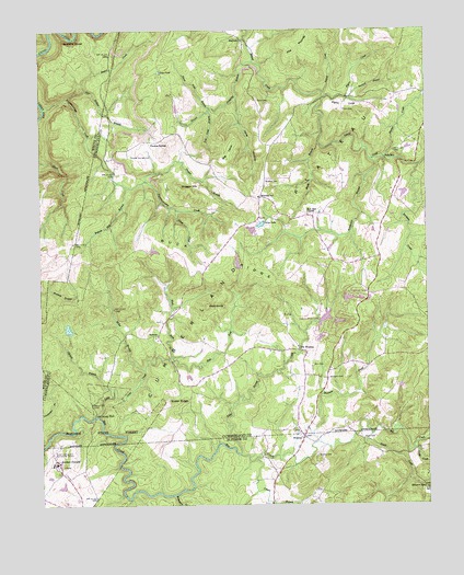
Herbert Domain, TN USGS Topographic Map
Click on map above to begin viewing in our Map Viewer.

This topographic map contains these locations and features:
Feature Name Type Latitude Longitude GNIS ID View Map
Akin CemeteryCemeteryN35.7870°W85.1622°1304780View Map
Barnes CreekStreamN35.8415°W85.1383°1276352View Map
Beaverdam CreekStreamN35.7528°W85.2075°1276725View Map
Big LevelSummitN35.8426°W85.1889°1277339View Map
Bolin CemeteryCemeteryN35.8567°W85.1791°1277906View Map
Brown GapGapN35.7545°W85.1258°1278577View Map
Brush CreekStreamN35.7687°W85.1430°1278679View Map
Bryant Mill BranchStreamN35.8340°W85.2219°1278752View Map
Buck RidgeRidgeN35.8148°W85.1941°1278833View Map
Burgess CemeteryCemeteryN35.8353°W85.1769°1279036View Map
Burgess Cemetery Number OneCemeteryN35.7964°W85.2227°1318267View Map
Burgess Cemetery Number TwoCemeteryN35.7973°W85.2113°1318268View Map
Burgess School (historical)SchoolN35.8262°W85.1647°1302831View Map
Burgesstown (historical)Populated PlaceN35.8265°W85.1611°1311131View Map
Burnt Field BranchStreamN35.8545°W85.1947°1279098View Map
Buzzard RoostSummitN35.8723°W85.2416°1279225View Map
Cove Field BranchStreamN35.8537°W85.1950°1281413View Map
Cowen BranchStreamN35.7620°W85.1816°1281468View Map
Cumberland County Fire Department Station 5 - 1BuildingN35.8268°W85.1793°2654948View Map
Cumberland County LandfillLocaleN35.8658°W85.1481°2677881View Map
Cumberland Mountain RetreatLocaleN35.8028°W85.1500°1302837View Map
Cumberland Mountain Retreat LakeReservoirN35.7984°W85.1600°1302140View Map
Cumberland Mountain Retreat Lake Number OneReservoirN35.8034°W85.1550°1302144View Map
Cumberland Mountain Retreat Lake Number ThreeReservoirN35.7992°W85.1580°1302139View Map
Deadtimber BranchStreamN35.7737°W85.2500°1282260View Map
Deer Hollow BranchStreamN35.8573°W85.2408°1282296View Map
Dogwood LakesReservoirN35.8045°W85.1503°1282611View Map
Dugger BranchStreamN35.8356°W85.2158°1283095View Map
Dugger HillSummitN35.8337°W85.2044°1283101View Map
East Fork Little Cane CreekStreamN35.7884°W85.2075°1283353View Map
Farmers CreekStreamN35.8392°W85.1275°1284141View Map
FlatrockLocaleN35.8726°W85.1847°1284433View Map
Flatrock School (historical)SchoolN35.8745°W85.1889°1646856View Map
Flynn CemeteryCemeteryN35.8542°W85.1516°1284538View Map
Flynn CoveValleyN35.8570°W85.1580°1284539View Map
Flynn CreekStreamN35.8573°W85.1502°1284540View Map
Flynn School (historical)SchoolN35.8584°W85.1564°1302859View Map
Granny BranchStreamN35.8537°W85.1950°1285836View Map
Grapevine (historical)Populated PlaceN35.7565°W85.1305°1311057View Map
Grapevine School (historical)SchoolN35.7551°W85.1263°1318016View Map
Gross LakeReservoirN35.8238°W85.1784°1286345View Map
Gum PondLakeN35.8642°W85.2109°1286410View Map
Hale MillPopulated PlaceN35.8409°W85.1372°1315172View Map
Henderson BranchStreamN35.8409°W85.1427°1287377View Map
Herbert DomainPopulated PlaceN35.7592°W85.2441°1287485View Map
Indian Rock LakeReservoirN35.7992°W85.1580°1289001View Map
J P Wyatt DamDamN35.8167°W85.2083°1302151View Map
J P Wyatt LakeReservoirN35.8167°W85.2083°1302150View Map
Jane HollowValleyN35.8571°W85.1864°1289292View Map
Jumping BranchStreamN35.8667°W85.1805°1289881View Map
Keith BranchStreamN35.8453°W85.1597°1289973View Map
Lake ParkPopulated PlaceN35.8195°W85.1819°1302894View Map
Little Cane CreekStreamN35.7737°W85.2327°1291410View Map
Little Laurel CreekStreamN35.7634°W85.1861°1291554View Map
Little Laurel CreekStreamN35.8415°W85.1383°1275403View Map
MidwayPopulated PlaceN35.8303°W85.1791°1646858View Map
Midway SchoolSchoolN35.8312°W85.1791°1293751View Map
Miller BranchStreamN35.7859°W85.2169°1293904View Map
Mount Gilead (historical)Populated PlaceN35.8445°W85.1750°1302906View Map
Mount Union School (historical)SchoolN35.7859°W85.1564°1302907View Map
Nails CreekStreamN35.7651°W85.1300°1295205View Map
NewtonPopulated PlaceN35.7948°W85.2125°1315603View Map
Newton CemeteryCemeteryN35.7984°W85.2108°1318269View Map
Newton School (historical)SchoolN35.7945°W85.2175°1302921View Map
Old Rocky FordCrossingN35.7734°W85.2327°1296361View Map
Old WinesapPopulated PlaceN35.7903°W85.1652°1315649View Map
Oldfield BranchStreamN35.7787°W85.2275°1296397View Map
Oldfield Branch DamDamN35.7951°W85.2416°1302138View Map
Oldfield Branch LakeReservoirN35.7966°W85.2410°1302137View Map
Perry CemeteryCemeteryN35.7656°W85.1336°1954870View Map
Pilot KnobSummitN35.8026°W85.1961°1297481View Map
Piney CreekStreamN35.8278°W85.2061°1297619View Map
Puncheoncamp CreekStreamN35.8548°W85.2486°1298701View Map
Raccoon CreekStreamN35.7670°W85.1608°1298790View Map
Rogers CreekStreamN35.8595°W85.2350°1300006View Map
Sawmill BranchStreamN35.8573°W85.1502°1300831View Map
Second CreekStreamN35.8584°W85.1580°1301017View Map
Short CreekStreamN35.8412°W85.2500°1270195View Map
Sluter RidgeRidgeN35.7770°W85.2061°1270543View Map
Spring LakeReservoirN35.8234°W85.1800°1302158View Map
Spring Lake DamDamN35.8234°W85.1800°1302159View Map
State of Tennessee DamDamN35.7686°W85.2473°1302124View Map
State of Tennessee ReservoirReservoirN35.7684°W85.2466°1302123View Map
Swallows CemeteryCemeteryN35.7834°W85.1572°1271926View Map
Taft Youth CenterBuildingN35.7612°W85.2452°1325868View Map
The PoundsSummitN35.8745°W85.1630°1307260View Map
Thomas CemeteryCemeteryN35.7634°W85.1611°1272478View Map
Thomas SpringsPopulated PlaceN35.8459°W85.2139°1314393View Map
Thomas Springs CemeteryCemeteryN35.8420°W85.2208°1272498View Map
Thomas Springs School (historical)SchoolN35.8462°W85.2136°1302964View Map
Twin LakeReservoirN35.8138°W85.1860°1302148View Map
Twin Lake DamDamN35.8134°W85.1850°1302149View Map
West Fork Little Cane CreekStreamN35.7884°W85.2072°1274181View Map
WinesapPopulated PlaceN35.7681°W85.1655°1314522View Map
Winesap CemeteryCemeteryN35.7698°W85.1686°1318264View Map
Winesap Freewill Baptist ChurchChurchN35.7692°W85.1666°1318263View Map
Wyatt CemeteryCemeteryN35.7676°W85.1461°1275196View Map
Zion Church (historical)ChurchN35.8320°W85.1786°1302918View Map
Zion Hill ChurchChurchN35.8265°W85.1636°1275374View Map

Note: Coordinates in the location and feature list above are referenced to NAD83 datum.


Copyright (C) 2008-2024 Ryan Niemi / Sunset Dynamics ... All Rights Reserved