TopoQuest Logo
Do you find TopoQuest useful?
Help keep TopoQuest running and adding new maps/features by donating!
Bitcoin:  19c7KJd3qBynnjoSw5npx9KScwjBe4ifkT
Litecoin:  LXs6TkuXGGXo1vDsWCkWVdjQX94eUKd6ui
Home View Maps Find Maps Find Places Resources & Links


Sampson, Tennessee Topographic Map

USGS Map Title: Sampson, TN
USGS Map MRC: 35085F3
DRG (GeoTIFF) Download: o35085f3.tif


Neighboring USGS Topographic Map Quads:


  Bald Knob, TN  
35085G4
 

  Lonewood, TN  
35085G3
 

  Herbert Domain, TN  
35085G2
 

  Spencer, TN  
35085F4
 

  Sampson, TN  
35085F3
 

  Billingsley Gap, TN  
35085F2
 

  Smartt Mountain, TN  
35085E4
 

  Brockdell, TN  
35085E3
 

  Pikeville, TN  
35085E2


Map MRC Location:

N36°
W86°
N36°
W85°
H8 H7 H6 H5 H4 H3 H2 H1
G8 G7 G6 G5 G4 G3 G2 G1
F8 F7 F6 F5 F4 F3 F2 F1
E8 E7 E6 E5 E4 E3 E2 E1
D8 D7 D6 D5 D4 D3 D2 D1
C8 C7 C6 C5 C4 C3 C2 C1
B8 B7 B6 B5 B4 B3 B2 B1
A8 A7 A6 A5 A4 A3 A2 A1
N35°
W86°
N35°
W85°

Sampson, TN USGS 1:24K Topographic Map Preview:
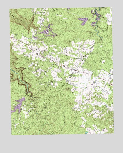
Sampson, TN USGS Topographic Map
Click on map above to begin viewing in our Map Viewer.

This topographic map contains these locations and features:
Feature Name Type Latitude Longitude GNIS ID View Map
Anderson MineMineN35.7401°W85.3347°1320872View Map
Back CreekStreamN35.7451°W85.2705°1276048View Map
Bald KnobSummitN35.7170°W85.3033°1276209View Map
Bear Hollow BranchStreamN35.6693°W85.3542°2749576View Map
Bear Pan RidgeRidgeN35.7451°W85.2939°1312033View Map
Big Hill BranchStreamN35.7306°W85.3366°1277309View Map
Big Ivy BranchStreamN35.6465°W85.3436°2749577View Map
Bledsoe County Correctional ComplexBuildingN35.7418°W85.2568°2766071View Map
Bradden CreekStreamN35.7112°W85.2652°1305375View Map
Bradden KnobSummitN35.6695°W85.3055°1305376View Map
Buzzards RoostSummitN35.6805°W85.3671°2749579View Map
Camp CreekStreamN35.6473°W85.3436°1312035View Map
Cane Creek FallsFallsN35.6628°W85.3505°1279527View Map
Chestnut RidgeRidgeN35.6566°W85.3030°2749575View Map
Commissioner District 3CivilN35.7286°W85.3305°2464205View Map
Cumberland Plateau Division (historical)CensusN35.6401°W85.2625°1269252View Map
DeBord CemeteryCemeteryN35.6278°W85.2650°1269522View Map
Fall CreekStreamN35.6681°W85.3544°1284106View Map
Fall Creek FallsFallsN35.6659°W85.3558°1284107View Map
Fall Creek Falls LakeReservoirN35.6528°W85.3659°1302011View Map
Fall Creek Falls Lake DamDamN35.6617°W85.3586°1302010View Map
Fall Creek Falls State ParkParkN35.6562°W85.3414°1284109View Map
Fall Creek Falls Volunteer Fire DepartmentBuildingN35.7146°W85.3538°2654484View Map
Flat CreekStreamN35.6659°W85.2508°1284376View Map
Group Camp 1LocaleN35.6481°W85.3497°1284108View Map
Guy MineMineN35.7323°W85.3280°1320899View Map
Harrison Gulf BranchStreamN35.6903°W85.3544°1287021View Map
Haston MineMineN35.7487°W85.2639°1318017View Map
Hemlock FallsFallsN35.7348°W85.3527°2749580View Map
Jack BranchStreamN35.7001°W85.2847°1289143View Map
Joe BranchStreamN35.6959°W85.3489°1289455View Map
Johnnie BranchStreamN35.7006°W85.3030°1289505View Map
Kellog KnobSummitN35.6765°W85.3055°1290015View Map
Little Fall CreekStreamN35.6531°W85.3649°2749578View Map
Long BranchStreamN35.7228°W85.2683°1291874View Map
Meadow CreekStreamN35.6370°W85.3319°1293496View Map
Mill BranchStreamN35.7351°W85.3547°1293796View Map
Mill CreekStreamN35.7423°W85.2655°1293840View Map
Mitchell BranchStreamN35.7351°W85.3508°1294097View Map
MooneyhamPopulated PlaceN35.7456°W85.3375°1315534View Map
Mooneyham CemeteryCemeteryN35.7459°W85.3369°1320920View Map
Mooneyham Division (historical)CensusN35.7456°W85.3264°1648992View Map
Mooneyham School (historical)SchoolN35.7440°W85.3355°1320921View Map
Mount Della ChurchChurchN35.6967°W85.3241°1294607View Map
Mount View ChurchChurchN35.6873°W85.3091°1294842View Map
New Martin SchoolSchoolN35.6945°W85.3239°1295604View Map
Pendergrass MineMineN35.7356°W85.2705°1320926View Map
Pilot RidgeRidgeN35.6821°W85.3392°2749574View Map
Pine LakeReservoirN35.6308°W85.2826°1301988View Map
Pine Lake DamDamN35.6252°W85.2842°1301989View Map
Piney CreekStreamN35.6859°W85.3683°1297624View Map
Rockhouse CreekStreamN35.6631°W85.3497°1269906View Map
Salzer MountainSummitN35.7445°W85.3130°1300616View Map
SampsonPopulated PlaceN35.6759°W85.2722°1315868View Map
Sampson School (historical)SchoolN35.6742°W85.2700°1318045View Map
Sandy BranchStreamN35.7415°W85.3461°1300741View Map
Walling CemeteryCemeteryN35.6762°W85.3294°1273700View Map
Walling CemeteryCemeteryN35.7242°W85.3664°1273701View Map
Walling Mill CreekStreamN35.6876°W85.3700°1273702View Map
Watson MineMineN35.7412°W85.2630°1318060View Map
Whiteside BranchStreamN35.7051°W85.2577°1274465View Map

Note: Coordinates in the location and feature list above are referenced to NAD83 datum.


Copyright (C) 2008-2024 Ryan Niemi / Sunset Dynamics ... All Rights Reserved