TopoQuest Logo
Do you find TopoQuest useful?
Help keep TopoQuest running and adding new maps/features by donating!
Bitcoin:  19c7KJd3qBynnjoSw5npx9KScwjBe4ifkT
Litecoin:  LXs6TkuXGGXo1vDsWCkWVdjQX94eUKd6ui
Home View Maps Find Maps Find Places Resources & Links


Hesperia, Michigan Topographic Map

USGS Map Title: Hesperia, MI
USGS Map MRC: 43086E1
DRG (GeoTIFF) Download: o43086e1.tif


Neighboring USGS Topographic Map Quads:


  Walkerville West, MI  
43086F2
 

  Walkerville East, MI  
43086F1
 

  Walkup Lake, MI  
43085F8
 

  Ferry, MI  
43086E2
 

  Hesperia, MI  
43086E1
 

  Dayton Center, MI  
43085E8
 

  Big Blue Lake, MI  
43086D2
 

  Holton, MI  
43086D1
 

  Fremont, MI  
43085D8


Map MRC Location:

N44°
W87°
N44°
W86°
H8 H7 H6 H5 H4 H3 H2 H1
G8 G7 G6 G5 G4 G3 G2 G1
F8 F7 F6 F5 F4 F3 F2 F1
E8 E7 E6 E5 E4 E3 E2 E1
D8 D7 D6 D5 D4 D3 D2 D1
C8 C7 C6 C5 C4 C3 C2 C1
B8 B7 B6 B5 B4 B3 B2 B1
A8 A7 A6 A5 A4 A3 A2 A1
N43°
W87°
N43°
W86°

Hesperia, MI USGS 1:24K Topographic Map Preview:
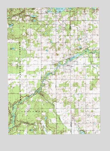
Hesperia, MI USGS Topographic Map
Click on map above to begin viewing in our Map Viewer.

This topographic map contains these locations and features:
Feature Name Type Latitude Longitude GNIS ID View Map
Bloggett LakeLakeN43.6079°W86.1200°1619252View Map
Brayton DrainStreamN43.5411°W86.0820°1619310View Map
Burris LakeLakeN43.6236°W86.0066°1619377View Map
Christ the King Catholic CemeteryCemeteryN43.5739°W86.0633°2515843View Map
Christ the King ChurchChurchN43.5639°W86.0417°2515767View Map
Countryside Church of ChristChurchN43.5728°W86.0792°2515769View Map
Cushman CreekStreamN43.5089°W86.1187°1619647View Map
Cushman SwampSwampN43.5034°W86.0739°1622814View Map
Darlington LakeLakeN43.6167°W86.0895°1619663View Map
Dayton Center CemeteryCemeteryN43.5189°W86.0176°1619677View Map
Doud SchoolSchoolN43.5258°W86.0195°1619749View Map
East Hesperia CemeteryCemeteryN43.5694°W86.0200°2541878View Map
Greenwood CemeteryCemeteryN43.5042°W86.1048°1620081View Map
Greenwood Township HallBuildingN43.5417°W86.0592°2515765View Map
HesperiaPopulated PlaceN43.5689°W86.0395°1620176View Map
Hesperia Area Fire DepartmentBuildingN43.5694°W86.0713°2515764View Map
Hesperia Baptist ChurchChurchN43.5706°W86.0300°2541789View Map
Hesperia Community LibraryBuildingN43.5675°W86.0389°2542145View Map
Hesperia High SchoolSchoolN43.5667°W86.0408°2542146View Map
Hesperia Medical CenterHospitalN43.5692°W86.0389°2542144View Map
Hesperia Police DepartmentBuildingN43.5718°W86.0389°2737445View Map
Hesperia PondLakeN43.5764°W86.0345°1620177View Map
Hesperia Post OfficePost OfficeN43.5719°W86.0403°2515766View Map
Hesperia Presbyterian ChurchChurchN43.5669°W86.0411°2515768View Map
Hesperia United Methodist ChurchChurchN43.5519°W86.0364°2541788View Map
Horseshoe Lake Cycle TrailTrailN43.5111°W86.0851°1622815View Map
Kirchner LakeLakeN43.6238°W86.0392°1620441View Map
Lighthouse Community ChurchChurchN43.5756°W86.0006°2541790View Map
Lost LakeLakeN43.5044°W86.0931°1620626View Map
Martin LakeLakeN43.5002°W86.0243°1623180View Map
McGill SchoolSchoolN43.5800°W86.0801°1620762View Map
Mud LakeLakeN43.5850°W86.1174°1620928View Map
Newell LakeLakeN43.6213°W86.0678°1621004View Map
North LakeLakeN43.5935°W86.0276°1621045View Map
Pines Point Recreation SiteLocaleN43.5278°W86.1195°1622775View Map
Podunk Canoe AccessLocaleN43.5258°W86.1137°1622774View Map
Saint HubertsPopulated PlaceN43.5425°W86.0851°1621476View Map
Stebbinsville Post Office (historical)Post OfficeN43.5283°W86.1211°2515366View Map
Sturtevant SchoolSchoolN43.5550°W86.0987°1621809View Map
Township of GreenwoodCivilN43.5114°W86.0993°1626403View Map
Township of NewfieldCivilN43.5981°W86.0989°1626800View Map
Village of HesperiaCivilN43.5691°W86.0407°2398497View Map
Waterman SchoolSchoolN43.6014°W86.0203°1622064View Map
WBLV-FM (Twin Lake)TowerN43.5500°W86.0428°1625758View Map
West Hesperia CemeteryCemeteryN43.5730°W86.0633°2515842View Map
Winters LakeLakeN43.6123°W86.0880°1622192View Map
Wrights CreekStreamN43.5795°W86.0153°1622222View Map

Note: Coordinates in the location and feature list above are referenced to NAD83 datum.


Copyright (C) 2008-2025 Ryan Niemi / Sunset Dynamics ... All Rights Reserved