TopoQuest Logo
Do you find TopoQuest useful?
Help keep TopoQuest running and adding new maps/features by donating!
Bitcoin:  19c7KJd3qBynnjoSw5npx9KScwjBe4ifkT
Litecoin:  LXs6TkuXGGXo1vDsWCkWVdjQX94eUKd6ui
Home View Maps Find Maps Find Places Resources & Links


Walkerville East, Michigan Topographic Map

USGS Map Title: Walkerville East, MI
USGS Map MRC: 43086F1
DRG (GeoTIFF) Download: o43086f1.tif


Neighboring USGS Topographic Map Quads:


  Crystal Valley, MI  
43086G2
 

  Carr, MI  
43086G1
 

  Big Star Lake, MI  
43085G8
 

  Walkerville West, MI  
43086F2
 

  Walkerville East, MI  
43086F1
 

  Walkup Lake, MI  
43085F8
 

  Ferry, MI  
43086E2
 

  Hesperia, MI  
43086E1
 

  Dayton Center, MI  
43085E8


Map MRC Location:

N44°
W87°
N44°
W86°
H8 H7 H6 H5 H4 H3 H2 H1
G8 G7 G6 G5 G4 G3 G2 G1
F8 F7 F6 F5 F4 F3 F2 F1
E8 E7 E6 E5 E4 E3 E2 E1
D8 D7 D6 D5 D4 D3 D2 D1
C8 C7 C6 C5 C4 C3 C2 C1
B8 B7 B6 B5 B4 B3 B2 B1
A8 A7 A6 A5 A4 A3 A2 A1
N43°
W87°
N43°
W86°

Walkerville East, MI USGS 1:24K Topographic Map Preview:
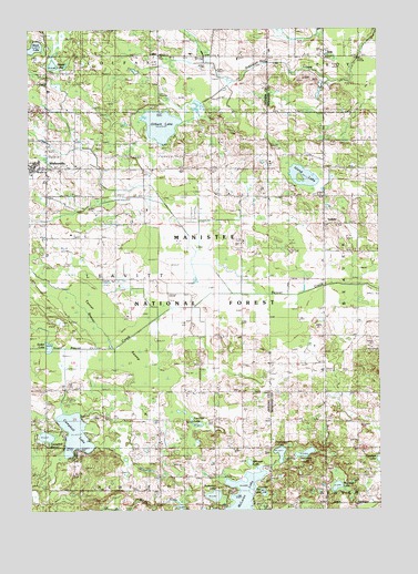
Walkerville East, MI USGS Topographic Map
Click on map above to begin viewing in our Map Viewer.

This topographic map contains these locations and features:
Feature Name Type Latitude Longitude GNIS ID View Map
Abson CemeteryCemeteryN43.7133°W86.0792°1618986View Map
Bar LakeLakeN43.6295°W86.0419°1619086View Map
Beaver Post Office (historical)Post OfficeN43.7150°W86.0189°2541856View Map
Bird Post Office (historical)Post OfficeN43.6958°W86.1069°2515413View Map
Black LakeLakeN43.7453°W86.1224°1619236View Map
Butternut LakeLakeN43.6288°W86.0595°1619387View Map
Campbell LakeLakeN43.6451°W86.1094°1619418View Map
ColfaxPopulated PlaceN43.7433°W86.0792°1619553View Map
Fairchild LakeLakeN43.6470°W86.0660°1619883View Map
Gilbert LakeLakeN43.7250°W86.0776°1620014View Map
Gilbert Lake Oil FieldOilfieldN43.7353°W86.0853°1623364View Map
Huber Oil FieldOilfieldN43.6289°W86.0040°1623420View Map
Island LakeLakeN43.7116°W86.0268°1620333View Map
Klondike Post Office (historical)Post OfficeN43.6639°W86.0639°2515386View Map
Little Campbell LakeLakeN43.6442°W86.1194°1620543View Map
McGann LakeLakeN43.6311°W86.0156°1620761View Map
McLaren LakeLakeN43.6270°W86.0507°1620773View Map
McLeam LakeLakeN43.6373°W86.0468°1622643View Map
Mountain LakeLakeN43.6398°W86.0267°1620918View Map
Rossel LakeLakeN43.7406°W86.1162°1621440View Map
Sorter LakeLakeN43.6674°W86.1183°1621674View Map
South Beaver CreekStreamN43.6670°W86.0981°1621676View Map
Tanner SwampSwampN43.6712°W86.1092°1622416View Map
Tourcotte LakeLakeN43.6397°W86.0358°1621927View Map
Township of LeavittCivilN43.6851°W86.0986°1626596View Map
TroyPopulated PlaceN43.7431°W86.0192°1621966View Map
Troy CemeteryCemeteryN43.7430°W86.0247°2541867View Map
VolneyPopulated PlaceN43.6995°W86.0198°1622034View Map
Volney Bible ChurchChurchN43.6994°W86.0194°2542143View Map
Volney CemeteryCemeteryN43.7069°W86.0203°2541866View Map
Volney Post Office (historical)Post OfficeN43.6994°W86.0197°2541813View Map
Volney SchoolSchoolN43.7072°W86.0198°1622035View Map
WalkervillePopulated PlaceN43.7145°W86.1245°1622051View Map
Walkerville Area Fire and RescueBuildingN43.7136°W86.1230°2627028View Map
Walkerville Elementary SchoolSchoolN43.7158°W86.1214°2515772View Map
Walkerville High SchoolSchoolN43.7147°W86.1228°2515773View Map
Walkerville Police DepartmentBuildingN43.7136°W86.1230°2515775View Map
Walkerville Post OfficePost OfficeN43.7136°W86.1233°2515774View Map
Walkerville Station (historical)LocaleN43.7139°W86.1189°2515771View Map
Walkerville United Methodist ChurchChurchN43.7139°W86.1169°2515777View Map
Walkerville Wesleyan ChurchChurchN43.7103°W86.1192°2515776View Map

Note: Coordinates in the location and feature list above are referenced to NAD83 datum.


Copyright (C) 2008-2024 Ryan Niemi / Sunset Dynamics ... All Rights Reserved