TopoQuest Logo
Do you find TopoQuest useful?
Help keep TopoQuest running and adding new maps/features by donating!
Bitcoin:  19c7KJd3qBynnjoSw5npx9KScwjBe4ifkT
Litecoin:  LXs6TkuXGGXo1vDsWCkWVdjQX94eUKd6ui
Home View Maps Find Maps Find Places Resources & Links


Hickory, North Carolina Topographic Map

USGS Map Title: Hickory, NC
USGS Map MRC: 35081F3
DRG (GeoTIFF) Download: o35081f3.tif


Neighboring USGS Topographic Map Quads:


  Granite Falls, NC  
35081G4
 

  Bethlehem, NC  
35081G3
 

  Millersville, NC  
35081G2
 

  Longview, NC  
35081F4
 

  Hickory, NC  
35081F3
 

  Newton, NC  
35081F2
 

  Banoak, NC  
35081E4
 

  Reepsville, NC  
35081E3
 

  Maiden, NC  
35081E2


Map MRC Location:

N36°
W82°
N36°
W81°
H8 H7 H6 H5 H4 H3 H2 H1
G8 G7 G6 G5 G4 G3 G2 G1
F8 F7 F6 F5 F4 F3 F2 F1
E8 E7 E6 E5 E4 E3 E2 E1
D8 D7 D6 D5 D4 D3 D2 D1
C8 C7 C6 C5 C4 C3 C2 C1
B8 B7 B6 B5 B4 B3 B2 B1
A8 A7 A6 A5 A4 A3 A2 A1
N35°
W82°
N35°
W81°

Hickory, NC USGS 1:24K Topographic Map Preview:
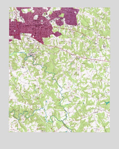
Hickory, NC USGS Topographic Map
Click on map above to begin viewing in our Map Viewer.

This topographic map contains these locations and features:
Feature Name Type Latitude Longitude GNIS ID View Map
Augustana ChurchChurchN35.7074°W81.3101°980367View Map
Barger BranchStreamN35.6987°W81.3448°980552View Map
Bethel ChurchChurchN35.6718°W81.3412°981146View Map
Bethlehem ChurchChurchN35.7040°W81.3268°981215View Map
BrookfordPopulated PlaceN35.7032°W81.3479°1019316View Map
Brookford Police DepartmentBuildingN35.7052°W81.3418°2766627View Map
Catawba Country ClubLocaleN35.6557°W81.3009°982748View Map
Catawba MallLocaleN35.7210°W81.3609°1007252View Map
Catawba Memorial ParkCemeteryN35.6971°W81.2737°982751View Map
Catawba Valley Community CollegeSchoolN35.6998°W81.2879°982754View Map
Catawba Valley Medical CenterHospitalN35.7137°W81.2673°1023885View Map
City of HickoryCivilN35.7425°W81.3230°2404693View Map
Clarrmont Central SchoolSchoolN35.7360°W81.3345°983237View Map
Cline CreekStreamN35.6787°W81.2592°983289View Map
Coulters Grove ChurchChurchN35.6276°W81.2654°983599View Map
Cripple CreekStreamN35.7490°W81.3609°983751View Map
FairbrookPopulated PlaceN35.7029°W81.2959°1020190View Map
FairgrovePopulated PlaceN35.7074°W81.2654°1020193View Map
Fairgrove ChurchChurchN35.7224°W81.2626°984903View Map
Fairview CemeteryCemeteryN35.7443°W81.3679°984910View Map
Frye CreekStreamN35.7490°W81.3609°985476View Map
Frye Regional Medical CenterHospitalN35.7373°W81.3371°2701531View Map
Gaither DamDamN35.6751°W81.2631°999234View Map
Gaither LakeReservoirN35.6751°W81.2631°999233View Map
Geitner BranchStreamN35.7051°W81.3570°985619View Map
Grandview Middle SchoolSchoolN35.7040°W81.3302°985919View Map
Green Park SchoolSchoolN35.7285°W81.3465°986070View Map
Griffin DamDamN35.6801°W81.3215°999241View Map
Griffin LakeReservoirN35.6801°W81.3215°999242View Map
Henry ForkStreamN35.6360°W81.3084°986626View Map
HickoryPopulated PlaceN35.7332°W81.3412°986686View Map
Hickory Career and Arts Magnet High SchoolSchoolN35.7434°W81.3313°983378View Map
Hickory Fire Department Station 1 HeadquartersBuildingN35.7329°W81.3348°2638215View Map
Hickory Fire Department Station 2 HighlandBuildingN35.7413°W81.3127°2639763View Map
Hickory Fire Department Station 3 West HickoryBuildingN35.7343°W81.3573°2639698View Map
Hickory Fire Department Station 5 FairbrookBuildingN35.7037°W81.2791°2638275View Map
Hickory Fire Department Station 7 SoutheastBuildingN35.7039°W81.3288°2639695View Map
Hickory High SchoolSchoolN35.7495°W81.3321°986711View Map
Hickory Motor SpeedwayLocaleN35.6957°W81.2695°986719View Map
Hickory Police DepartmentBuildingN35.7296°W81.3435°2769934View Map
Hickory Post OfficePost OfficeN35.7311°W81.3410°2766589View Map
Hickory Rescue SquadBuildingN35.7282°W81.3429°2720635View Map
Hickory Stone QuarryMineN35.7161°W81.3000°2649046View Map
Highland SchoolSchoolN35.7426°W81.3170°986782View Map
Hillside ChurchChurchN35.7026°W81.3443°986837View Map
Hop CreekStreamN35.6482°W81.3306°987037View Map
Jacob ForkStreamN35.6360°W81.3079°987505View Map
James DamDamN35.6551°W81.3281°999206View Map
James LakeReservoirN35.6551°W81.3281°999205View Map
Kenworth SchoolSchoolN35.7287°W81.3306°987926View Map
Lenoir - Rhyne UniversitySchoolN35.7390°W81.3288°988353View Map
Longview CreekStreamN35.7046°W81.3620°989021View Map
Martin-Marietta DamDamN35.7135°W81.2965°999288View Map
Martin-Marietta LakeReservoirN35.7135°W81.2965°999287View Map
Midland Shopping CenterLocaleN35.7385°W81.3451°1007256View Map
Miller BranchStreamN35.7082°W81.2737°989995View Map
Mountain ViewPopulated PlaceN35.6832°W81.3690°1867433View Map
Mountain View Census Designated PlaceCensusN35.6828°W81.3685°2403314View Map
Mountain View ChurchChurchN35.6415°W81.3565°990721View Map
Mountain View SchoolSchoolN35.6904°W81.3579°990729View Map
Muddy CreekStreamN35.6632°W81.3093°990755View Map
New Jerusalem ChurchChurchN35.6929°W81.2845°991050View Map
Newton Fire Department Station 3 StartownBuildingN35.6366°W81.2679°2638719View Map
Oakwood CemeteryCemeteryN35.7393°W81.3429°991491View Map
Old Robinson CemeteryCemeteryN35.7301°W81.3362°991599View Map
RhoneyPopulated PlaceN35.6257°W81.3326°1022239View Map
Ridgeview CemeteryCemeteryN35.7210°W81.3448°993342View Map
Ridgeview SchoolSchoolN35.7232°W81.3418°993345View Map
Saint Pauls Memorial ParkParkN35.6468°W81.2640°994105View Map
Saint Stephens Lutheran SchoolSchoolN35.7459°W81.2906°994140View Map
Saint Timothys ChurchChurchN35.7187°W81.2504°994147View Map
Shuford Mills DamDamN35.7001°W81.3465°999275View Map
Shuford Mills LakeReservoirN35.7001°W81.3465°999274View Map
StartownPopulated PlaceN35.6451°W81.2692°995430View Map
Startown Elementary SchoolSchoolN35.6388°W81.2694°1006484View Map
SweetwaterPopulated PlaceN35.7307°W81.2995°995783View Map
Temple ChurchChurchN35.7232°W81.3193°995920View Map
Town of BrookfordCivilN35.7029°W81.3455°2405328View Map
Township of HickoryCivilN35.7170°W81.3343°1026527View Map
Valley Hills MallLocaleN35.7168°W81.3443°1007259View Map
ViewmontPopulated PlaceN35.7476°W81.3373°1023081View Map
Weavers Avenue ParkParkN35.7265°W81.3676°996907View Map
Westmont SchoolSchoolN35.7326°W81.3618°997071View Map
WHKY-AM (Hickory)TowerN35.7285°W81.2981°1018487View Map
WHKY-FM (Hickory)TowerN35.7285°W81.2981°1018296View Map
WHKY-TV (Hickory)TowerN35.7326°W81.3309°1018598View Map
Wilson's AirportAirportN35.6521°W81.3579°2679196View Map
WIRC-AM (Hickory)TowerN35.7187°W81.3098°1018481View Map
WSPF-AM (Hickory)TowerN35.7229°W81.2779°1018483View Map
WXRC-FM (Hickory)TowerN35.7187°W81.3098°1018294View Map
Zion ChurchChurchN35.6687°W81.3370°997773View Map

Note: Coordinates in the location and feature list above are referenced to NAD83 datum.


Copyright (C) 2008-2025 Ryan Niemi / Sunset Dynamics ... All Rights Reserved