TopoQuest Logo
Do you find TopoQuest useful?
Help keep TopoQuest running and adding new maps/features by donating!
Bitcoin:  19c7KJd3qBynnjoSw5npx9KScwjBe4ifkT
Litecoin:  LXs6TkuXGGXo1vDsWCkWVdjQX94eUKd6ui
Home View Maps Find Maps Find Places Resources & Links


Millersville, North Carolina Topographic Map

USGS Map Title: Millersville, NC
USGS Map MRC: 35081G2
DRG (GeoTIFF) Download: o35081g2.tif


Neighboring USGS Topographic Map Quads:


  Ellendale, NC  
35081H3
 

  Taylorsville, NC  
35081H2
 

  Hiddenite, NC  
35081H1
 

  Bethlehem, NC  
35081G3
 

  Millersville, NC  
35081G2
 

  Stony Point, NC  
35081G1
 

  Hickory, NC  
35081F3
 

  Newton, NC  
35081F2
 

  Catawba, NC  
35081F1


Map MRC Location:

N36°
W82°
N36°
W81°
H8 H7 H6 H5 H4 H3 H2 H1
G8 G7 G6 G5 G4 G3 G2 G1
F8 F7 F6 F5 F4 F3 F2 F1
E8 E7 E6 E5 E4 E3 E2 E1
D8 D7 D6 D5 D4 D3 D2 D1
C8 C7 C6 C5 C4 C3 C2 C1
B8 B7 B6 B5 B4 B3 B2 B1
A8 A7 A6 A5 A4 A3 A2 A1
N35°
W82°
N35°
W81°

Millersville, NC USGS 1:24K Topographic Map Preview:
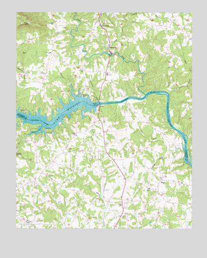
Millersville, NC USGS Topographic Map
Click on map above to begin viewing in our Map Viewer.

This topographic map contains these locations and features:
Feature Name Type Latitude Longitude GNIS ID View Map
Alexander County AirportAirportN35.8509°W81.1395°997987View Map
Barrett MountainSummitN35.8687°W81.2409°980584View Map
Benfield CreekStreamN35.8260°W81.2079°980987View Map
Bethel ChurchChurchN35.7774°W81.1462°981150View Map
Buck HillSummitN35.8515°W81.2459°1019356View Map
Dellinger CreekStreamN35.7951°W81.1387°984127View Map
Elk Shoal CreekStreamN35.7929°W81.1301°984705View Map
Friendship ChurchChurchN35.8518°W81.2254°985449View Map
Glade CreekStreamN35.8507°W81.1806°985712View Map
Grace and Truth Bible CampLocaleN35.8174°W81.2437°985879View Map
Isenhour ParkPopulated PlaceN35.8685°W81.1876°1020900View Map
Island CreekStreamN35.8279°W81.1409°987424View Map
Jumping RunStreamN35.8740°W81.1706°987820View Map
Long Shoal CreekStreamN35.8043°W81.2423°989006View Map
Lower Little RiverStreamN35.8276°W81.1579°989098View Map
MillersvillePopulated PlaceN35.8557°W81.1834°1021470View Map
Mount Zion ChurchChurchN35.7537°W81.2409°990658View Map
Naked CreekStreamN35.8149°W81.2017°990844View Map
North State DamDamN35.8480°W81.1735°999576View Map
North State LakeReservoirN35.8485°W81.1731°999575View Map
Oxford ChurchChurchN35.7987°W81.1865°991760View Map
Oxford DamDamN35.8221°W81.1927°991761View Map
Oxford Elementary SchoolSchoolN35.7734°W81.1562°991764View Map
Oxford Fire Department Station 2 Catfish Fire DistrictBuildingN35.7890°W81.1792°2639201View Map
Oxford ParkPopulated PlaceN35.7640°W81.1726°991763View Map
Oxford Volunteer Fire Department - Catfish DistrictBuildingN35.7702°W81.1474°2638695View Map
Paynes StoreLocaleN35.8657°W81.1317°1023498View Map
Punchbowl CreekStreamN35.8240°W81.1915°992904View Map
Ralph Flowers DamDamN35.8018°W81.1581°999480View Map
Ralph Flowers LakeReservoirN35.8018°W81.1581°999481View Map
Reitzel CoveBayN35.8062°W81.2343°993238View Map
Saint Johns ChurchChurchN35.8735°W81.1895°993957View Map
Saint Lukes CemeteryCemeteryN35.7807°W81.2270°993984View Map
Saint Peters ChurchChurchN35.8043°W81.2081°994120View Map
Saint StephensLocaleN35.7654°W81.2498°1023532View Map
Saint Stephens Fire Department Station 4 Base 2BuildingN35.7710°W81.2494°2639202View Map
Smyrna ChurchChurchN35.8396°W81.2290°995032View Map
Sulphur SpringsSpringN35.7926°W81.2496°995679View Map
Taylorsville BeachPopulated PlaceN35.8282°W81.2037°1022896View Map
Township of ClinesCivilN35.7643°W81.1870°1026526View Map
Wayside ChurchChurchN35.8412°W81.2020°996897View Map
Wittenburg SchoolSchoolN35.8396°W81.1848°997515View Map
Wittenburg Volunteer Fire DepartmentBuildingN35.8400°W81.1845°2639182View Map

Note: Coordinates in the location and feature list above are referenced to NAD83 datum.


Copyright (C) 2008-2024 Ryan Niemi / Sunset Dynamics ... All Rights Reserved