TopoQuest Logo
Do you find TopoQuest useful?
Help keep TopoQuest running and adding new maps/features by donating!
Bitcoin:  19c7KJd3qBynnjoSw5npx9KScwjBe4ifkT
Litecoin:  LXs6TkuXGGXo1vDsWCkWVdjQX94eUKd6ui
Home View Maps Find Maps Find Places Resources & Links


Hickory Flat, Kentucky Topographic Map

USGS Map Title: Hickory Flat, KY
USGS Map MRC: 36086F4
DRG (GeoTIFF) Download: o36086f4.tif


Neighboring USGS Topographic Map Quads:


  Woodburn, KY  
36086G5
 

  Drake, KY  
36086G4
 

  Allen Springs, KY  
36086G3
 

  Franklin, KY  
36086F5
 

  Hickory Flat, KY  
36086F4
 

  Adolphus, KY  
36086F3
 

  Portland, TN  
36086E5
 

  Fountain Head, TN  
36086E4
 

  Turners Station, TN  
36086E3


Map MRC Location:

N37°
W87°
N37°
W86°
H8 H7 H6 H5 H4 H3 H2 H1
G8 G7 G6 G5 G4 G3 G2 G1
F8 F7 F6 F5 F4 F3 F2 F1
E8 E7 E6 E5 E4 E3 E2 E1
D8 D7 D6 D5 D4 D3 D2 D1
C8 C7 C6 C5 C4 C3 C2 C1
B8 B7 B6 B5 B4 B3 B2 B1
A8 A7 A6 A5 A4 A3 A2 A1
N36°
W87°
N36°
W86°

Hickory Flat, KY USGS 1:24K Topographic Map Preview:
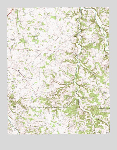
Hickory Flat, KY USGS Topographic Map
Click on map above to begin viewing in our Map Viewer.

This topographic map contains these locations and features:
Feature Name Type Latitude Longitude GNIS ID View Map
Allen CemeteryCemeteryN36.7193°W86.3937°485851View Map
Bethany ChurchChurchN36.7442°W86.4492°486930View Map
Boiling SpringsSpringN36.6312°W86.4255°1647553View Map
Bornes FordPopulated PlaceN36.6625°W86.4122°507557View Map
ClarePopulated PlaceN36.7150°W86.3947°507705View Map
East Simpson DivisionCivilN36.7182°W86.4676°1937259View Map
Eubanks FordPopulated PlaceN36.6925°W86.4136°507954View Map
Harrell CemeteryCemeteryN36.6767°W86.3922°493793View Map
Hickory FlatPopulated PlaceN36.7078°W86.4619°508229View Map
HighlandPopulated PlaceN36.7067°W86.4392°508238View Map
Hobdy CemeteryCemeteryN36.6267°W86.4294°1287940View Map
Hop Over (historical)Populated PlaceN36.7054°W86.4182°2742857View Map
Loving ChapelChurchN36.7189°W86.4922°497226View Map
Martins Chapel CemeteryCemeteryN36.6356°W86.4530°1646703View Map
Martins ChurchChurchN36.6334°W86.4528°1306726View Map
Mays BranchStreamN36.6762°W86.4183°497741View Map
McElroy FordPopulated PlaceN36.7339°W86.4100°508578View Map
McKendree ChurchChurchN36.7031°W86.4403°497895View Map
Middle Fork ChurchChurchN36.7223°W86.3878°498114View Map
New RoePopulated PlaceN36.6659°W86.3825°508694View Map
Perdue CemeteryCemeteryN36.6411°W86.4392°1297179View Map
Pirkle CemeteryCemeteryN36.6542°W86.4253°500758View Map
Pleasant Hill ChurchChurchN36.6639°W86.4361°500846View Map
RapidsLocaleN36.6662°W86.4661°501577View Map
Round Pond (historical)Populated PlaceN36.6817°W86.4796°2742868View Map
Round Pond ChurchChurchN36.6795°W86.4697°502410View Map
Round Pond Elementary SchoolSchoolN36.6881°W86.4864°502411View Map
Shady Grove Baptist ChurchChurchN36.7215°W86.4631°503212View Map
Smyrna (historical)Populated PlaceN36.6865°W86.3969°2742850View Map
Smyrna CreekStreamN36.6961°W86.4116°503831View Map
Smyrna Cumberland Presbyterian ChurchChurchN36.6862°W86.3971°503830View Map
State Line CemeteryCemeteryN36.6498°W86.4778°1646702View Map
State Line ChurchChurchN36.6498°W86.4783°1303804View Map
Sulphur Fork CreekStreamN36.7477°W86.4098°504737View Map
Thompson BranchStreamN36.6581°W86.4986°505187View Map

Note: Coordinates in the location and feature list above are referenced to NAD83 datum.


Copyright (C) 2008-2024 Ryan Niemi / Sunset Dynamics ... All Rights Reserved