TopoQuest Logo
Do you find TopoQuest useful?
Help keep TopoQuest running and adding new maps/features by donating!
Bitcoin:  19c7KJd3qBynnjoSw5npx9KScwjBe4ifkT
Litecoin:  LXs6TkuXGGXo1vDsWCkWVdjQX94eUKd6ui
Home View Maps Find Maps Find Places Resources & Links


Turners Station, Tennessee Topographic Map

USGS Map Title: Turners Station, TN
USGS Map MRC: 36086E3
DRG (GeoTIFF) Download: o36086e3.tif


Neighboring USGS Topographic Map Quads:


  Hickory Flat, KY  
36086F4
 

  Adolphus, KY  
36086F3
 

  Petroleum, KY  
36086F2
 

  Fountain Head, TN  
36086E4
 

  Turners Station, TN  
36086E3
 

  Westmoreland, TN  
36086E2
 

  Gallatin, TN  
36086D4
 

  Bethpage, TN  
36086D3
 

  Hartsville, TN  
36086D2


Map MRC Location:

N37°
W87°
N37°
W86°
H8 H7 H6 H5 H4 H3 H2 H1
G8 G7 G6 G5 G4 G3 G2 G1
F8 F7 F6 F5 F4 F3 F2 F1
E8 E7 E6 E5 E4 E3 E2 E1
D8 D7 D6 D5 D4 D3 D2 D1
C8 C7 C6 C5 C4 C3 C2 C1
B8 B7 B6 B5 B4 B3 B2 B1
A8 A7 A6 A5 A4 A3 A2 A1
N36°
W87°
N36°
W86°

Turners Station, TN USGS 1:24K Topographic Map Preview:
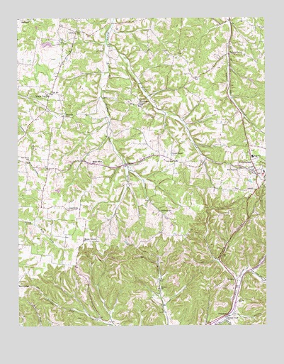
Turners Station, TN USGS Topographic Map
Click on map above to begin viewing in our Map Viewer.

This topographic map contains these locations and features:
Feature Name Type Latitude Longitude GNIS ID View Map
AngeltownPopulated PlaceN36.5473°W86.3497°1304841View Map
BledsoePopulated PlaceN36.5156°W86.2655°1277677View Map
Bledsoe ChurchChurchN36.5150°W86.3033°1277681View Map
Bledsoe Creek ChurchChurchN36.5028°W86.2697°1305290View Map
Bon AirPopulated PlaceN36.5948°W86.3580°1314713View Map
Bon Air School (historical)SchoolN36.5937°W86.3589°1320593View Map
Bostic ChapelChurchN36.5673°W86.2978°1278006View Map
Bradley CemeteryCemeteryN36.5098°W86.2642°1278185View Map
BransfordPopulated PlaceN36.5042°W86.2700°1314725View Map
Bransford Census Designated PlaceCensusN36.5133°W86.2853°2584573View Map
Butt CemeteryCemeteryN36.6156°W86.3525°1279196View Map
Commissioner District 1CivilN36.5699°W86.3348°2464288View Map
Duffer HollowValleyN36.5024°W86.3287°1647559View Map
Dutch CreekStreamN36.6145°W86.3300°1283237View Map
FairfieldPopulated PlaceN36.6198°W86.3455°1315035View Map
Fairfield CemeteryCemeteryN36.6200°W86.3453°1646723View Map
Fairfield Census Designated PlaceCensusN36.6209°W86.3425°2584577View Map
Fairfield ChurchChurchN36.6200°W86.3442°1320617View Map
Fairfield School (historical)SchoolN36.6200°W86.3422°1320618View Map
Forest ChapelChurchN36.5698°W86.2975°1284581View Map
Free Methodist CemeteryCemeteryN36.5670°W86.2814°1646726View Map
Gregory HollowValleyN36.5223°W86.2587°1286245View Map
HighlandPopulated PlaceN36.6245°W86.3730°1315235View Map
Keen HollowValleyN36.6029°W86.3311°1647560View Map
LibertyPopulated PlaceN36.5656°W86.3203°1315388View Map
Liberty Presbyterian ChurchChurchN36.5656°W86.3225°1325963View Map
Maple Grove ChurchChurchN36.5662°W86.3378°1292621View Map
Meadowbrook Game Farm DamDamN36.6150°W86.3567°1302693View Map
Meadowbrook Game Farm LakeReservoirN36.6147°W86.3600°1302692View Map
Mount VernonPopulated PlaceN36.5353°W86.3422°1315560View Map
Mount Vernon CemeteryCemeteryN36.5339°W86.3378°1646721View Map
Mount Vernon ChurchChurchN36.5342°W86.3378°1320669View Map
New Hope CemeteryCemeteryN36.5634°W86.2628°1646727View Map
New Hope General Baptist ChurchChurchN36.5637°W86.2644°1306824View Map
Oak Grove Community Fire DepartmentBuildingN36.5702°W86.3587°2653898View Map
Oak Grove SchoolSchoolN36.5673°W86.3694°1296132View Map
Otter ForkStreamN36.5017°W86.2708°1296519View Map
Phillips HollowValleyN36.5222°W86.2587°1297365View Map
Pine LakeReservoirN36.5567°W86.3500°1302675View Map
Pine Lake DamDamN36.5567°W86.3500°1302674View Map
PondvillePopulated PlaceN36.5856°W86.3514°1298124View Map
ProvidencePopulated PlaceN36.5898°W86.3128°1298599View Map
Providence Baptist ChurchChurchN36.5898°W86.3133°1646724View Map
Providence CemeteryCemeteryN36.5906°W86.3130°1646725View Map
Providence School (historical)SchoolN36.5895°W86.3139°1320686View Map
Rockhouse HollowValleyN36.5263°W86.2741°1299826View Map
Sulphur Fork CemeteryCemeteryN36.5939°W86.3592°1646722View Map
Sulphur Fork ChurchChurchN36.5937°W86.3592°1271782View Map
Sumner County Sheriff's DepartmentBuildingN36.5703°W86.3587°2765989View Map
Turners StationPopulated PlaceN36.6103°W86.2683°1273090View Map
Turners United Methodist ChurchChurchN36.6106°W86.2692°1325968View Map
Westmoreland Division (historical)CensusN36.5737°W86.3228°1648976View Map
Westmoreland Elementary SchoolSchoolN36.5620°W86.2508°1320721View Map
Westmoreland High SchoolSchoolN36.5687°W86.2567°1320723View Map
WithamtownPopulated PlaceN36.5467°W86.3039°1314527View Map

Note: Coordinates in the location and feature list above are referenced to NAD83 datum.


Copyright (C) 2008-2024 Ryan Niemi / Sunset Dynamics ... All Rights Reserved