TopoQuest Logo
Do you find TopoQuest useful?
Help keep TopoQuest running and adding new maps/features by donating!
Bitcoin:  19c7KJd3qBynnjoSw5npx9KScwjBe4ifkT
Litecoin:  LXs6TkuXGGXo1vDsWCkWVdjQX94eUKd6ui
Home View Maps Find Maps Find Places Resources & Links


Hidden Lake Bench, Montana Topographic Map

USGS Map Title: Hidden Lake Bench, MT
USGS Map MRC: 44111F5
DRG (GeoTIFF) Download: o44111f5.tif


Neighboring USGS Topographic Map Quads:


  Freezeout Mountain, MT  
44111G6
 

  Cliff Lake, MT  
44111G5
 

  Earthquake Lake, MT  
44111G4
 

  Elk Springs, MT  
44111F6
 

  Hidden Lake Bench, MT  
44111F5
 

  Targhee Peak, ID  
44111F4
 

  Upper Red Rock Lake, MT  
44111E6
 

  Mount Jefferson, MT  
44111E5
 

  Sawtell Peak, ID  
44111E4


Map MRC Location:

N45°
W112°
N45°
W111°
H8 H7 H6 H5 H4 H3 H2 H1
G8 G7 G6 G5 G4 G3 G2 G1
F8 F7 F6 F5 F4 F3 F2 F1
E8 E7 E6 E5 E4 E3 E2 E1
D8 D7 D6 D5 D4 D3 D2 D1
C8 C7 C6 C5 C4 C3 C2 C1
B8 B7 B6 B5 B4 B3 B2 B1
A8 A7 A6 A5 A4 A3 A2 A1
N44°
W112°
N44°
W111°

Hidden Lake Bench, MT USGS 1:24K Topographic Map Preview:
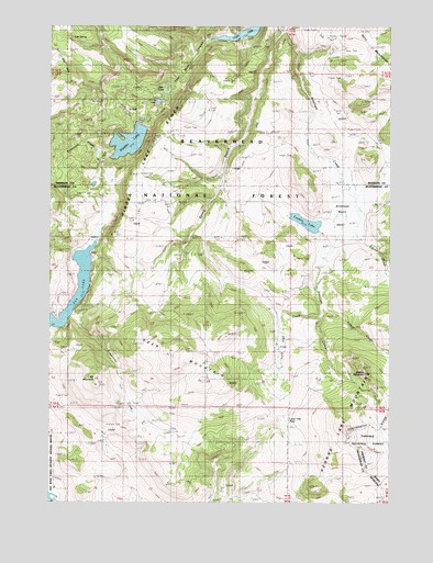
Hidden Lake Bench, MT USGS Topographic Map
Click on map above to begin viewing in our Map Viewer.

This topographic map contains these locations and features:
Feature Name Type Latitude Longitude GNIS ID View Map
13S01E28AACD01 SpringSpringN44.6749°W111.6016°807163View Map
13S01E33AAC_01 SpringSpringN44.6605°W111.6008°807146View Map
13S01E36DDD_01 SpringSpringN44.6521°W111.5391°807137View Map
14S02E06CCCB01 SpringSpringN44.6358°W111.5363°807134View Map
14S02E07CBAD01 SpringSpringN44.6254°W111.5366°807133View Map
Antelope BasinBasinN44.7008°W111.5147°779056View Map
Antelope CreekStreamN44.7499°W111.5389°778783View Map
Anthill CreekStreamN44.6744°W111.5252°779079View Map
Brimstone CreekStreamN44.7163°W111.6030°780414View Map
Conklin LakeLakeN44.6985°W111.5315°770055View Map
Deer MountainSummitN44.6574°W111.5669°782264View Map
Elk LakeLakeN44.6719°W111.6235°783092View Map
Elk MountainSummitN44.6574°W111.6091°783094View Map
Goose LakeLakeN44.7303°W111.5862°784113View Map
Hidden LakeLakeN44.7195°W111.5971°784827View Map
Hidden Lake BenchBenchN44.7174°W111.5866°784842View Map
Hidden Lake Camp GroundLocaleN44.7269°W111.5930°784843View Map
Horn MountainsRangeN44.7410°W111.5002°806780View Map
Limestone CreekStreamN44.6744°W111.6172°786145View Map
Lone Tree CreekStreamN44.6749°W111.5255°786493View Map
Lone Tree PassGapN44.6463°W111.5386°786498View Map
Lost Mine CanyonValleyN44.7474°W111.5611°786623View Map
Lost SpringSpringN44.7471°W111.6177°786634View Map
Orr RanchLocaleN44.6958°W111.5258°788497View Map
Otter LakeLakeN44.7341°W111.5832°788515View Map
Poison CreekStreamN44.6949°W111.5144°789032View Map
Saddle MountainSummitN44.6594°W111.5094°789891View Map
Spring BranchStreamN44.7499°W111.5394°791192View Map

Note: Coordinates in the location and feature list above are referenced to NAD83 datum.


Copyright (C) 2008-2025 Ryan Niemi / Sunset Dynamics ... All Rights Reserved