TopoQuest Logo
Do you find TopoQuest useful?
Help keep TopoQuest running and adding new maps/features by donating!
Bitcoin:  19c7KJd3qBynnjoSw5npx9KScwjBe4ifkT
Litecoin:  LXs6TkuXGGXo1vDsWCkWVdjQX94eUKd6ui
Home View Maps Find Maps Find Places Resources & Links


Earthquake Lake, Montana Topographic Map

USGS Map Title: Earthquake Lake, MT
USGS Map MRC: 44111G4
DRG (GeoTIFF) Download: o44111g4.tif


Neighboring USGS Topographic Map Quads:


  Bad Luck Creek, MT  
44111H5
 

  Hilgard Peak, MT  
44111H4
 

  Pika Point, MT  
44111H3
 

  Cliff Lake, MT  
44111G5
 

  Earthquake Lake, MT  
44111G4
 

  Hebgen Dam, MT  
44111G3
 

  Hidden Lake Bench, MT  
44111F5
 

  Targhee Peak, ID  
44111F4
 

  Targhee Pass, ID  
44111F3


Map MRC Location:

N45°
W112°
N45°
W111°
H8 H7 H6 H5 H4 H3 H2 H1
G8 G7 G6 G5 G4 G3 G2 G1
F8 F7 F6 F5 F4 F3 F2 F1
E8 E7 E6 E5 E4 E3 E2 E1
D8 D7 D6 D5 D4 D3 D2 D1
C8 C7 C6 C5 C4 C3 C2 C1
B8 B7 B6 B5 B4 B3 B2 B1
A8 A7 A6 A5 A4 A3 A2 A1
N44°
W112°
N44°
W111°

Earthquake Lake, MT USGS 1:24K Topographic Map Preview:
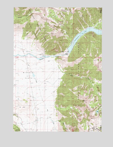
Earthquake Lake, MT USGS Topographic Map
Click on map above to begin viewing in our Map Viewer.

This topographic map contains these locations and features:
Feature Name Type Latitude Longitude GNIS ID View Map
12S02E03ABDB01 WellWellN44.8219°W111.4638°807218View Map
Beaver Creek CampgroundLocaleN44.8546°W111.3797°794462View Map
Eagle CreekStreamN44.8530°W111.3952°782749View Map
Earthquake LakeLakeN44.8529°W111.3889°793664View Map
Earthquake Lake DamDamN44.8299°W111.4258°795999View Map
Earthquake Lake Visitor CenterBuildingN44.8308°W111.4255°1797804View Map
Earthquake MemorialLocaleN44.8305°W111.4294°793665View Map
Henrys Lake MountainsRangeN44.7810°W111.4000°383109View Map
Little Mile CreekStreamN44.7599°W111.4452°786327View Map
Madison SlideSlopeN44.8274°W111.4257°793667View Map
Mile CreekStreamN44.8255°W111.4994°787340View Map
Montbestos Post Office (historical)Post OfficeN44.7571°W111.4280°1797478View Map
Olifee RanchLocaleN44.8424°W111.4886°788436View Map
Raynolds Pass Fishing Access SiteLocaleN44.8266°W111.4869°794463View Map
Rock CreekStreamN44.8383°W111.4175°789660View Map
Rock Creek CampgroundLocaleN44.8305°W111.4261°789688View Map
Shaw RanchLocaleN44.7799°W111.4586°790300View Map
Sheep CreekStreamN44.8246°W111.4536°790324View Map
Sheep LakeLakeN44.7702°W111.3819°793670View Map
Sheep MountainSummitN44.7813°W111.3986°790354View Map
Slide InnLocaleN44.8263°W111.4591°1797662View Map
Stagger RanchLocaleN44.8277°W111.4577°791416View Map
The HornSummitN44.7727°W111.4963°792038View Map

Note: Coordinates in the location and feature list above are referenced to NAD83 datum.


Copyright (C) 2008-2025 Ryan Niemi / Sunset Dynamics ... All Rights Reserved