TopoQuest Logo
Do you find TopoQuest useful?
Help keep TopoQuest running and adding new maps/features by donating!
Bitcoin:  19c7KJd3qBynnjoSw5npx9KScwjBe4ifkT
Litecoin:  LXs6TkuXGGXo1vDsWCkWVdjQX94eUKd6ui
Home View Maps Find Maps Find Places Resources & Links


Babcock, Wisconsin Topographic Map

USGS Map Title: Babcock, WI
USGS Map MRC: 44090C1
DRG (GeoTIFF) Download: o44090c1.tif


Neighboring USGS Topographic Map Quads:


  Pittsville, WI  
44090D2
 

  Lake Dexter, WI  
44090D1
 

  Vesper, WI  
44089D8
 

  Quail Point Flowage, WI  
44090C2
 

  Babcock, WI  
44090C1
 

  Nekoosa, WI  
44089C8
 

  Finley, WI  
44090B2
 

  New Miner, WI  
44090B1
 

  Arkdale NW, WI  
44089B8


Map MRC Location:

N45°
W91°
N45°
W90°
H8 H7 H6 H5 H4 H3 H2 H1
G8 G7 G6 G5 G4 G3 G2 G1
F8 F7 F6 F5 F4 F3 F2 F1
E8 E7 E6 E5 E4 E3 E2 E1
D8 D7 D6 D5 D4 D3 D2 D1
C8 C7 C6 C5 C4 C3 C2 C1
B8 B7 B6 B5 B4 B3 B2 B1
A8 A7 A6 A5 A4 A3 A2 A1
N44°
W91°
N44°
W90°

Babcock, WI USGS 1:24K Topographic Map Preview:
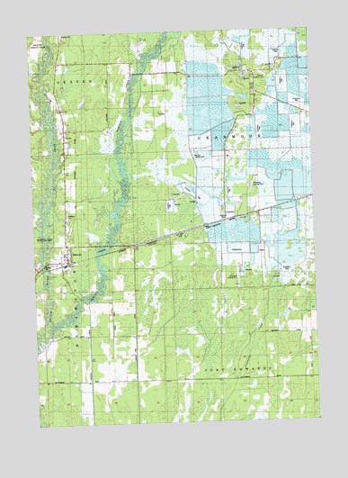
Babcock, WI USGS Topographic Map
Click on map above to begin viewing in our Map Viewer.

This topographic map contains these locations and features:
Feature Name Type Latitude Longitude GNIS ID View Map
13 ReservoirReservoirN44.3200°W90.0068°1792894View Map
BabcockPopulated PlaceN44.3016°W90.1112°1561050View Map
Babcock CemeteryCemeteryN44.3163°W90.1101°1561051View Map
Babcock Census Designated PlaceCensusN44.3044°W90.1076°2586453View Map
Bennett Landing Strip (historical)AirportN44.3605°W90.0207°1846984View Map
Brazeau Landing Strip (historical)AirportN44.3352°W90.0529°1846987View Map
CranmoorPopulated PlaceN44.3147°W90.0329°1577559View Map
Cranmoor SchoolSchoolN44.3544°W90.0232°1563510View Map
Emmerich DamDamN44.3200°W90.0068°1792893View Map
Gottschalk FieldAirportN44.2981°W90.0346°1582104View Map
Hemlock CreekStreamN44.2791°W90.1179°1566284View Map
Remington Volunteer Fire DepartmentBuildingN44.3047°W90.1097°2697636View Map
Speedwing Field (historical)AirportN44.2961°W90.0437°1581867View Map
Town of CranmoorCivilN44.3470°W90.0185°1583025View Map
Two Mile CreekStreamN44.3477°W90.1160°2760616View Map
Whittlesey Cranberry Co AirportAirportN44.3255°W90.0273°1581866View Map

Note: Coordinates in the location and feature list above are referenced to NAD83 datum.


Copyright (C) 2008-2024 Ryan Niemi / Sunset Dynamics ... All Rights Reserved