TopoQuest Logo
Do you find TopoQuest useful?
Help keep TopoQuest running and adding new maps/features by donating!
Bitcoin:  19c7KJd3qBynnjoSw5npx9KScwjBe4ifkT
Litecoin:  LXs6TkuXGGXo1vDsWCkWVdjQX94eUKd6ui
Home View Maps Find Maps Find Places Resources & Links


Nekoosa, Wisconsin Topographic Map

USGS Map Title: Nekoosa, WI
USGS Map MRC: 44089C8
DRG (GeoTIFF) Download: o44089c8.tif


Neighboring USGS Topographic Map Quads:


  Lake Dexter, WI  
44090D1
 

  Vesper, WI  
44089D8
 

  Wisconsin Rapids North, WI  
44089D7
 

  Babcock, WI  
44090C1
 

  Nekoosa, WI  
44089C8
 

  Wisconsin Rapids South, WI  
44089C7
 

  New Miner, WI  
44090B1
 

  Arkdale NW, WI  
44089B8
 

  Arkdale NE, WI  
44089B7


Map MRC Location:

N45°
W90°
N45°
W89°
H8 H7 H6 H5 H4 H3 H2 H1
G8 G7 G6 G5 G4 G3 G2 G1
F8 F7 F6 F5 F4 F3 F2 F1
E8 E7 E6 E5 E4 E3 E2 E1
D8 D7 D6 D5 D4 D3 D2 D1
C8 C7 C6 C5 C4 C3 C2 C1
B8 B7 B6 B5 B4 B3 B2 B1
A8 A7 A6 A5 A4 A3 A2 A1
N44°
W90°
N44°
W89°

Nekoosa, WI USGS 1:24K Topographic Map Preview:
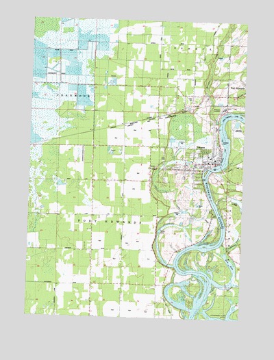
Nekoosa, WI USGS Topographic Map
Click on map above to begin viewing in our Map Viewer.

This topographic map contains these locations and features:
Feature Name Type Latitude Longitude GNIS ID View Map
11 ReservoirReservoirN44.3616°W89.9501°1792662View Map
14 ReservoirReservoirN44.3503°W89.9523°1792660View Map
Alexander Middle SchoolSchoolN44.3094°W89.9170°2715655View Map
Arbutus School (historical)SchoolN44.2714°W89.9626°1876648View Map
Bethlehem Lutheran ChurchChurchN44.3141°W89.9076°1846985View Map
City of NekoosaCivilN44.3134°W89.9073°1583788View Map
Cranmoor AirstripAirportN44.3171°W89.9687°1582105View Map
Grass LakeLakeN44.2866°W89.9233°1565763View Map
Green Grove School (historical)SchoolN44.3436°W89.9110°1876652View Map
Humke Elementary SchoolSchoolN44.3108°W89.9048°1847033View Map
Lynn CreekStreamN44.2722°W89.9140°1568847View Map
Moccasin CreekStreamN44.3327°W89.8893°1569621View Map
NekoosaPopulated PlaceN44.3125°W89.9043°1570148View Map
Nekoosa AcademySchoolN44.3098°W89.9048°2715807View Map
Nekoosa Alternate Charter Middle SchoolSchoolN44.3093°W89.9167°2715744View Map
Nekoosa Fire DepartmentBuildingN44.3150°W89.9010°2697856View Map
Nekoosa Flowage 5564ReservoirN44.3133°W89.8935°1793109View Map
Nekoosa High SchoolSchoolN44.3091°W89.9095°1847061View Map
Nekoosa JunctionPopulated PlaceN44.3377°W89.8893°1577743View Map
Nekoosa Police DepartmentBuildingN44.3151°W89.9015°2759964View Map
Nekoosa Post OfficePost OfficeN44.3150°W89.9046°1847062View Map
Nekoosa WP348 DamDamN44.3126°W89.8942°1793108View Map
Pine Grove School (historical)SchoolN44.3658°W89.8957°1876655View Map
Plank Hill School (historical)SchoolN44.2744°W89.9243°1876657View Map
Ripple CreekStreamN44.3366°W89.8785°1572340View Map
Riverside CemeteryCemeteryN44.3302°W89.8913°1847083View Map
Riverside ParkParkN44.3244°W89.8890°1572376View Map
Ross LakeLakeN44.2738°W89.8815°1572623View Map
Sacred Heart of Jesus ChurchChurchN44.3211°W89.8890°1847090View Map
Sacred Heart SchoolSchoolN44.3212°W89.8893°1847089View Map
Sevenmile CreekStreamN44.2816°W89.8865°1573916View Map
Tenmile CreekStreamN44.2639°W89.8854°1575305View Map
Town of Port EdwardsCivilN44.2864°W89.9732°1583955View Map
Village of Port Edwards CemeteryCemeteryN44.3428°W89.8975°2099744View Map
WCAE-AM (Nekoosa)TowerN44.2680°W89.9599°1582334View Map
Wittenberg School (historical)SchoolN44.3077°W89.9546°1876665View Map
Wood County 2 C 6118 DamDamN44.3483°W89.9535°1792659View Map
Wood County 3 C 6118 DamDamN44.3616°W89.9501°1792661View Map

Note: Coordinates in the location and feature list above are referenced to NAD83 datum.


Copyright (C) 2008-2025 Ryan Niemi / Sunset Dynamics ... All Rights Reserved