TopoQuest Logo
Do you find TopoQuest useful?
Help keep TopoQuest running and adding new maps/features by donating!
Bitcoin:  19c7KJd3qBynnjoSw5npx9KScwjBe4ifkT
Litecoin:  LXs6TkuXGGXo1vDsWCkWVdjQX94eUKd6ui
Home View Maps Find Maps Find Places Resources & Links


Vesper, Wisconsin Topographic Map

USGS Map Title: Vesper, WI
USGS Map MRC: 44089D8
DRG (GeoTIFF) Download: o44089d8.tif


Neighboring USGS Topographic Map Quads:


  Arpin, WI  
44090E1
 

  Sherry, WI  
44089E8
 

  Junction City, WI  
44089E7
 

  Lake Dexter, WI  
44090D1
 

  Vesper, WI  
44089D8
 

  Wisconsin Rapids North, WI  
44089D7
 

  Babcock, WI  
44090C1
 

  Nekoosa, WI  
44089C8
 

  Wisconsin Rapids South, WI  
44089C7


Map MRC Location:

N45°
W90°
N45°
W89°
H8 H7 H6 H5 H4 H3 H2 H1
G8 G7 G6 G5 G4 G3 G2 G1
F8 F7 F6 F5 F4 F3 F2 F1
E8 E7 E6 E5 E4 E3 E2 E1
D8 D7 D6 D5 D4 D3 D2 D1
C8 C7 C6 C5 C4 C3 C2 C1
B8 B7 B6 B5 B4 B3 B2 B1
A8 A7 A6 A5 A4 A3 A2 A1
N44°
W90°
N44°
W89°

Vesper, WI USGS 1:24K Topographic Map Preview:
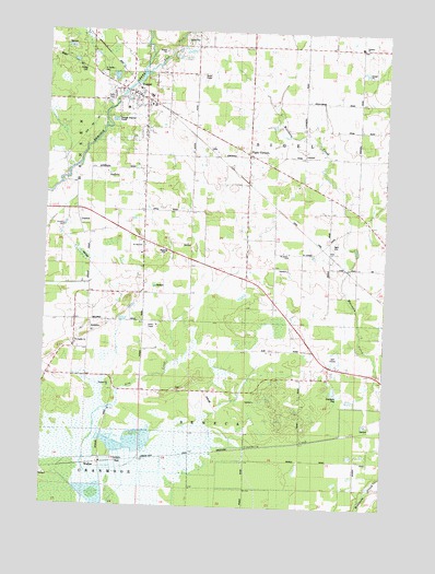
Vesper, WI USGS Topographic Map
Click on map above to begin viewing in our Map Viewer.

This topographic map contains these locations and features:
Feature Name Type Latitude Longitude GNIS ID View Map
Altdorf School (historical)SchoolN44.4175°W89.9893°1876647View Map
Bean School (historical)SchoolN44.4497°W89.9874°1876649View Map
Bethany ChurchChurchN44.4958°W89.8848°1561618View Map
Bethany Lutheran CemeteryCemeteryN44.4963°W89.8843°1964373View Map
East Fork Hemlock CreekStreamN44.4883°W89.9649°1564323View Map
Eight CornersPopulated PlaceN44.4677°W89.9254°1564469View Map
Elm CreekStreamN44.3808°W89.9793°1564554View Map
Faith Reformed Church CemeteryCemeteryN44.4822°W89.9765°1847007View Map
Lone Pine School (historical)SchoolN44.4383°W89.8754°1876654View Map
Pioneer School (historical)SchoolN44.4669°W89.8757°1876656View Map
Saint James Catholic ChurchChurchN44.4863°W89.9726°1847094View Map
Saint James CemeteryCemeteryN44.4880°W89.9796°1572976View Map
Saint Johns ChurchChurchN44.4411°W89.9110°1573096View Map
Saint Joseph ChurchChurchN44.4175°W89.9885°1847099View Map
Saint Josephs CemeteryCemeteryN44.4175°W89.9879°1964376View Map
Saint Paul ChurchChurchN44.4436°W89.9635°1847105View Map
Saint Pauls Lutheran CemeteryCemeteryN44.4433°W89.9635°1964379View Map
Sigel CemeteryCemeteryN44.4452°W89.8935°1574091View Map
Snyder School (historical)SchoolN44.4380°W89.9365°1876661View Map
Spring Lake School (historical)SchoolN44.4963°W89.9362°1876662View Map
Swensen AirportAirportN44.4169°W89.9858°2444147View Map
Town of SenecaCivilN44.3973°W89.9513°1584124View Map
Town of SigelCivilN44.4676°W89.9038°1584160View Map
Trinity CemeteryCemeteryN44.4902°W89.9879°1575612View Map
Turner School (historical)SchoolN44.4675°W89.9357°1876664View Map
VesperPopulated PlaceN44.4822°W89.9640°1576070View Map
Vesper DamDamN44.4833°W89.9735°1792312View Map
Vesper Elementary SchoolSchoolN44.4795°W89.9711°1847127View Map
Vesper Police DepartmentBuildingN44.4835°W89.9674°2759966View Map
Vesper Pond 38ReservoirN44.4833°W89.9735°1792313View Map
Vesper Volunteer Fire DepartmentBuildingN44.4834°W89.9674°2697706View Map
Village of VesperCivilN44.4805°W89.9676°1584330View Map
WalkerPopulated PlaceN44.3861°W89.9787°1847130View Map
Winch AirfieldAirportN44.4947°W89.9122°1582277View Map

Note: Coordinates in the location and feature list above are referenced to NAD83 datum.


Copyright (C) 2008-2025 Ryan Niemi / Sunset Dynamics ... All Rights Reserved