TopoQuest Logo
Do you find TopoQuest useful?
Help keep TopoQuest running and adding new maps/features by donating!
Bitcoin:  19c7KJd3qBynnjoSw5npx9KScwjBe4ifkT
Litecoin:  LXs6TkuXGGXo1vDsWCkWVdjQX94eUKd6ui
Home View Maps Find Maps Find Places Resources & Links


Lake Dexter, Wisconsin Topographic Map

USGS Map Title: Lake Dexter, WI
USGS Map MRC: 44090D1
DRG (GeoTIFF) Download: o44090d1.tif


Neighboring USGS Topographic Map Quads:


  Lake Manakiki, WI  
44090E2
 

  Arpin, WI  
44090E1
 

  Sherry, WI  
44089E8
 

  Pittsville, WI  
44090D2
 

  Lake Dexter, WI  
44090D1
 

  Vesper, WI  
44089D8
 

  Quail Point Flowage, WI  
44090C2
 

  Babcock, WI  
44090C1
 

  Nekoosa, WI  
44089C8


Map MRC Location:

N45°
W91°
N45°
W90°
H8 H7 H6 H5 H4 H3 H2 H1
G8 G7 G6 G5 G4 G3 G2 G1
F8 F7 F6 F5 F4 F3 F2 F1
E8 E7 E6 E5 E4 E3 E2 E1
D8 D7 D6 D5 D4 D3 D2 D1
C8 C7 C6 C5 C4 C3 C2 C1
B8 B7 B6 B5 B4 B3 B2 B1
A8 A7 A6 A5 A4 A3 A2 A1
N44°
W91°
N44°
W90°

Lake Dexter, WI USGS 1:24K Topographic Map Preview:
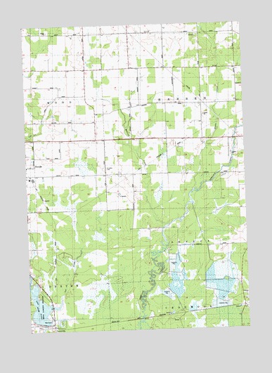
Lake Dexter, WI USGS Topographic Map
Click on map above to begin viewing in our Map Viewer.

This topographic map contains these locations and features:
Feature Name Type Latitude Longitude GNIS ID View Map
Dawes CreekStreamN44.4325°W90.0293°1563742View Map
Dexter County ParkParkN44.3875°W90.1237°1847002View Map
DextervillePopulated PlaceN44.3764°W90.1107°1563957View Map
Dexterville 2WP1566 DamDamN44.3781°W90.1166°1792813View Map
Lake DexterReservoirN44.3871°W90.1200°1563956View Map
Little Hemlock CreekStreamN44.4177°W90.0457°1568278View Map
Natwick School (historical)SchoolN44.4680°W90.0485°1876824View Map
North Hansen School (historical)SchoolN44.4966°W90.0551°1876825View Map
Owl CreekStreamN44.3847°W90.1143°1570966View Map
PittsvillePopulated PlaceN44.4391°W90.1246°1571567View Map
Pittsville Fire DepartmentBuildingN44.4421°W90.1247°2698074View Map
Pleasant Valley Cranberry MarshLocaleN44.4286°W90.0744°2723767View Map
Saint Johns CemeteryCemeteryN44.4413°W90.0787°1573057View Map
Town of HansenCivilN44.4676°W90.0230°1583348View Map
Wood CountyCivilN44.4553°W90.0415°1581130View Map

Note: Coordinates in the location and feature list above are referenced to NAD83 datum.


Copyright (C) 2008-2025 Ryan Niemi / Sunset Dynamics ... All Rights Reserved