TopoQuest Logo
Do you find TopoQuest useful?
Help keep TopoQuest running and adding new maps/features by donating!
Bitcoin:  19c7KJd3qBynnjoSw5npx9KScwjBe4ifkT
Litecoin:  LXs6TkuXGGXo1vDsWCkWVdjQX94eUKd6ui
Home View Maps Find Maps Find Places Resources & Links


Hilger, Montana Topographic Map

USGS Map Title: Hilger, MT
USGS Map MRC: 47109C3
DRG (GeoTIFF) Download: o47109c3.tif


Neighboring USGS Topographic Map Quads:


  Hilger NW, MT  
47109D4
 

  Christina, MT  
47109D3
 

  The Horse Ranch, MT  
47109D2
 

  Kendall, MT  
47109C4
 

  Hilger, MT  
47109C3
 

  Armells, MT  
47109C2
 

  Brooks, MT  
47109B4
 

  New Year, MT  
47109B3
 

  Judith Peak, MT  
47109B2


Map MRC Location:

N48°
W110°
N48°
W109°
H8 H7 H6 H5 H4 H3 H2 H1
G8 G7 G6 G5 G4 G3 G2 G1
F8 F7 F6 F5 F4 F3 F2 F1
E8 E7 E6 E5 E4 E3 E2 E1
D8 D7 D6 D5 D4 D3 D2 D1
C8 C7 C6 C5 C4 C3 C2 C1
B8 B7 B6 B5 B4 B3 B2 B1
A8 A7 A6 A5 A4 A3 A2 A1
N47°
W110°
N47°
W109°

Hilger, MT USGS 1:24K Topographic Map Preview:
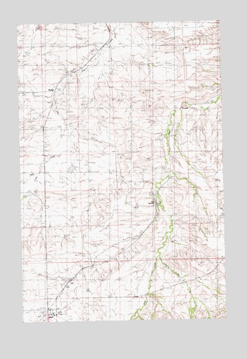
Hilger, MT USGS Topographic Map
Click on map above to begin viewing in our Map Viewer.

This topographic map contains these locations and features:
Feature Name Type Latitude Longitude GNIS ID View Map
17N18E01ABAC01 WellWellN47.2722°W109.3657°821852View Map
17N19E07BBC_01 WellWellN47.2553°W109.3577°821719View Map
17N19E07BC__01 WellWellN47.2536°W109.3568°821707View Map
17N19E07BC__02 WellWellN47.2536°W109.3568°821708View Map
18N18E12ACA_01 WellWellN47.3375°W109.3646°822294View Map
18N18E24DCD_01 WellWellN47.3005°W109.3663°822060View Map
18N19E08ABB_01 WellWellN47.3444°W109.3243°822345View Map
18N19E08BCD_01 WellWellN47.3347°W109.3324°822283View Map
18N19E18DA__01 WellWellN47.3166°W109.3399°822159View Map
18N19E19BBB_01 WellWellN47.3105°W109.3574°822123View Map
18N19E28BCA_01 WellWellN47.2947°W109.3093°822009View Map
18N19E31CCC_01 WellWellN47.2711°W109.3538°821847View Map
18N19E31CCCD01 WellWellN47.2750°W109.3577°821878View Map
18N19E33AAA_01 WellWellN47.2805°W109.2966°821903View Map
HilgerPopulated PlaceN47.2539°W109.3599°772408View Map
Hilger (historical)LocaleN47.2539°W109.3599°1722892View Map
Hilger Fire DepartmentBuildingN47.2550°W109.3579°2546513View Map
Hilger Post OfficePost OfficeN47.2529°W109.3618°1722893View Map
Hilger School (historical)SchoolN47.2539°W109.3599°1722895View Map
Little Deer CreekStreamN47.2772°W109.2907°805786View Map
Little Dog CreekStreamN47.3125°W109.3638°773440View Map
MoultonPopulated PlaceN47.3458°W109.3546°774419View Map
Moulton (historical)LocaleN47.3458°W109.3546°1722925View Map
Moulton Post Office (historical)Post OfficeN47.3458°W109.3546°1722924View Map
Presbyterian ChurchChurchN47.2539°W109.3599°1722894View Map
Roy JunctionLocaleN47.2986°W109.2927°805787View Map
Roy Junction School (historical)SchoolN47.3055°W109.3168°1722684View Map
Saint Victor ChurchChurchN47.2539°W109.3599°1722896View Map
Van Haur DamDamN47.3133°W109.3407°796186View Map

Note: Coordinates in the location and feature list above are referenced to NAD83 datum.


Copyright (C) 2008-2024 Ryan Niemi / Sunset Dynamics ... All Rights Reserved