TopoQuest Logo
Do you find TopoQuest useful?
Help keep TopoQuest running and adding new maps/features by donating!
Bitcoin:  19c7KJd3qBynnjoSw5npx9KScwjBe4ifkT
Litecoin:  LXs6TkuXGGXo1vDsWCkWVdjQX94eUKd6ui
Home View Maps Find Maps Find Places Resources & Links


Judith Peak, Montana Topographic Map

USGS Map Title: Judith Peak, MT
USGS Map MRC: 47109B2
DRG (GeoTIFF) Download: o47109b2.tif


Neighboring USGS Topographic Map Quads:


  Hilger, MT  
47109C3
 

  Armells, MT  
47109C2
 

  Fergus, MT  
47109C1
 

  New Year, MT  
47109B3
 

  Judith Peak, MT  
47109B2
 

  Lewis Peak, MT  
47109B1
 

  Pike Creek, MT  
47109A3
 

  Horsethief Coulee West, MT  
47109A2
 

  Horsethief Coulee East, MT  
47109A1


Map MRC Location:

N48°
W110°
N48°
W109°
H8 H7 H6 H5 H4 H3 H2 H1
G8 G7 G6 G5 G4 G3 G2 G1
F8 F7 F6 F5 F4 F3 F2 F1
E8 E7 E6 E5 E4 E3 E2 E1
D8 D7 D6 D5 D4 D3 D2 D1
C8 C7 C6 C5 C4 C3 C2 C1
B8 B7 B6 B5 B4 B3 B2 B1
A8 A7 A6 A5 A4 A3 A2 A1
N47°
W110°
N47°
W109°

Judith Peak, MT USGS 1:24K Topographic Map Preview:
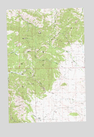
Judith Peak, MT USGS Topographic Map
Click on map above to begin viewing in our Map Viewer.

This topographic map contains these locations and features:
Feature Name Type Latitude Longitude GNIS ID View Map
16N20E06ADCC01 WellWellN47.1791°W109.2318°821267View Map
17N20E19AC__01 SpringSpringN47.2227°W109.2205°821532View Map
Alpine GulchValleyN47.1791°W109.2496°768221View Map
Armell Creek Number 1 MineMineN47.2347°W109.2110°802926View Map
Big Grassy PeakSummitN47.2039°W109.2177°768790View Map
Black Bull MineMineN47.1611°W109.2363°802909View Map
Black Bull MineMineN47.1603°W109.2352°768916View Map
Canyon (historical)Populated PlaceN47.1772°W109.2104°1722813View Map
Chicago GulchValleyN47.1986°W109.1482°769806View Map
Collar GulchValleyN47.1861°W109.1646°770030View Map
Collar PeakSummitN47.2019°W109.1946°770031View Map
Crystal PeakSummitN47.1858°W109.1943°770362View Map
Cumberland MineMineN47.1816°W109.2085°770369View Map
East Fork Armell Creek Number 1 MineMineN47.2339°W109.1674°802927View Map
East Fork Armell Creek Number 2 MineMineN47.2319°W109.1674°802928View Map
East Fork Armell Creek Number 3 MineMineN47.2339°W109.1499°802929View Map
East Fork Creek Number 1 MineMineN47.2278°W109.1632°802930View Map
East Fork Creek Number 2 MineMineN47.2230°W109.1660°802931View Map
East Fork Creek Number 3 MineMineN47.2228°W109.1663°802932View Map
East Fork Fords CreekStreamN47.1975°W109.1474°771039View Map
East Fork Number 4 MineMineN47.2141°W109.1507°802951View Map
East Fork Number 5 MineMineN47.2133°W109.1496°802950View Map
East Fork Number 6 MineMineN47.2255°W109.1591°802952View Map
Elk PeakSummitN47.2266°W109.1443°771195View Map
Elk Peak Number 1 MineMineN47.2228°W109.1554°802933View Map
Elk Peak Number 2 MineMineN47.2236°W109.1554°802934View Map
Elk Peak Number 3 MineMineN47.2236°W109.1541°802935View Map
Elk Peak Number 4 MineMineN47.2255°W109.1549°802936View Map
Elk Peak Number 5 MineMineN47.2269°W109.1535°802937View Map
Elk Peak Number 6 MineMineN47.2244°W109.1535°802938View Map
Elk Peak Number 7 MineMineN47.2216°W109.1499°802939View Map
Fort Maginnis (historical)MilitaryN47.1417°W109.1339°1722852View Map
Fort Maginnis CemeteryCemeteryN47.1880°W109.1474°771513View Map
Fort Maginnis Military Reservation (historical)MilitaryN47.1667°W109.1256°1722850View Map
Gilt Edge CemeteryCemeteryN47.1325°W109.2035°1722573View Map
Gilt Edge Hospital (historical)HospitalN47.1269°W109.2021°1722572View Map
Gilt Edge MineMineN47.1450°W109.2285°802893View Map
Gilt Edge School (historical)SchoolN47.1280°W109.2016°1722843View Map
GiltedgePopulated PlaceN47.1269°W109.2021°771780View Map
Giltedge MineMineN47.1441°W109.2274°771781View Map
Giltedge Post Office (historical)Post OfficeN47.1280°W109.2016°1722844View Map
Gold HillSummitN47.1783°W109.2152°771834View Map
Judith MountainsRangeN47.2189°W109.2285°806782View Map
Judith PeakSummitN47.2166°W109.2218°772916View Map
Justice MineMineN47.1761°W109.2293°802908View Map
Lewistown Air Force Station (historical)MilitaryN47.2175°W109.2222°2087778View Map
Lower Old Glory MineMineN47.2353°W109.1360°802941View Map
Lower Old Nelson MineMineN47.1741°W109.2177°802957View Map
Lower Ox Frame Gulch MineMineN47.1450°W109.2355°802960View Map
Maginnis MineMineN47.1736°W109.2310°773807View Map
Maginnis MountainSummitN47.2150°W109.1716°773808View Map
MaidenPopulated PlaceN47.1778°W109.2302°773822View Map
Maiden CanyonValleyN47.1564°W109.1838°773823View Map
Maiden PeakSummitN47.1897°W109.2268°773825View Map
Maiden Post Office (historical)Post OfficeN47.1783°W109.2307°1722857View Map
Manitoba GulchValleyN47.1486°W109.2246°773858View Map
Miranda MineMineN47.1730°W109.2224°802955View Map
Old Glory MineMineN47.2328°W109.1404°802940View Map
Old Glory MineMineN47.2319°W109.1410°774928View Map
Ox Frame GulchValleyN47.1283°W109.2046°775012View Map
Pekay PeakSummitN47.1622°W109.2277°775142View Map
Pekay Peak Number 1 MineMineN47.1541°W109.2230°802961View Map
Pekay Peak Number 2 MineMineN47.1541°W109.2216°802962View Map
Red MountainSummitN47.2253°W109.1916°775651View Map
Red Mountain MineMineN47.2194°W109.1916°802954View Map
Ruins of Fort MaginnisLocaleN47.1828°W109.1346°776011View Map
Rustle (historical)Populated PlaceN47.1925°W109.2077°1722965View Map
Sheep MountainSummitN47.1672°W109.2146°776455View Map
Spotted Horse (historical)LocaleN47.1791°W109.2118°1722814View Map
Spotted Horse MineMineN47.1805°W109.2146°802892View Map
Spotted Horse MineMineN47.1761°W109.2110°776944View Map
Tail Holt MineMineN47.2075°W109.2104°802895View Map
Tail Holt MineMineN47.2064°W109.2107°777405View Map
Uper Ox Frame Gulch MineMineN47.1461°W109.2355°802959View Map
Upper Old Nelson MineMineN47.1741°W109.2177°802956View Map
Verde MineMineN47.2214°W109.2299°802953View Map
Virgin GulchValleyN47.1389°W109.2091°778035View Map
Virgin Gulch Number 1 MineMineN47.1569°W109.2341°802958View Map
War Eagle MineMineN47.1661°W109.2396°802891View Map

Note: Coordinates in the location and feature list above are referenced to NAD83 datum.


Copyright (C) 2008-2024 Ryan Niemi / Sunset Dynamics ... All Rights Reserved