TopoQuest Logo
Do you find TopoQuest useful?
Help keep TopoQuest running and adding new maps/features by donating!
Bitcoin:  19c7KJd3qBynnjoSw5npx9KScwjBe4ifkT
Litecoin:  LXs6TkuXGGXo1vDsWCkWVdjQX94eUKd6ui
Home View Maps Find Maps Find Places Resources & Links


New Year, Montana Topographic Map

USGS Map Title: New Year, MT
USGS Map MRC: 47109B3
DRG (GeoTIFF) Download: o47109b3.tif


Neighboring USGS Topographic Map Quads:


  Kendall, MT  
47109C4
 

  Hilger, MT  
47109C3
 

  Armells, MT  
47109C2
 

  Brooks, MT  
47109B4
 

  New Year, MT  
47109B3
 

  Judith Peak, MT  
47109B2
 

  Lewistown, MT  
47109A4
 

  Pike Creek, MT  
47109A3
 

  Horsethief Coulee West, MT  
47109A2


Map MRC Location:

N48°
W110°
N48°
W109°
H8 H7 H6 H5 H4 H3 H2 H1
G8 G7 G6 G5 G4 G3 G2 G1
F8 F7 F6 F5 F4 F3 F2 F1
E8 E7 E6 E5 E4 E3 E2 E1
D8 D7 D6 D5 D4 D3 D2 D1
C8 C7 C6 C5 C4 C3 C2 C1
B8 B7 B6 B5 B4 B3 B2 B1
A8 A7 A6 A5 A4 A3 A2 A1
N47°
W110°
N47°
W109°

New Year, MT USGS 1:24K Topographic Map Preview:
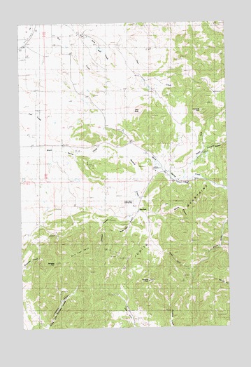
New Year, MT USGS Topographic Map
Click on map above to begin viewing in our Map Viewer.

This topographic map contains these locations and features:
Feature Name Type Latitude Longitude GNIS ID View Map
16N19E02A___01 WellWellN47.1830°W109.2724°821289View Map
16N19E10BCDB01 WellWellN47.1680°W109.3088°821203View Map
16N19E10CCBB01 WellWellN47.1625°W109.3116°821151View Map
16N19E10DDBC01 WellWellN47.1619°W109.2966°821147View Map
17N19E34CBAA01 WellWellN47.1936°W109.2902°821355View Map
17N19E34CCBD01 WellWellN47.1861°W109.2930°821305View Map
Andersonville (historical)Populated PlaceN47.1869°W109.2846°1722787View Map
Andersonville Post Office (historical)Post OfficeN47.1869°W109.2846°1722786View Map
Bald ButteSummitN47.2133°W109.3010°768467View Map
Bull CreekStreamN47.2250°W109.3093°806763View Map
Burnette PeakSummitN47.1508°W109.3535°769411View Map
Devils CanyonValleyN47.1705°W109.2952°770617View Map
Devils Canyon Number 1 MineMineN47.1741°W109.2868°802921View Map
Devils Canyon Number 2 MineMineN47.1730°W109.2888°802922View Map
Dexter GulchValleyN47.1697°W109.2993°770637View Map
East Fork Bull CreekStreamN47.2453°W109.3707°805842View Map
Folda School (historical)SchoolN47.2000°W109.3174°1722673View Map
Hilger CemeteryCemeteryN47.2297°W109.3446°1722776View Map
Jackson CouleeValleyN47.1755°W109.3068°772774View Map
Limekiln Canyon MineMineN47.1350°W109.3535°802925View Map
Limpke Number 2 DamDamN47.2233°W109.2974°797932View Map
Lincoln GulchValleyN47.1955°W109.2638°786163View Map
Lower New Year MineMineN47.1550°W109.3188°802916View Map
Lucier Ranch Landing Strip (historical)AirportN47.1766°W109.3074°805778View Map
Maiden Fur FarmLocaleN47.1983°W109.2627°773824View Map
Maiden SchoolSchoolN47.1847°W109.2841°773826View Map
Muskrat CreekStreamN47.1972°W109.3152°774521View Map
New YearPopulated PlaceN47.1719°W109.2905°774600View Map
New Year East Number 1 MineMineN47.1525°W109.3107°802919View Map
New Year East Number 2 MineMineN47.1519°W109.3118°802920View Map
New Year GulchValleyN47.1714°W109.3052°774601View Map
New Year Gulch MineMineN47.1569°W109.3230°802918View Map
New Year MineMineN47.1536°W109.3216°802915View Map
New Year MineMineN47.1544°W109.3174°774602View Map
New Year PeakSummitN47.1555°W109.3393°774603View Map
New Year Post Office (historical)Post OfficeN47.1719°W109.2905°1722921View Map
New Year Subsidence MineMineN47.1536°W109.3216°802917View Map
North Fork Warm Spring CreekStreamN47.1853°W109.2766°774822View Map
Porphyry PeakSummitN47.2133°W109.2655°775383View Map
Pyramid Creek MineMineN47.1333°W109.2863°802923View Map
Pyramid PeakSummitN47.1436°W109.2980°775500View Map
Ruby Gulch MineMineN47.1378°W109.3216°802924View Map
Standard School (historical)SchoolN47.1997°W109.3541°777150View Map
Trout Creek CemeteryCemeteryN47.2485°W109.3598°1722970View Map
Western MinesMineN47.1678°W109.2785°778322View Map
Western Mines Number 1 MineMineN47.1697°W109.2882°802906View Map
Western Mines Number 2 MineMineN47.1686°W109.2799°802912View Map
Western Mines Number 3 MineMineN47.1686°W109.2777°802913View Map
Western Mines Number 4 MineMineN47.1694°W109.2799°802914View Map

Note: Coordinates in the location and feature list above are referenced to NAD83 datum.


Copyright (C) 2008-2025 Ryan Niemi / Sunset Dynamics ... All Rights Reserved