TopoQuest Logo
Do you find TopoQuest useful?
Help keep TopoQuest running and adding new maps/features by donating!
Bitcoin:  19c7KJd3qBynnjoSw5npx9KScwjBe4ifkT
Litecoin:  LXs6TkuXGGXo1vDsWCkWVdjQX94eUKd6ui
Home View Maps Find Maps Find Places Resources & Links


Hill City, Texas Topographic Map

USGS Map Title: Hill City, TX
USGS Map MRC: 32097C7
DRG (GeoTIFF) Download: o32097c7.tif


Neighboring USGS Topographic Map Quads:


  Tolar, TX  
32097D8
 

  Granbury, TX  
32097D7
 

  Acton, TX  
32097D6
 

  Paluxy, TX  
32097C8
 

  Hill City, TX  
32097C7
 

  Nemo, TX  
32097C6
 

  Chalk Mountain, TX  
32097B8
 

  Glen Rose West, TX  
32097B7
 

  Glen Rose East, TX  
32097B6


Map MRC Location:

N33°
W98°
N33°
W97°
H8 H7 H6 H5 H4 H3 H2 H1
G8 G7 G6 G5 G4 G3 G2 G1
F8 F7 F6 F5 F4 F3 F2 F1
E8 E7 E6 E5 E4 E3 E2 E1
D8 D7 D6 D5 D4 D3 D2 D1
C8 C7 C6 C5 C4 C3 C2 C1
B8 B7 B6 B5 B4 B3 B2 B1
A8 A7 A6 A5 A4 A3 A2 A1
N32°
W98°
N32°
W97°

Hill City, TX USGS 1:24K Topographic Map Preview:
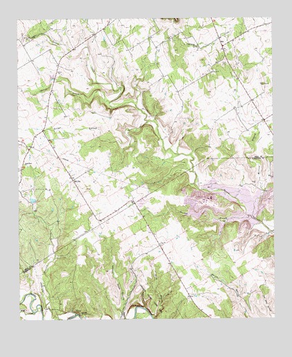
Hill City, TX USGS Topographic Map
Click on map above to begin viewing in our Map Viewer.

This topographic map contains these locations and features:
Feature Name Type Latitude Longitude GNIS ID View Map
Cedar BrakeLocaleN32.2526°W97.8459°1332380View Map
Commanche Peak Nuclear Power Plant AmbulanceBuildingN32.2985°W97.7855°2655873View Map
Denio BranchStreamN32.2513°W97.8103°1334252View Map
Dinosaur Valley State ParkParkN32.2565°W97.8114°1334378View Map
Dinosaur Valley State Park TrailTrailN32.2563°W97.8114°2032843View Map
Hill CityPopulated PlaceN32.3079°W97.8486°1378453View Map
Lollar BranchStreamN32.3321°W97.8120°1340337View Map
Mambrino Baptist ChurchChurchN32.3718°W97.7550°2020872View Map
Million BranchStreamN32.2915°W97.7603°1341684View Map
Mount Pleasant CemeteryCemeteryN32.3665°W97.8692°1342096View Map
NeriPopulated PlaceN32.3638°W97.7750°1378736View Map
Neri SchoolSchoolN32.3632°W97.7870°1342421View Map
Opossum BranchStreamN32.2501°W97.8195°1375299View Map
Opossum HollowValleyN32.2566°W97.8242°1343298View Map
Panter BranchStreamN32.3401°W97.8303°1343520View Map
Panther BranchStreamN32.2926°W97.7625°1343523View Map
Parker AirportAirportN32.3505°W97.8082°2676543View Map
Post Oak CemeteryCemeteryN32.2815°W97.8061°1344402View Map
Prairie Creek ChurchChurchN32.3151°W97.8725°1344497View Map
Rough CreekStreamN32.2532°W97.8678°1345642View Map
Running M Ranch AirportAirportN32.2624°W97.8644°1386732View Map
Safe Shutdown ImpoundmentReservoirN32.2951°W97.7836°1863834View Map
Safe Shutdown Impoundment DamDamN32.2951°W97.7836°1863833View Map
Somervell County JailBuildingN32.2501°W97.7509°2738699View Map
Somervell County Sheriff's OfficeBuildingN32.2501°W97.7508°2738943View Map
Squaw Creek DamDamN32.2885°W97.7603°1863318View Map
Squaw Creek ReservoirReservoirN32.2885°W97.7603°1863319View Map
Wildcat HollowValleyN32.2549°W97.8139°1350065View Map

Note: Coordinates in the location and feature list above are referenced to NAD83 datum.


Copyright (C) 2008-2025 Ryan Niemi / Sunset Dynamics ... All Rights Reserved