TopoQuest Logo
Do you find TopoQuest useful?
Help keep TopoQuest running and adding new maps/features by donating!
Bitcoin:  19c7KJd3qBynnjoSw5npx9KScwjBe4ifkT
Litecoin:  LXs6TkuXGGXo1vDsWCkWVdjQX94eUKd6ui
Home View Maps Find Maps Find Places Resources & Links


Paluxy, Texas Topographic Map

USGS Map Title: Paluxy, TX
USGS Map MRC: 32097C8
DRG (GeoTIFF) Download: o32097c8.tif


Neighboring USGS Topographic Map Quads:


  Bluff Dale NE, TX  
32098D1
 

  Tolar, TX  
32097D8
 

  Granbury, TX  
32097D7
 

  Bluff Dale, TX  
32098C1
 

  Paluxy, TX  
32097C8
 

  Hill City, TX  
32097C7
 

  Johnsville, TX  
32098B1
 

  Chalk Mountain, TX  
32097B8
 

  Glen Rose West, TX  
32097B7


Map MRC Location:

N33°
W98°
N33°
W97°
H8 H7 H6 H5 H4 H3 H2 H1
G8 G7 G6 G5 G4 G3 G2 G1
F8 F7 F6 F5 F4 F3 F2 F1
E8 E7 E6 E5 E4 E3 E2 E1
D8 D7 D6 D5 D4 D3 D2 D1
C8 C7 C6 C5 C4 C3 C2 C1
B8 B7 B6 B5 B4 B3 B2 B1
A8 A7 A6 A5 A4 A3 A2 A1
N32°
W98°
N32°
W97°

Paluxy, TX USGS 1:24K Topographic Map Preview:
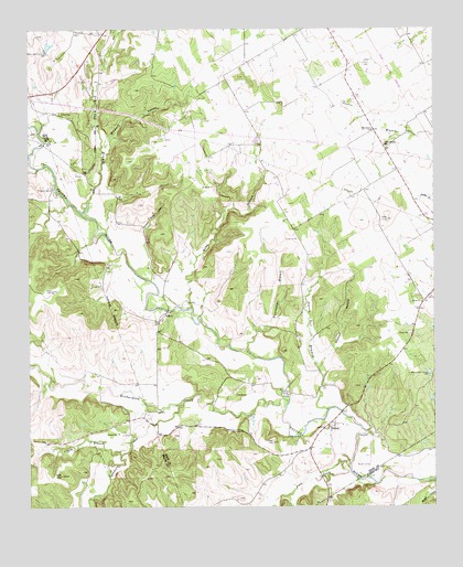
Paluxy, TX USGS Topographic Map
Click on map above to begin viewing in our Map Viewer.

This topographic map contains these locations and features:
Feature Name Type Latitude Longitude GNIS ID View Map
Brooks CemeteryCemeteryN32.2610°W97.8956°1331316View Map
Buzzard Roost HollowValleyN32.3199°W97.9672°1331776View Map
Camp PaluxyLocaleN32.3338°W97.9934°1331995View Map
Dry BranchStreamN32.2638°W97.9723°1334651View Map
Dry BranchStreamN32.3271°W97.9842°1334652View Map
Dunnagan BranchStreamN32.2907°W97.9328°1334798View Map
Elm Grove ChurchChurchN32.3488°W97.8942°1335384View Map
Glenn CemeteryCemeteryN32.3532°W97.9906°1336591View Map
Goss HollowValleyN32.3105°W97.9517°1336749View Map
Holmes HollowValleyN32.2862°W97.9112°1337977View Map
PaluxyPopulated PlaceN32.2707°W97.9075°1378827View Map
Paluxy Post OfficePost OfficeN32.2716°W97.9061°2731536View Map
Panter Branch HallLocaleN32.3451°W97.8906°1343521View Map
Pony CreekStreamN32.2604°W97.9017°1344348View Map
Richardson CreekStreamN32.2779°W97.9203°1345175View Map
Rock ChurchChurchN32.3004°W97.9581°1345360View Map
Starve Out BranchStreamN32.2754°W97.9084°1347829View Map
Sycamore CreekStreamN32.2768°W97.9531°1348172View Map
Texas A and M LakeReservoirN32.3706°W97.9941°1864396View Map
Texas A and M Lake DamDamN32.3701°W97.9953°1864395View Map
Windmill HollowValleyN32.3406°W97.9773°1350296View Map

Note: Coordinates in the location and feature list above are referenced to NAD83 datum.


Copyright (C) 2008-2025 Ryan Niemi / Sunset Dynamics ... All Rights Reserved