TopoQuest Logo
Do you find TopoQuest useful?
Help keep TopoQuest running and adding new maps/features by donating!
Bitcoin:  19c7KJd3qBynnjoSw5npx9KScwjBe4ifkT
Litecoin:  LXs6TkuXGGXo1vDsWCkWVdjQX94eUKd6ui
Home View Maps Find Maps Find Places Resources & Links


Hillsboro, Tennessee Topographic Map

USGS Map Title: Hillsboro, TN
USGS Map MRC: 35085D8
DRG (GeoTIFF) Download: o35085d8.tif


Neighboring USGS Topographic Map Quads:


  Fredonia, TN  
35086E1
 

  Morrison, TN  
35085E8
 

  Viola, TN  
35085E7
 

  Manchester, TN  
35086D1
 

  Hillsboro, TN  
35085D8
 

  Cane Hollow, TN  
35085D7
 

  Capitol Hill, TN  
35086C1
 

  Alto, TN  
35085C8
 

  Burrow Cove, TN  
35085C7


Map MRC Location:

N36°
W86°
N36°
W85°
H8 H7 H6 H5 H4 H3 H2 H1
G8 G7 G6 G5 G4 G3 G2 G1
F8 F7 F6 F5 F4 F3 F2 F1
E8 E7 E6 E5 E4 E3 E2 E1
D8 D7 D6 D5 D4 D3 D2 D1
C8 C7 C6 C5 C4 C3 C2 C1
B8 B7 B6 B5 B4 B3 B2 B1
A8 A7 A6 A5 A4 A3 A2 A1
N35°
W86°
N35°
W85°

Hillsboro, TN USGS 1:24K Topographic Map Preview:
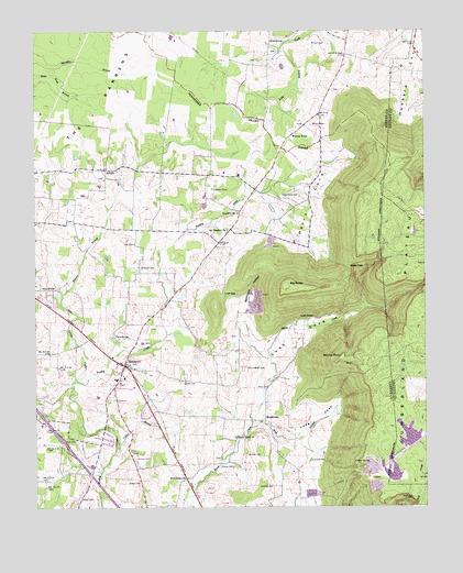
Hillsboro, TN USGS Topographic Map
Click on map above to begin viewing in our Map Viewer.

This topographic map contains these locations and features:
Feature Name Type Latitude Longitude GNIS ID View Map
AsburyPopulated PlaceN35.4637°W85.9772°1314603View Map
Asbury ChurchChurchN35.4612°W85.9775°1647306View Map
Asbury School (historical)SchoolN35.4637°W85.9733°1643837View Map
Austell CemeteryCemeteryN35.3817°W85.9664°1275989View Map
Beans Creek ChurchChurchN35.3934°W85.9355°1276547View Map
Big ButteSummitN35.4331°W85.9191°1277266View Map
Blue SpringSpringN35.4329°W85.9933°1277780View Map
Blue Spring CreekStreamN35.4081°W85.9878°1277804View Map
Bray BranchStreamN35.3959°W85.9305°1278255View Map
Brooks PointCapeN35.4145°W85.9011°1278490View Map
Collier BranchStreamN35.3906°W85.9742°1280970View Map
Commissioner District 5CivilN35.3786°W85.9389°2464432View Map
Cowan SpringSpringN35.3865°W85.8930°1281460View Map
Crockett CemeteryCemeteryN35.3873°W85.9119°1281637View Map
Crockett CemeteryCemeteryN35.4381°W85.9655°1281638View Map
Cumberland AcademySchoolN35.4617°W85.9247°1281820View Map
Cumberland Mountain LakeReservoirN35.3939°W85.8804°1301795View Map
Cumberland Mountain Lake DamDamN35.3917°W85.8766°1301796View Map
Cumberland Mountain Sd Company LakeReservoirN35.3837°W85.8853°1301786View Map
Cunningham CemeteryCemeteryN35.4117°W85.9319°1281865View Map
Emmanuel ChurchChurchN35.3829°W85.9519°1283755View Map
Gate GapGapN35.4379°W85.8989°1285230View Map
Gentry CemeteryCemeteryN35.4081°W85.9516°1285277View Map
Gum SpringSpringN35.4973°W85.9197°1286416View Map
Henry CoveValleyN35.4720°W85.9015°1287444View Map
Henry Cove CemeteryCemeteryN35.4570°W85.9147°1287445View Map
HillsboroPopulated PlaceN35.4126°W85.9703°1287843View Map
Hillsboro Baptist ChurchChurchN35.4081°W85.9728°1316000View Map
Hillsboro Census Designated PlaceCensusN35.4086°W85.9639°2586062View Map
Hillsboro Church of ChristChurchN35.4087°W85.9728°1316001View Map
Hillsboro Cumberland Presbyterian ChurchChurchN35.4126°W85.9697°1316003View Map
Hillsboro Division (historical)CensusN35.3967°W85.9655°1648655View Map
Hillsboro Elementary SchoolSchoolN35.4092°W85.9714°1316004View Map
Hillsboro Methodist ChurchChurchN35.4051°W85.9650°1643860View Map
Hillsboro Post OfficePost OfficeN35.4114°W85.9707°1650291View Map
Hillsboro QuarryMineN35.4306°W85.9292°2633396View Map
Hillsboro Volunteer Fire DepartmentBuildingN35.4096°W85.9724°2654406View Map
Lambert CemeteryCemeteryN35.3890°W85.9322°1290551View Map
Long CoveValleyN35.3945°W85.9206°1291929View Map
Lusk CoveValleyN35.4138°W85.9251°1292300View Map
Lusk GapGapN35.4309°W85.9391°1292301View Map
Mount Pleasant ChurchChurchN35.4481°W85.9378°1294757View Map
Pond SpringSpringN35.4198°W85.9742°1298117View Map
Price CemeteryCemeteryN35.4070°W85.9250°1298498View Map
Sandy Field (historical)AirportN35.3834°W85.8833°1301335View Map
Simmons CemeteryCemeteryN35.4587°W85.9422°1270298View Map
Spencer Field (historical)AirportN35.3876°W85.9625°1301338View Map
StephensonPopulated PlaceN35.3979°W85.9264°1314336View Map
Stephenson School (historical)SchoolN35.3981°W85.9261°1643895View Map
Stillhouse HollowValleyN35.4248°W85.9326°1271411View Map
Thomas CemeteryCemeteryN35.3859°W85.9364°1272474View Map
Warren BranchStreamN35.4309°W85.9911°1273819View Map
Wilder CemeteryCemeteryN35.3776°W85.9858°1274559View Map
Winton CemeteryCemeteryN35.4756°W85.9103°1274891View Map
Winton CemeteryCemeteryN35.4973°W85.9061°1274892View Map
Winton TownPopulated PlaceN35.4731°W85.9164°1314525View Map
Womack CemeteryCemeteryN35.3806°W85.9236°1275007View Map
Yate CemeteryCemeteryN35.4442°W85.9680°1275246View Map
Zion Hill ChurchChurchN35.4523°W85.9339°1275372View Map

Note: Coordinates in the location and feature list above are referenced to NAD83 datum.


Copyright (C) 2008-2024 Ryan Niemi / Sunset Dynamics ... All Rights Reserved