TopoQuest Logo
Do you find TopoQuest useful?
Help keep TopoQuest running and adding new maps/features by donating!
Bitcoin:  19c7KJd3qBynnjoSw5npx9KScwjBe4ifkT
Litecoin:  LXs6TkuXGGXo1vDsWCkWVdjQX94eUKd6ui
Home View Maps Find Maps Find Places Resources & Links


Hillsboro, New Mexico Topographic Map

USGS Map Title: Hillsboro, NM
USGS Map MRC: 32107H5
DRG (GeoTIFF) Download: o32107h5.tif


Neighboring USGS Topographic Map Quads:


  Apache Peak, NM  
33107A6
 

  Bell Mountain, NM  
33107A5
 

  Saladone Tank, NM  
33107A4
 

  Kingston, NM  
32107H6
 

  Hillsboro, NM  
32107H5
 

  Skute Stone Arroyo, NM  
32107H4
 

  P A Mountain, NM  
32107G6
 

  McClede Mountain, NM  
32107G5
 

  Clark Spring Canyon, NM  
32107G4


Map MRC Location:

N33°
W108°
N33°
W107°
H8 H7 H6 H5 H4 H3 H2 H1
G8 G7 G6 G5 G4 G3 G2 G1
F8 F7 F6 F5 F4 F3 F2 F1
E8 E7 E6 E5 E4 E3 E2 E1
D8 D7 D6 D5 D4 D3 D2 D1
C8 C7 C6 C5 C4 C3 C2 C1
B8 B7 B6 B5 B4 B3 B2 B1
A8 A7 A6 A5 A4 A3 A2 A1
N32°
W108°
N32°
W107°

Hillsboro, NM USGS 1:24K Topographic Map Preview:
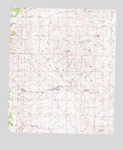
Hillsboro, NM USGS Topographic Map
Click on map above to begin viewing in our Map Viewer.

This topographic map contains these locations and features:
Feature Name Type Latitude Longitude GNIS ID View Map
27-100 3 Water WellWellN32.9212°W107.5889°923030View Map
Animas PeakSummitN32.9737°W107.5220°885763View Map
BigelowMineN32.9529°W107.5584°915470View Map
Black PeakMineN32.9515°W107.5339°917092View Map
Black PeakSummitN32.9587°W107.5314°898727View Map
Black Peak MineMineN32.9587°W107.5303°917091View Map
Black Range MuseumBuildingN32.9209°W107.5670°929521View Map
BonanzaMineN32.9498°W107.5559°917094View Map
Buetecke MineMineN32.9820°W107.5261°939422View Map
Bullion MineMineN32.9820°W107.5261°939423View Map
Carrajel ShaftMineN32.9548°W107.5500°917089View Map
Chance MineMineN32.9640°W107.5161°939425View Map
Christ Episcopal ChurchChurchN32.9209°W107.5670°902516View Map
Cincinnati MineMineN32.9640°W107.5161°939426View Map
Cold Springs CanyonValleyN32.9365°W107.5678°900994View Map
Copper FlatFlatN32.9701°W107.5325°887828View Map
Copper FlatFlatN32.9751°W107.5225°924800View Map
Copper Flat Bulk Sample Plan MineMineN32.9717°W107.5317°939559View Map
Copper Flat MineMineN32.9717°W107.5317°939558View Map
Copper King MineMineN32.9681°W107.5339°915293View Map
Crescent Lode MineMineN32.9367°W107.5464°915294View Map
Dry CanyonValleyN32.9665°W107.6145°905873View Map
Dutch GulchMineN32.9812°W107.5089°917187View Map
Eighty-Five MineMineN32.9556°W107.5470°917188View Map
EmpireMineN32.9598°W107.5617°915289View Map
Empire MineMineN32.9579°W107.5520°915290View Map
Empire PeakSummitN32.9579°W107.5573°888873View Map
FreidbergMineN32.9848°W107.5206°917189View Map
FullertonMineN32.9695°W107.5173°917190View Map
Garfield-ButlerMineN32.9529°W107.5656°917191View Map
Gold Dust CampLocaleN32.9529°W107.5075°929123View Map
Gold Dust PlacersMineN32.9515°W107.5020°915287View Map
Golddust CampLocaleN32.9517°W107.5014°889470View Map
Golden RuleMineN32.9812°W107.5173°915449View Map
Grayback ArroyoArroyoN32.9684°W107.5089°902256View Map
Hall MineMineN32.9162°W107.5248°915577View Map
HillsboroPopulated PlaceN32.9209°W107.5670°890016View Map
Hillsboro Census Designated PlaceCensusN32.9218°W107.5772°2584112View Map
Hillsboro Community LibraryBuildingN32.9209°W107.5670°929395View Map
Hillsboro Historic DistrictLocaleN32.9209°W107.5670°935183View Map
Hillsboro Peak lookout Tower and CabinLocaleN32.9197°W107.5664°935694View Map
Hillsboro Post OfficePost OfficeN32.9209°W107.5670°937371View Map
Hillsboro Volunteer Fire Station 1BuildingN32.9201°W107.5672°2658041View Map
Hillsboro Weather StationLocaleN32.9209°W107.5670°931845View Map
Hillsboro-Copper FlatMineN32.9667°W107.5339°915463View Map
Homestake MineMineN32.9806°W107.5284°939643View Map
Jackpot MineMineN32.9551°W107.5623°915575View Map
KatherineMineN32.9445°W107.5517°915454View Map
Lake Valley Mining DistrictLocaleN32.9209°W107.5670°934444View Map
Little Wonder MineMineN32.9756°W107.5256°915573View Map
Lost ArrowheadMineN32.9934°W107.5114°915568View Map
LuxemburgMineN32.9598°W107.5131°915461View Map
Mary RichmondMineN32.9579°W107.5517°915462View Map
McKinley MineMineN32.9362°W107.5478°939627View Map
Morning Glory MineMineN32.9479°W107.5345°915474View Map
National DefenseMineN32.9348°W107.5298°914590View Map
National Defense Department Number OneMineN32.9340°W107.5267°916470View Map
North Percha CreekStreamN32.9220°W107.5711°909175View Map
OpportunityMineN32.9404°W107.5506°915434View Map
PalmaMineN32.9256°W107.5270°917104View Map
Palma GroupMineN32.9284°W107.5278°916532View Map
Petroglyph MineMineN32.9340°W107.5442°915480View Map
Quintana InclineMineN32.9690°W107.5306°915482View Map
RattlesnakeMineN32.9423°W107.5539°915429View Map
Rattlesnake PlacersMineN32.9376°W107.5609°915430View Map
Ready PayMineN32.9473°W107.5423°915484View Map
Ready Pay GulchValleyN32.9179°W107.5248°893712View Map
Republic MineMineN32.9790°W107.5206°939613View Map
Sawpit CanyonValleyN32.9229°W107.6223°910858View Map
ShermanMineN32.9456°W107.5436°917110View Map
Snake GulchValleyN32.9326°W107.5603°894963View Map
Stowaway MineMineN32.9445°W107.5486°917103View Map
SweetwaterMineN32.9784°W107.5114°914592View Map
The BoxValleyN32.9148°W107.5173°898164View Map
Tom Murphy HouseBuildingN32.9209°W107.6003°935500View Map
Tripp MineMineN32.9806°W107.5284°939417View Map
Trujillo Park CanyonValleyN32.8809°W107.6125°911834View Map
Union Community Church Historic SiteChurchN32.9209°W107.5670°934332View Map
Vanadinite MineMineN32.9184°W107.5234°915471View Map
Virginia ClaimMineN32.9362°W107.5478°915473View Map
Warm SpringsSpringN32.9498°W107.5756°900405View Map
Warm Springs CanyonValleyN32.9201°W107.5495°896259View Map
WicksMineN32.9415°W107.5336°915440View Map
Wisconsin MineMineN32.9790°W107.5206°939619View Map

Note: Coordinates in the location and feature list above are referenced to NAD83 datum.


Copyright (C) 2008-2025 Ryan Niemi / Sunset Dynamics ... All Rights Reserved