TopoQuest Logo
Do you find TopoQuest useful?
Help keep TopoQuest running and adding new maps/features by donating!
Bitcoin:  19c7KJd3qBynnjoSw5npx9KScwjBe4ifkT
Litecoin:  LXs6TkuXGGXo1vDsWCkWVdjQX94eUKd6ui
Home View Maps Find Maps Find Places Resources & Links


Hillsborough, North Carolina Topographic Map

USGS Map Title: Hillsborough, NC
USGS Map MRC: 36079A1
DRG (GeoTIFF) Download: o36079a1.tif


Neighboring USGS Topographic Map Quads:


  Cedar Grove, NC  
36079B2
 

  Caldwell, NC  
36079B1
 

  Rougemont, NC  
36078B8
 

  Efland, NC  
36079A2
 

  Hillsborough, NC  
36079A1
 

  Northwest Durham, NC  
36078A8
 

  White Cross, NC  
35079H2
 

  Chapel Hill, NC  
35079H1
 

  Southwest Durham, NC  
35078H8


Map MRC Location:

N37°
W80°
N37°
W79°
H8 H7 H6 H5 H4 H3 H2 H1
G8 G7 G6 G5 G4 G3 G2 G1
F8 F7 F6 F5 F4 F3 F2 F1
E8 E7 E6 E5 E4 E3 E2 E1
D8 D7 D6 D5 D4 D3 D2 D1
C8 C7 C6 C5 C4 C3 C2 C1
B8 B7 B6 B5 B4 B3 B2 B1
A8 A7 A6 A5 A4 A3 A2 A1
N36°
W80°
N36°
W79°

Hillsborough, NC USGS 1:24K Topographic Map Preview:
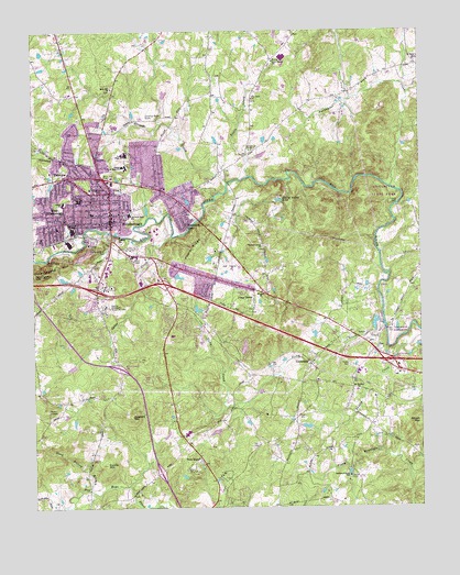
Hillsborough, NC USGS Topographic Map
Click on map above to begin viewing in our Map Viewer.

This topographic map contains these locations and features:
Feature Name Type Latitude Longitude GNIS ID View Map
Ben Johnson LakeReservoirN36.0835°W79.1197°1023364View Map
Ben Johnson Lake DamDamN36.0835°W79.1197°1000036View Map
Bluffs of EnoPopulated PlaceN36.0893°W79.0361°1002552View Map
BrigadoonPopulated PlaceN36.0540°W79.0186°1002551View Map
Buckquarter CreekStreamN36.0840°W79.0092°982152View Map
Cabes FordPopulated PlaceN36.0796°W79.0072°1019463View Map
Cameron Park Elementary SchoolSchoolN36.0772°W79.0947°2455270View Map
Cameron Park SchoolSchoolN36.0771°W79.0933°982483View Map
Carolina Friends SchoolSchoolN36.0075°W79.0234°982661View Map
Cates CreekStreamN36.0713°W79.0803°982756View Map
Central Elementary SchoolSchoolN36.0792°W79.1149°2455271View Map
Central High SchoolSchoolN36.0804°W79.1106°982963View Map
Central SchoolSchoolN36.0801°W79.1145°982970View Map
Colonial HillsPopulated PlaceN36.0574°W79.0692°1002556View Map
Colonial ParkPopulated PlaceN36.0524°W79.0597°1002555View Map
Cornwallis HillsPopulated PlaceN36.0468°W79.1033°1002502View Map
Couch MountainSummitN36.0224°W79.0003°1019803View Map
County Subsidiary Prison Number 056LocaleN36.0529°W79.1014°1023635View Map
Cresmont Memorial ParkCemeteryN36.0872°W79.1018°989360View Map
Currie HillSummitN36.0115°W79.1017°983854View Map
Dimmocks MillPopulated PlaceN36.0688°W79.1231°1002499View Map
EastwoodPopulated PlaceN36.0835°W79.0778°1002493View Map
EnoPopulated PlaceN36.0413°W79.0142°1020159View Map
Eno Fire and Emergency ServicesBuildingN36.0397°W79.0138°2638813View Map
Eno River State ParkParkN36.0835°W79.0136°1024795View Map
Exchange Club ParkParkN36.0676°W79.1008°984887View Map
FairviewPopulated PlaceN36.0871°W79.1133°1020199View Map
Falls of New HopePopulated PlaceN36.0088°W79.0625°1002546View Map
Flat Rock ChurchChurchN36.1074°W79.0542°985182View Map
Fox Pond DamDamN36.0918°W79.0531°1000057View Map
Freeland DamDamN36.0518°W79.0731°999985View Map
Governor Burke GraveCemeteryN36.1029°W79.0881°985874View Map
Grady A Brown Elementary SchoolSchoolN36.0518°W79.1242°1008232View Map
GreenbriarPopulated PlaceN36.0332°W79.0128°1002550View Map
Hideaway EstatesPopulated PlaceN36.0026°W79.0775°1002545View Map
HillcrestPopulated PlaceN36.0932°W79.0900°1002494View Map
HillsboroughPopulated PlaceN36.0754°W79.0997°986830View Map
Hillsborough Police DepartmentBuildingN36.0765°W79.0998°2769594View Map
Hillsborough Post OfficePost OfficeN36.0750°W79.0974°2455248View Map
Interchange 161CrossingN36.0559°W79.1249°2455095View Map
Interchange 163CrossingN36.0591°W79.1214°2455096View Map
Interchange 164CrossingN36.0568°W79.1042°2455097View Map
Interchange 165CrossingN36.0588°W79.0825°2455098View Map
Interchange 170CrossingN36.0383°W79.0116°2455099View Map
Interchange 261CrossingN36.0368°W79.0973°2455121View Map
Interchange 263CrossingN36.0095°W79.0842°2455122View Map
Jappa OaksPopulated PlaceN36.0493°W79.0750°1002554View Map
Kingsboro EstatesPopulated PlaceN36.0726°W79.1225°1002497View Map
Lake OverlookReservoirN36.0417°W79.0568°2439613View Map
Little CreekStreamN36.0868°W79.0556°988593View Map
Maplewood CemeteryCemeteryN36.0832°W79.1042°989326View Map
Mars Hill ChurchChurchN36.1101°W79.0989°989361View Map
Mount Hermon ChurchChurchN36.0307°W79.0206°990409View Map
Mountain ViewPopulated PlaceN36.0776°W79.0742°1021575View Map
New HopePopulated PlaceN36.0101°W79.0739°1021633View Map
New Hope Elementary SchoolSchoolN36.0186°W79.0747°2454677View Map
New Hope Volunteer Fire Department Station 2BuildingN36.0140°W79.0711°2638803View Map
New Sharon ChurchChurchN36.1171°W79.0472°991101View Map
NonameReservoirN36.0518°W79.0731°999986View Map
Oak RidgePopulated PlaceN36.0740°W79.0547°1002558View Map
Oakdale FarmsPopulated PlaceN36.0513°W79.1025°1002501View Map
Occoneechee MountainSummitN36.0618°W79.1217°1021715View Map
Orange Correctional CenterBuildingN36.0532°W79.1014°2769843View Map
Orange CountyCivilN36.0611°W79.1206°1008576View Map
Orange County Emergency Medical ServicesBuildingN36.0202°W79.0731°2720519View Map
Orange County Rescue SquadBuildingN36.0648°W79.1004°2720520View Map
Orange County Sheriff's OfficeBuildingN36.0742°W79.0987°2769640View Map
Orange HeightsPopulated PlaceN36.0835°W79.1242°1002496View Map
Orange High SchoolSchoolN36.0926°W79.0947°991677View Map
Orange Junior High SchoolSchoolN36.0896°W79.0947°991678View Map
Orange Rural Fire Department Station 1BuildingN36.0742°W79.0997°2638557View Map
Palmers Grove ChurchChurchN36.0685°W79.0511°991801View Map
Panthers DenRidgeN36.0643°W79.1200°991841View Map
Piedmont Minerals DamDamN36.0701°W79.1081°1000014View Map
Piedmont Minerals LakeReservoirN36.0706°W79.1071°1000013View Map
Piney GrovePopulated PlaceN36.0571°W79.0536°992333View Map
Poplar RidgeRidgeN36.0663°W79.0739°992698View Map
Poplar RidgePopulated PlaceN36.0724°W79.0686°1002557View Map
RosewoodPopulated PlaceN36.0779°W79.1231°1002498View Map
Saint Marys ChurchChurchN36.1176°W79.0000°994034View Map
Scarlett HillSummitN36.0243°W79.0939°1022518View Map
Spring Valley LakeLakeN36.0807°W79.0453°995360View Map
Stagecoach RunPopulated PlaceN36.0424°W79.0861°1002504View Map
Steep Bottom BranchStreamN36.0049°W79.1070°995453View Map
Stony CreekStreamN36.0488°W79.0120°995554View Map
Strayhorn HillsPopulated PlaceN36.0429°W79.0550°1002553View Map
Strayhorn PondReservoirN36.0235°W79.0564°999918View Map
Strayhorn Pond DamDamN36.0235°W79.0564°999919View Map
Strouds CreekStreamN36.0851°W79.0622°995617View Map
Sunshine AcresPopulated PlaceN36.0496°W79.1136°1002500View Map
Temple of TruthChurchN36.0938°W79.0550°995915View Map
Town of HillsboroughCivilN36.0800°W79.1109°2405840View Map
Township of EnoCivilN36.0841°W79.0239°1027015View Map
Township of HillsboroughCivilN36.0830°W79.1020°1027016View Map
UniversityPopulated PlaceN36.0374°W79.0356°996533View Map
University AcresPopulated PlaceN36.0149°W79.0472°1002547View Map
Walnut CovePopulated PlaceN36.0082°W79.0956°1002544View Map
Wayside ChurchChurchN36.0568°W79.0511°996898View Map
West HillsboroughPopulated PlaceN36.0746°W79.1195°1023167View Map
Whispering PinesPopulated PlaceN36.0310°W79.0047°1002549View Map
WildwoodPopulated PlaceN36.0457°W79.0870°1002503View Map
Wilkerson AcresPopulated PlaceN36.0946°W79.1039°1002495View Map
Windy Hill FarmPopulated PlaceN36.0249°W79.0350°1002548View Map

Note: Coordinates in the location and feature list above are referenced to NAD83 datum.


Copyright (C) 2008-2024 Ryan Niemi / Sunset Dynamics ... All Rights Reserved