TopoQuest Logo
Do you find TopoQuest useful?
Help keep TopoQuest running and adding new maps/features by donating!
Bitcoin:  19c7KJd3qBynnjoSw5npx9KScwjBe4ifkT
Litecoin:  LXs6TkuXGGXo1vDsWCkWVdjQX94eUKd6ui
Home View Maps Find Maps Find Places Resources & Links


Caldwell, North Carolina Topographic Map

USGS Map Title: Caldwell, NC
USGS Map MRC: 36079B1
DRG (GeoTIFF) Download: o36079b1.tif


Neighboring USGS Topographic Map Quads:


  Ridgeville, NC  
36079C2
 

  Hurdle Mills, NC  
36079C1
 

  Timberlake, NC  
36078C8
 

  Cedar Grove, NC  
36079B2
 

  Caldwell, NC  
36079B1
 

  Rougemont, NC  
36078B8
 

  Efland, NC  
36079A2
 

  Hillsborough, NC  
36079A1
 

  Northwest Durham, NC  
36078A8


Map MRC Location:

N37°
W80°
N37°
W79°
H8 H7 H6 H5 H4 H3 H2 H1
G8 G7 G6 G5 G4 G3 G2 G1
F8 F7 F6 F5 F4 F3 F2 F1
E8 E7 E6 E5 E4 E3 E2 E1
D8 D7 D6 D5 D4 D3 D2 D1
C8 C7 C6 C5 C4 C3 C2 C1
B8 B7 B6 B5 B4 B3 B2 B1
A8 A7 A6 A5 A4 A3 A2 A1
N36°
W80°
N36°
W79°

Caldwell, NC USGS 1:24K Topographic Map Preview:
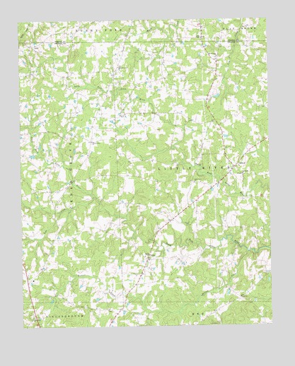
Caldwell, NC USGS Topographic Map
Click on map above to begin viewing in our Map Viewer.

This topographic map contains these locations and features:
Feature Name Type Latitude Longitude GNIS ID View Map
Ashleys LakeReservoirN36.1885°W79.0647°1000288View Map
Ashleys Lake DamDamN36.1885°W79.0647°1000289View Map
BerrylandPopulated PlaceN36.2335°W79.0247°1002514View Map
Berrys Grove ChurchChurchN36.2351°W79.0256°981048View Map
CaldwellPopulated PlaceN36.1899°W79.0172°1006153View Map
Caldwell Fire DepartmentBuildingN36.1874°W79.0149°2639414View Map
CascadesPopulated PlaceN36.1257°W79.0414°1002520View Map
Charter MeadowsPopulated PlaceN36.1757°W79.0075°1002515View Map
Forrest CreekStreamN36.1554°W79.0114°985314View Map
Glengrove ChurchChurchN36.1871°W79.0136°985731View Map
Jones Grove ChurchChurchN36.1288°W79.1195°987753View Map
Kindful AcresPopulated PlaceN36.2013°W79.1008°1002519View Map
Larry HallPopulated PlaceN36.1838°W79.0953°1002518View Map
Lattisville Grove ChurchChurchN36.2310°W79.0753°988166View Map
LawsPopulated PlaceN36.2399°W79.1186°1006272View Map
Little River ChurchChurchN36.1835°W79.0378°988755View Map
North ForkPopulated PlaceN36.1796°W79.0275°1002516View Map
Obies ChapelChurchN36.2426°W79.0333°991506View Map
Orange Rural Fire Department Station 2BuildingN36.1372°W79.1045°2639431View Map
Paynes ChapelChurchN36.1532°W79.0617°991961View Map
Rays CreekStreamN36.1776°W79.0883°993084View Map
SchleyPopulated PlaceN36.1526°W79.0614°994411View Map
Springcrest MeadowsPopulated PlaceN36.1835°W79.0567°1002517View Map
Stone PondReservoirN36.2268°W79.0931°1000383View Map
Stone Pond DamDamN36.2268°W79.0931°1000384View Map
Township of Little RiverCivilN36.1887°W79.0137°1027017View Map
Walnut Grove ChurchChurchN36.2004°W79.0886°996742View Map

Note: Coordinates in the location and feature list above are referenced to NAD83 datum.


Copyright (C) 2008-2025 Ryan Niemi / Sunset Dynamics ... All Rights Reserved