TopoQuest Logo
Do you find TopoQuest useful?
Help keep TopoQuest running and adding new maps/features by donating!
Bitcoin:  19c7KJd3qBynnjoSw5npx9KScwjBe4ifkT
Litecoin:  LXs6TkuXGGXo1vDsWCkWVdjQX94eUKd6ui
Home View Maps Find Maps Find Places Resources & Links


Backus, Minnesota Topographic Map

USGS Map Title: Backus, MN
USGS Map MRC: 46094G5
DRG (GeoTIFF) Download: o46094g5.tif


Neighboring USGS Topographic Map Quads:


  Crystal Lake, MN  
46094H6
 

  Hackensack, MN  
46094H5
 

  Webb Lake, MN  
46094H4
 

  Oshawa, MN  
46094G6
 

  Backus, MN  
46094G5
 

  Mildred, MN  
46094G4
 

  Spider Lake, MN  
46094F6
 

  Bungo Creek, MN  
46094F5
 

  Pine River, MN  
46094F4


Map MRC Location:

N47°
W95°
N47°
W94°
H8 H7 H6 H5 H4 H3 H2 H1
G8 G7 G6 G5 G4 G3 G2 G1
F8 F7 F6 F5 F4 F3 F2 F1
E8 E7 E6 E5 E4 E3 E2 E1
D8 D7 D6 D5 D4 D3 D2 D1
C8 C7 C6 C5 C4 C3 C2 C1
B8 B7 B6 B5 B4 B3 B2 B1
A8 A7 A6 A5 A4 A3 A2 A1
N46°
W95°
N46°
W94°

Backus, MN USGS 1:24K Topographic Map Preview:
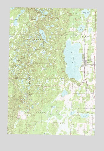
Backus, MN USGS Topographic Map
Click on map above to begin viewing in our Map Viewer.

This topographic map contains these locations and features:
Feature Name Type Latitude Longitude GNIS ID View Map
Abel LakeLakeN46.7771°W94.5593°655070View Map
BackusPopulated PlaceN46.8202°W94.5164°655183View Map
Backus (historical)LocaleN46.8206°W94.5167°2071387View Map
Backus Elementary SchoolChurchN46.8639°W94.5117°2071393View Map
Backus Municipal AirportAirportN46.8269°W94.5072°660045View Map
Backus Police DepartmentBuildingN46.8198°W94.5157°2758707View Map
Backus Post OfficePost OfficeN46.8206°W94.5164°2071386View Map
Backus Volunteer Fire DepartmentBuildingN46.8199°W94.5157°2071391View Map
Beuber LakeLakeN46.8709°W94.5161°655346View Map
Cedar CreekStreamN46.7527°W94.5669°655678View Map
Church of the NazareneChurchN46.8244°W94.5008°2071392View Map
City of BackusCivilN46.8207°W94.5147°2394048View Map
Cow LakeLakeN46.7695°W94.5148°655842View Map
Cranberry LakeLakeN46.8223°W94.6165°655853View Map
Deer LakeLakeN46.8387°W94.5792°655960View Map
Deerfield TrailTrailN46.8677°W94.5597°655971View Map
Department of Natural Resources Division of Forestry - Backus Forestry OfficeBuildingN46.8198°W94.5099°2666173View Map
Emmanuel Lutheran ChurchChurchN46.8247°W94.5008°2071390View Map
Evergreen CemeteryCemeteryN46.8197°W94.5033°656177View Map
First Perch LakeLakeN46.8725°W94.5767°656241View Map
Goose LakeLakeN46.8667°W94.6117°656409View Map
Island LakeLakeN46.8535°W94.5222°656727View Map
Lakeside Baptist ChurchChurchN46.8206°W94.5136°2071389View Map
Lee LakeLakeN46.8457°W94.5954°656977View Map
Long LakeLakeN46.8479°W94.5769°657180View Map
Ox Camp LakeLakeN46.8309°W94.5756°657712View Map
Perch LakeLakeN46.8176°W94.6127°657775View Map
Pine Mountain CampgroundLocaleN46.8000°W94.5250°2071395View Map
Pine Mountain LakeReservoirN46.8000°W94.5169°1775933View Map
Pine Mountain LakeLakeN46.8235°W94.5331°657843View Map
Pine Mountain Lake DamDamN46.8000°W94.5169°1775932View Map
Pine Mountain Lookout TowerTowerN46.8241°W94.6033°659921View Map
Scribner LakeLakeN46.7911°W94.5444°658197View Map
Second Perch LakeLakeN46.8696°W94.5770°658208View Map
Second Trestle LakeLakeN46.8639°W94.5860°658209View Map
Seventh Day Adventist ChurchChurchN46.8203°W94.5161°2071388View Map
Sleepy Island LakeLakeN46.8344°W94.5887°658303View Map
South Fork Pine River DamDamN46.7550°W94.5669°1777020View Map
Stony CreekStreamN46.8427°W94.5403°658488View Map
Third Perch LakeLakeN46.8733°W94.5868°658656View Map
Township of Bull MooseCivilN46.7613°W94.5973°663701View Map
Township of DeerfieldCivilN46.8483°W94.5966°663943View Map

Note: Coordinates in the location and feature list above are referenced to NAD83 datum.


Copyright (C) 2008-2024 Ryan Niemi / Sunset Dynamics ... All Rights Reserved