TopoQuest Logo
Do you find TopoQuest useful?
Help keep TopoQuest running and adding new maps/features by donating!
Bitcoin:  19c7KJd3qBynnjoSw5npx9KScwjBe4ifkT
Litecoin:  LXs6TkuXGGXo1vDsWCkWVdjQX94eUKd6ui
Home View Maps Find Maps Find Places Resources & Links


Mildred, Minnesota Topographic Map

USGS Map Title: Mildred, MN
USGS Map MRC: 46094G4
DRG (GeoTIFF) Download: o46094g4.tif


Neighboring USGS Topographic Map Quads:


  Hackensack, MN  
46094H5
 

  Webb Lake, MN  
46094H4
 

  Woman Lake, MN  
46094H3
 

  Backus, MN  
46094G5
 

  Mildred, MN  
46094G4
 

  Lake Ada, MN  
46094G3
 

  Bungo Creek, MN  
46094F5
 

  Pine River, MN  
46094F4
 

  Jenkins, MN  
46094F3


Map MRC Location:

N47°
W95°
N47°
W94°
H8 H7 H6 H5 H4 H3 H2 H1
G8 G7 G6 G5 G4 G3 G2 G1
F8 F7 F6 F5 F4 F3 F2 F1
E8 E7 E6 E5 E4 E3 E2 E1
D8 D7 D6 D5 D4 D3 D2 D1
C8 C7 C6 C5 C4 C3 C2 C1
B8 B7 B6 B5 B4 B3 B2 B1
A8 A7 A6 A5 A4 A3 A2 A1
N46°
W95°
N46°
W94°

Mildred, MN USGS 1:24K Topographic Map Preview:
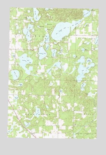
Mildred, MN USGS Topographic Map
Click on map above to begin viewing in our Map Viewer.

This topographic map contains these locations and features:
Feature Name Type Latitude Longitude GNIS ID View Map
Bass LakeLakeN46.8542°W94.4490°655241View Map
Big Portage LakeLakeN46.8530°W94.4276°655372View Map
Boot LakeLakeN46.7626°W94.4731°655481View Map
Bowen LakeReservoirN46.8105°W94.4909°655492View Map
Bowen Lake DamDamN46.8150°W94.4953°1775930View Map
Brockway LakeLakeN46.8201°W94.4369°655518View Map
Clear LakeLakeN46.7744°W94.4586°655742View Map
Corset LakeLakeN46.8418°W94.3894°655809View Map
Crooked LakeLakeN46.8641°W94.4709°655879View Map
Deep Portage LakeLakeN46.8706°W94.3921°655956View Map
Dick LakeLakeN46.7561°W94.4964°655993View Map
Ding Pot LakeLakeN46.7930°W94.3861°655997View Map
Elbow LakeLakeN46.8595°W94.3930°656133View Map
Fawn LakeLakeN46.8376°W94.4468°656209View Map
Hattie Lake DamDamN46.8100°W94.3919°1775934View Map
Horse LakeLakeN46.7953°W94.4262°656641View Map
Horseshoe LakeLakeN46.8516°W94.4742°656651View Map
Johnson LakeLakeN46.8322°W94.4373°656806View Map
Lake HattieReservoirN46.8167°W94.3960°656543View Map
Lindsey LakeLakeN46.8222°W94.4770°657013View Map
Lindsey Lake CampgroundsLocaleN46.8333°W94.4778°2071396View Map
Little Deep LakeLakeN46.8352°W94.3960°657051View Map
Little Lake HattieReservoirN46.8253°W94.3878°657079View Map
Little Sand LakeLakeN46.8001°W94.3954°657120View Map
Lizzie CreekStreamN46.7922°W94.3864°657163View Map
Loon LakeLakeN46.8533°W94.4669°657206View Map
MildredPopulated PlaceN46.7550°W94.4647°657393View Map
Mildred Bible ChapelChurchN46.7553°W94.4664°2071394View Map
Mildred Post Office (historical)Post OfficeN46.7550°W94.4644°2071347View Map
Minnow LakeLakeN46.8010°W94.4829°657412View Map
Mud LakeLakeN46.8293°W94.4086°657508View Map
Ox Yoke LakeLakeN46.8693°W94.4633°657713View Map
Pig LakeLakeN46.7883°W94.4886°657821View Map
Pine River CemeteryCemeteryN46.7577°W94.4664°657851View Map
Portage LakeReservoirN46.8416°W94.4303°1775929View Map
Portage Lake DamDamN46.8416°W94.4303°1775928View Map
Rainy LakeLakeN46.8448°W94.4485°657973View Map
Rice Portage LakeLakeN46.8602°W94.4073°658045View Map
Sanborn LakeLakeN46.8316°W94.4539°658143View Map
Swede LakeLakeN46.8287°W94.4938°658575View Map
Sylvan LakeLakeN46.8440°W94.3758°658584View Map
Tamarack LakeLakeN46.8594°W94.4491°658601View Map
Township of Pine RiverCivilN46.7622°W94.4715°665311View Map
Township of PowersCivilN46.8497°W94.4696°665348View Map
Tuck-A-Way Resort and CampgroundLocaleN46.8139°W94.3861°2071397View Map
Twin LakesLakeN46.8347°W94.4268°658790View Map
Willard LakeLakeN46.8569°W94.4598°659013View Map

Note: Coordinates in the location and feature list above are referenced to NAD83 datum.


Copyright (C) 2008-2025 Ryan Niemi / Sunset Dynamics ... All Rights Reserved