TopoQuest Logo
Do you find TopoQuest useful?
Help keep TopoQuest running and adding new maps/features by donating!
Bitcoin:  19c7KJd3qBynnjoSw5npx9KScwjBe4ifkT
Litecoin:  LXs6TkuXGGXo1vDsWCkWVdjQX94eUKd6ui
Home View Maps Find Maps Find Places Resources & Links


Webb Lake, Minnesota Topographic Map

USGS Map Title: Webb Lake, MN
USGS Map MRC: 46094H4
DRG (GeoTIFF) Download: o46094h4.tif


Neighboring USGS Topographic Map Quads:


  Hackensack, MN  
46094H5
 

  Webb Lake, MN  
46094H4
 

  Woman Lake, MN  
46094H3
 

  Backus, MN  
46094G5
 

  Mildred, MN  
46094G4
 

  Lake Ada, MN  
46094G3


Map MRC Location:

N47°
W95°
N47°
W94°
H8 H7 H6 H5 H4 H3 H2 H1
G8 G7 G6 G5 G4 G3 G2 G1
F8 F7 F6 F5 F4 F3 F2 F1
E8 E7 E6 E5 E4 E3 E2 E1
D8 D7 D6 D5 D4 D3 D2 D1
C8 C7 C6 C5 C4 C3 C2 C1
B8 B7 B6 B5 B4 B3 B2 B1
A8 A7 A6 A5 A4 A3 A2 A1
N46°
W95°
N46°
W94°

Webb Lake, MN USGS 1:24K Topographic Map Preview:
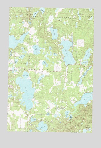
Webb Lake, MN USGS Topographic Map
Click on map above to begin viewing in our Map Viewer.

This topographic map contains these locations and features:
Feature Name Type Latitude Longitude GNIS ID View Map
Bass PondLakeN46.9020°W94.3855°655258View Map
Big Deep LakeLakeN46.9102°W94.3828°655359View Map
Black Portage LakeLakeN46.8765°W94.3859°655414View Map
Blind LakeLakeN46.8906°W94.4070°655433View Map
Blue Bill LakeLakeN46.9936°W94.4618°655444View Map
Blueberry LakeLakeN46.9530°W94.4313°655454View Map
Boss LakeLakeN46.9318°W94.4744°655486View Map
Cranberry LakeLakeN46.9992°W94.3805°655859View Map
Cub LakeLakeN46.9845°W94.4702°655903View Map
Diamond LakeLakeN46.9978°W94.4514°655988View Map
Fish LakeLakeN46.9456°W94.4888°656245View Map
Four Point LakeLakeN46.8797°W94.4483°656304View Map
Gut LakeLakeN46.9986°W94.4290°657192View Map
High Bank LakeLakeN46.9532°W94.4968°656581View Map
Horseshoe LakeLakeN46.9437°W94.4463°656652View Map
KCCW-TV (Walker)TowerN46.9341°W94.4572°663164View Map
Kid LakeLakeN46.9533°W94.3840°656885View Map
KZPX-FM (Nisswa)TowerN46.9344°W94.4586°663096View Map
Lake Four Hundred EighteenLakeN46.9846°W94.4794°659091View Map
Larson LakeLakeN46.9577°W94.4588°656954View Map
Little Boy LakeLakeN46.8934°W94.4124°657037View Map
Little Webb LakeLakeN46.9742°W94.4335°657150View Map
Long LakeLakeN46.9280°W94.4528°657181View Map
Lost LakeLakeN46.9453°W94.3873°657218View Map
Mascot CampgroundsLocaleN46.9681°W94.4106°2071127View Map
Mud LakeLakeN46.9104°W94.4979°657518View Map
Mud Portage LakeLakeN46.8783°W94.3786°657520View Map
Oak LakeLakeN46.9841°W94.4013°657647View Map
Pickerel LakeLakeN46.8870°W94.4628°657806View Map
Pleasant LakeLakeN46.9152°W94.4728°657869View Map
Popple LakeLakeN46.9901°W94.3796°657903View Map
Round LakeLakeN46.8929°W94.4404°658100View Map
South Stocking LakeLakeN46.9926°W94.3972°658377View Map
Stony LakeLakeN46.9662°W94.4917°658492View Map
Surprise LakeLakeN46.9592°W94.4390°658555View Map
Sylvester LakeLakeN46.9501°W94.4803°658587View Map
Three Island LakeLakeN46.9566°W94.4780°658671View Map
Township of Birch LakeCivilN46.9367°W94.4683°663597View Map
Trillium LakeLakeN46.9318°W94.3888°657159View Map
Webb LakeLakeN46.9554°W94.4133°658917View Map
Webb Lake AirportAirportN46.9598°W94.4247°2676841View Map
Weed LakeLakeN46.9814°W94.4008°658925View Map
Woodchuck LakeLakeN46.9433°W94.4727°659068View Map

Note: Coordinates in the location and feature list above are referenced to NAD83 datum.


Copyright (C) 2008-2025 Ryan Niemi / Sunset Dynamics ... All Rights Reserved