TopoQuest Logo
Do you find TopoQuest useful?
Help keep TopoQuest running and adding new maps/features by donating!
Bitcoin:  19c7KJd3qBynnjoSw5npx9KScwjBe4ifkT
Litecoin:  LXs6TkuXGGXo1vDsWCkWVdjQX94eUKd6ui
Home View Maps Find Maps Find Places Resources & Links


Pine River, Minnesota Topographic Map

USGS Map Title: Pine River, MN
USGS Map MRC: 46094F4
DRG (GeoTIFF) Download: o46094f4.tif


Neighboring USGS Topographic Map Quads:


  Backus, MN  
46094G5
 

  Mildred, MN  
46094G4
 

  Lake Ada, MN  
46094G3
 

  Bungo Creek, MN  
46094F5
 

  Pine River, MN  
46094F4
 

  Jenkins, MN  
46094F3
 

  Graff, MN  
46094E5
 

  Pine River SW, MN  
46094E4
 

  Nisswa, MN  
46094E3


Map MRC Location:

N47°
W95°
N47°
W94°
H8 H7 H6 H5 H4 H3 H2 H1
G8 G7 G6 G5 G4 G3 G2 G1
F8 F7 F6 F5 F4 F3 F2 F1
E8 E7 E6 E5 E4 E3 E2 E1
D8 D7 D6 D5 D4 D3 D2 D1
C8 C7 C6 C5 C4 C3 C2 C1
B8 B7 B6 B5 B4 B3 B2 B1
A8 A7 A6 A5 A4 A3 A2 A1
N46°
W95°
N46°
W94°

Pine River, MN USGS 1:24K Topographic Map Preview:
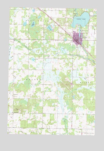
Pine River, MN USGS Topographic Map
Click on map above to begin viewing in our Map Viewer.

This topographic map contains these locations and features:
Feature Name Type Latitude Longitude GNIS ID View Map
Anderson CemeteryCemeteryN46.6447°W94.4928°639335View Map
Apostolic ChurchChurchN46.6639°W94.4919°639410View Map
Behler CreekStreamN46.7050°W94.4219°639868View Map
Chickamaw BeachPopulated PlaceN46.7436°W94.3853°641152View Map
City of Chickamaw BeachCivilN46.7452°W94.3844°2393513View Map
City of Pine RiverCivilN46.7225°W94.3974°2396210View Map
First Lutheran ChurchChurchN46.7189°W94.4006°2071062View Map
Grace United Methodist ChurchChurchN46.7258°W94.4061°2071067View Map
Hoblin CreekStreamN46.7069°W94.4642°645044View Map
Maple HillSummitN46.6486°W94.4875°647473View Map
Maple Hill CemeteryCemeteryN46.6461°W94.4917°2071072View Map
Maple Hill ChurchChurchN46.6461°W94.4917°659993View Map
Mud LakeLakeN46.6985°W94.4649°648315View Map
Norway LakeReservoirN46.7200°W94.4003°1775937View Map
Norway LakeLakeN46.7391°W94.3969°648748View Map
Norway Lake DamDamN46.7200°W94.4003°1775936View Map
Our Lady of Lourdes Catholic ChurchChurchN46.7228°W94.4078°2071065View Map
Pequot Lakes Baptist ChurchChurchN46.7181°W94.3869°2071106View Map
Pine Ridge CemeteryCemeteryN46.7097°W94.4011°2071071View Map
Pine RiverPopulated PlaceN46.7180°W94.4042°649494View Map
Pine River - Backus High SchoolSchoolN46.7192°W94.3881°2071070View Map
Pine River (historical)LocaleN46.7167°W94.4028°2071105View Map
Pine River Baptist ChurchChurchN46.7236°W94.4083°2071066View Map
Pine River Country ClubLocaleN46.7236°W94.4250°2071111View Map
Pine River Elementary SchoolSchoolN46.7256°W94.4033°2071107View Map
Pine River Family ClinicHospitalN46.7203°W94.4008°2071068View Map
Pine River LibraryBuildingN46.7211°W94.4047°2071102View Map
Pine River Police DepartmentBuildingN46.7191°W94.4055°2758706View Map
Pine River Post OfficePost OfficeN46.7181°W94.4039°2071103View Map
Pine River Regional AirportAirportN46.7241°W94.3830°660356View Map
Pine River United Methodist ChurchChurchN46.7194°W94.4019°2071061View Map
Pine River Volunteer Fire DepartmentBuildingN46.7191°W94.4055°2071104View Map
Sand LakeLakeN46.7299°W94.4426°651156View Map
South Fork Pine RiverStreamN46.7005°W94.3889°658364View Map
Tamarack LakeLakeN46.7333°W94.4663°653026View Map
Township of WaldenCivilN46.6750°W94.4719°665897View Map
Township of WilsonCivilN46.6745°W94.3769°666008View Map
Whispering Pines Good Samaritan CenterHospitalN46.7222°W94.4028°2071069View Map
Wilson CreekStreamN46.7038°W94.4878°639179View Map

Note: Coordinates in the location and feature list above are referenced to NAD83 datum.


Copyright (C) 2008-2024 Ryan Niemi / Sunset Dynamics ... All Rights Reserved