TopoQuest Logo
Do you find TopoQuest useful?
Help keep TopoQuest running and adding new maps/features by donating!
Bitcoin:  19c7KJd3qBynnjoSw5npx9KScwjBe4ifkT
Litecoin:  LXs6TkuXGGXo1vDsWCkWVdjQX94eUKd6ui
Home View Maps Find Maps Find Places Resources & Links


Minden City, Michigan Topographic Map

USGS Map Title: Minden City, MI
USGS Map MRC: 43082F7
DRG (GeoTIFF) Download: o43082f7.tif


Neighboring USGS Topographic Map Quads:


  Bad Axe East, MI  
43082G8
 

  Bad Axe SE, MI  
43082G7
 

  Harbor Beach, MI  
43082G6
 

  Ubly, MI  
43082F8
 

  Minden City, MI  
43082F7
 

  Ruth, MI  
43082F6
 

  Argyle, MI  
43082E8
 

  Palms, MI  
43082E7
 

  Deckerville, MI  
43082E6


Map MRC Location:

N44°
W83°
N44°
W82°
H8 H7 H6 H5 H4 H3 H2 H1
G8 G7 G6 G5 G4 G3 G2 G1
F8 F7 F6 F5 F4 F3 F2 F1
E8 E7 E6 E5 E4 E3 E2 E1
D8 D7 D6 D5 D4 D3 D2 D1
C8 C7 C6 C5 C4 C3 C2 C1
B8 B7 B6 B5 B4 B3 B2 B1
A8 A7 A6 A5 A4 A3 A2 A1
N43°
W83°
N43°
W82°

Minden City, MI USGS 1:24K Topographic Map Preview:
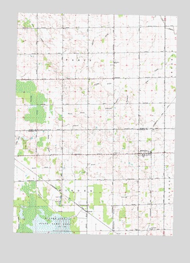
Minden City, MI USGS Topographic Map
Click on map above to begin viewing in our Map Viewer.

This topographic map contains these locations and features:
Feature Name Type Latitude Longitude GNIS ID View Map
Boltzer DrainCanalN43.7422°W82.8038°621699View Map
Brackley Cemetery (historical)CemeteryN43.7208°W82.8306°2548568View Map
Butch DrainCanalN43.6925°W82.8277°622360View Map
Cook DrainCanalN43.7450°W82.7599°623734View Map
Darlington DrainCanalN43.6259°W82.7969°624316View Map
Grifka DrainCanalN43.7097°W82.8060°627435View Map
Kowalski DrainCanalN43.7022°W82.7877°629862View Map
Lamka DrainCanalN43.6772°W82.8722°630104View Map
Lloyd DrainCanalN43.6625°W82.8172°630844View Map
Minden CityPopulated PlaceN43.6714°W82.7783°632443View Map
Minden City CemeteryCemeteryN43.6714°W82.7977°632444View Map
Minden City Fire DepartmentBuildingN43.6706°W82.7751°2626931View Map
Minden City Post OfficePost OfficeN43.6717°W82.7742°2554048View Map
Minden City StationLocaleN43.6722°W82.7683°2554047View Map
Osintoski DrainCanalN43.6983°W82.7985°634139View Map
Palms SchoolSchoolN43.6284°W82.7777°634330View Map
Paris DrainCanalN43.6764°W82.8497°634367View Map
ParisvillePopulated PlaceN43.7139°W82.7994°1617770View Map
Parisville Post Office (historical)Post OfficeN43.7139°W82.7994°2548548View Map
Pawlowski Post Office (historical)Post OfficeN43.7431°W82.8200°2548543View Map
PeatvillePopulated PlaceN43.6378°W82.8174°1617778View Map
Saint Mary's Catholic CemeteryCemeteryN43.7217°W82.8000°2548567View Map
Saint Mary's ChurchChurchN43.7233°W82.7994°2548361View Map
Saint Mary's Historical MuseumBuildingN43.7228°W82.7994°2548360View Map
Saint Marys SchoolSchoolN43.7228°W82.7991°636927View Map
Saint Patricks CemeteryCemeteryN43.6286°W82.7674°636972View Map
Swiercz DrainCanalN43.6414°W82.8474°1614501View Map
Township of MindenCivilN43.6409°W82.8178°1626749View Map
Township of ParisCivilN43.7277°W82.8193°1626881View Map
Village of Minden CityCivilN43.6714°W82.7768°2399369View Map

Note: Coordinates in the location and feature list above are referenced to NAD83 datum.


Copyright (C) 2008-2025 Ryan Niemi / Sunset Dynamics ... All Rights Reserved