TopoQuest Logo
Do you find TopoQuest useful?
Help keep TopoQuest running and adding new maps/features by donating!
Bitcoin:  19c7KJd3qBynnjoSw5npx9KScwjBe4ifkT
Litecoin:  LXs6TkuXGGXo1vDsWCkWVdjQX94eUKd6ui
Home View Maps Find Maps Find Places Resources & Links


Holden, Missouri Topographic Map

USGS Map Title: Holden, MO
USGS Map MRC: 38093F8
DRG (GeoTIFF) Download: o38093f8.tif


Neighboring USGS Topographic Map Quads:


  Elm, MO  
38094G1
 

  Pittsville, MO  
38093G8
 

  Warrensburg West, MO  
38093G7
 

  Kingsville, MO  
38094F1
 

  Holden, MO  
38093F8
 

  Centerview, MO  
38093F7
 

  Quick City, MO  
38094E1
 

  Blairstown, MO  
38093E8
 

  Chilhowee, MO  
38093E7


Map MRC Location:

N39°
W94°
N39°
W93°
H8 H7 H6 H5 H4 H3 H2 H1
G8 G7 G6 G5 G4 G3 G2 G1
F8 F7 F6 F5 F4 F3 F2 F1
E8 E7 E6 E5 E4 E3 E2 E1
D8 D7 D6 D5 D4 D3 D2 D1
C8 C7 C6 C5 C4 C3 C2 C1
B8 B7 B6 B5 B4 B3 B2 B1
A8 A7 A6 A5 A4 A3 A2 A1
N38°
W94°
N38°
W93°

Holden, MO USGS 1:24K Topographic Map Preview:
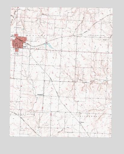
Holden, MO USGS Topographic Map
Click on map above to begin viewing in our Map Viewer.

This topographic map contains these locations and features:
Feature Name Type Latitude Longitude GNIS ID View Map
Borthick School (historical)SchoolN38.6594°W93.9189°745526View Map
City of HoldenCivilN38.7136°W93.9895°2394398View Map
Doak School (historical)SchoolN38.6308°W93.9869°745523View Map
Doran (historical)LocaleN38.7289°W93.9041°745144View Map
East Pin Oak CreekStreamN38.7386°W93.9952°717333View Map
Elliott CemeteryCemeteryN38.6992°W93.8849°717484View Map
F-2 LakeReservoirN38.7400°W93.9319°762928View Map
Fairview CemeteryCemeteryN38.7325°W93.9922°717756View Map
Ferguson CemeteryCemeteryN38.7433°W93.9622°717885View Map
Flynn School (historical)SchoolN38.7209°W93.9629°745524View Map
HoldenPopulated PlaceN38.7142°W93.9913°719697View Map
Holden Elementary SchoolSchoolN38.7014°W93.9912°2442453View Map
Holden Fire DepartmentBuildingN38.7167°W93.9902°2621452View Map
Holden High SchoolSchoolN38.7017°W93.9896°2545392View Map
Holden Intermediate SchoolSchoolN38.7107°W93.9921°719700View Map
Holden Middle SchoolSchoolN38.7016°W93.9872°2545282View Map
Holden Post OfficePost OfficeN38.7183°W93.9932°2782966View Map
Holden Reservoir East DamDamN38.7150°W93.9552°763125View Map
Holden Reservoir West DamDamN38.7150°W93.9569°763094View Map
Johnson County Fire Protection District 2 Station 3 MadisonBuildingN38.7101°W93.9713°2620425View Map
King School (historical)SchoolN38.7036°W93.9188°745525View Map
MagnoliaPopulated PlaceN38.6392°W93.9141°721752View Map
Miller MausoleumBuildingN38.7303°W93.9930°755319View Map
New Liberty CemeteryCemeteryN38.6294°W93.9279°723273View Map
Number 199 ReservoirReservoirN38.6550°W93.9786°763077View Map
Number 203 ReservoirReservoirN38.7138°W93.9571°763095View Map
Outon CemeteryCemeteryN38.6361°W93.9567°723898View Map
Pleasant Shade School (historical)SchoolN38.6650°W93.9595°729797View Map
Saint Patrick CemeteryCemeteryN38.7102°W93.9752°725853View Map
South Fork Blackwater River Watershed Dam F-21DamN38.7400°W93.9319°762927View Map
Sunny Point School (historical)SchoolN38.7159°W93.8794°2744007View Map
Township of MadisonCivilN38.7321°W93.9740°766837View Map
West Pin Oak CreekStreamN38.7386°W93.9952°728605View Map
White Oak CreekStreamN38.6250°W93.9474°728749View Map
Wilson Lake DamDamN38.6550°W93.9786°763076View Map

Note: Coordinates in the location and feature list above are referenced to NAD83 datum.


Copyright (C) 2008-2024 Ryan Niemi / Sunset Dynamics ... All Rights Reserved