TopoQuest Logo
Do you find TopoQuest useful?
Help keep TopoQuest running and adding new maps/features by donating!
Bitcoin:  19c7KJd3qBynnjoSw5npx9KScwjBe4ifkT
Litecoin:  LXs6TkuXGGXo1vDsWCkWVdjQX94eUKd6ui
Home View Maps Find Maps Find Places Resources & Links


Quick City, Missouri Topographic Map

USGS Map Title: Quick City, MO
USGS Map MRC: 38094E1
DRG (GeoTIFF) Download: o38094e1.tif


Neighboring USGS Topographic Map Quads:


  East Lynne, MO  
38094F2
 

  Kingsville, MO  
38094F1
 

  Holden, MO  
38093F8
 

  Garden City, MO  
38094E2
 

  Quick City, MO  
38094E1
 

  Blairstown, MO  
38093E8
 

  Dayton, MO  
38094D2
 

  Creighton, MO  
38094D1
 

  Hartwell, MO  
38093D8


Map MRC Location:

N39°
W95°
N39°
W94°
H8 H7 H6 H5 H4 H3 H2 H1
G8 G7 G6 G5 G4 G3 G2 G1
F8 F7 F6 F5 F4 F3 F2 F1
E8 E7 E6 E5 E4 E3 E2 E1
D8 D7 D6 D5 D4 D3 D2 D1
C8 C7 C6 C5 C4 C3 C2 C1
B8 B7 B6 B5 B4 B3 B2 B1
A8 A7 A6 A5 A4 A3 A2 A1
N38°
W95°
N38°
W94°

Quick City, MO USGS 1:24K Topographic Map Preview:
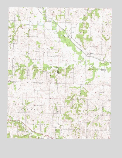
Quick City, MO USGS Topographic Map
Click on map above to begin viewing in our Map Viewer.

This topographic map contains these locations and features:
Feature Name Type Latitude Longitude GNIS ID View Map
Bee Branch School (historical)SchoolN38.5500°W94.0374°745450View Map
Bogard CreekStreamN38.5672°W94.0194°714479View Map
Bunker Hill School (historical)SchoolN38.5158°W94.0380°745451View Map
Dover School (historical)SchoolN38.5531°W94.0838°717024View Map
Flying G AirportAirportN38.5465°W94.0957°758651View Map
Forest School (historical)SchoolN38.5533°W94.1197°718098View Map
Grant CemeteryCemeteryN38.5381°W94.0760°718702View Map
Hendricks CemeteryCemeteryN38.5221°W94.0139°719378View Map
Kaysinger Basin Planning RegionCivilN38.5003°W94.0003°758121View Map
Little Walnut CreekStreamN38.6028°W94.0577°721353View Map
Mount Xenia School (historical)SchoolN38.5867°W94.0961°745198View Map
Page CemeteryCemeteryN38.5305°W94.0444°723956View Map
Panther CreekStreamN38.5706°W94.0416°723990View Map
Pemberton CemeteryCemeteryN38.5828°W94.0875°724185View Map
Pleasant Ridge School (historical)SchoolN38.5956°W94.0313°2743983View Map
Pumpkin Green School (historical)SchoolN38.5247°W94.1124°745937View Map
Quick CityPopulated PlaceN38.5811°W94.0288°725023View Map
Quick City School (historical)SchoolN38.5814°W94.0291°745533View Map
Salmon Lake NorthReservoirN38.5350°W94.0686°763134View Map
Salmon Lake North DamDamN38.5350°W94.0686°763133View Map
Salmon Lake SouthReservoirN38.5333°W94.0702°763132View Map
Salmon Lake South DamDamN38.5333°W94.0702°763131View Map
Scaly Bark CreekStreamN38.5950°W94.0502°726085View Map
Sherwood Elementary SchoolSchoolN38.5092°W94.0867°2545451View Map
Sherwood High SchoolSchoolN38.5071°W94.0862°2545224View Map
Sherwood Middle SchoolSchoolN38.5082°W94.0872°2545195View Map
Township of BogardCivilN38.5155°W94.0106°766736View Map
Township of Rose HillCivilN38.6247°W94.0371°766840View Map
Township of ShermanCivilN38.5078°W94.1108°766445View Map
Trinity Lutheran CemeteryCemeteryN38.5061°W94.0708°721686View Map
Wadesburg School (historical)SchoolN38.5245°W94.0774°745936View Map
Walnut CreekStreamN38.5675°W94.0236°728296View Map

Note: Coordinates in the location and feature list above are referenced to NAD83 datum.


Copyright (C) 2008-2025 Ryan Niemi / Sunset Dynamics ... All Rights Reserved