TopoQuest Logo
Do you find TopoQuest useful?
Help keep TopoQuest running and adding new maps/features by donating!
Bitcoin:  19c7KJd3qBynnjoSw5npx9KScwjBe4ifkT
Litecoin:  LXs6TkuXGGXo1vDsWCkWVdjQX94eUKd6ui
Home View Maps Find Maps Find Places Resources & Links


Centerview, Missouri Topographic Map

USGS Map Title: Centerview, MO
USGS Map MRC: 38093F7
DRG (GeoTIFF) Download: o38093f7.tif


Neighboring USGS Topographic Map Quads:


  Pittsville, MO  
38093G8
 

  Warrensburg West, MO  
38093G7
 

  Warrensburg East, MO  
38093G6
 

  Holden, MO  
38093F8
 

  Centerview, MO  
38093F7
 

  Cornelia, MO  
38093F6
 

  Blairstown, MO  
38093E8
 

  Chilhowee, MO  
38093E7
 

  Leeton, MO  
38093E6


Map MRC Location:

N39°
W94°
N39°
W93°
H8 H7 H6 H5 H4 H3 H2 H1
G8 G7 G6 G5 G4 G3 G2 G1
F8 F7 F6 F5 F4 F3 F2 F1
E8 E7 E6 E5 E4 E3 E2 E1
D8 D7 D6 D5 D4 D3 D2 D1
C8 C7 C6 C5 C4 C3 C2 C1
B8 B7 B6 B5 B4 B3 B2 B1
A8 A7 A6 A5 A4 A3 A2 A1
N38°
W94°
N38°
W93°

Centerview, MO USGS 1:24K Topographic Map Preview:
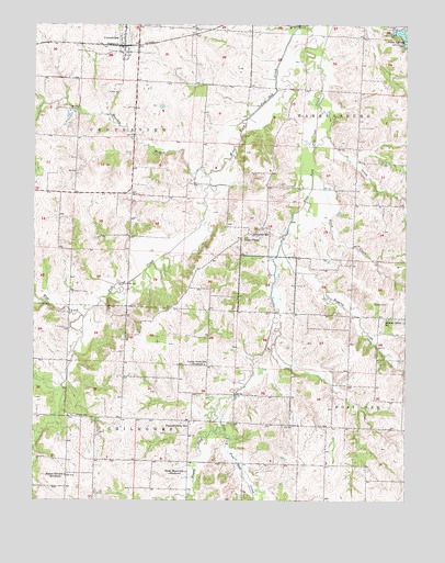
Centerview, MO USGS Topographic Map
Click on map above to begin viewing in our Map Viewer.

This topographic map contains these locations and features:
Feature Name Type Latitude Longitude GNIS ID View Map
Bradley BranchStreamN38.7111°W93.8169°714616View Map
Brawley CreekStreamN38.6928°W93.7922°714652View Map
Briscoe School (historical)SchoolN38.6914°W93.8666°745527View Map
CenterviewPopulated PlaceN38.7442°W93.8452°729717View Map
Centerview Post OfficePost OfficeN38.7435°W93.8455°2782822View Map
City of CenterviewCivilN38.7454°W93.8452°2393782View Map
Crest Ridge Elementary SchoolSchoolN38.7416°W93.8435°2545387View Map
Easterwood LakeReservoirN38.6483°W93.7802°763506View Map
Easterwood Lake DamDamN38.6483°W93.7802°763505View Map
Fletcher CreekStreamN38.7295°W93.7799°718020View Map
Glendale School (historical)SchoolN38.6950°W93.8017°718509View Map
Greer CemeteryCemeteryN38.6769°W93.7605°718855View Map
Hazel Mound School (historical)SchoolN38.6325°W93.8238°719299View Map
Hickory Grove School (historical)SchoolN38.6731°W93.7569°729750View Map
Hogan ForkStreamN38.6528°W93.8074°719686View Map
Houts ChapelChurchN38.6945°W93.8044°719903View Map
Johnson CountyCivilN38.7441°W93.8064°758505View Map
Johnson County Fire Protection District Station 5 CenterviewBuildingN38.7494°W93.8396°2621130View Map
Lions LakeReservoirN38.7479°W93.7522°762876View Map
Lions Lake DamDamN38.7483°W93.7540°762875View Map
Locust Grove School (historical)SchoolN38.6608°W93.8177°721395View Map
Masonic Hall School (historical)SchoolN38.6667°W93.8438°745191View Map
Pertle Springs DamDamN38.7451°W93.7506°762889View Map
Pisgah CemeteryCemeteryN38.6473°W93.8619°724437View Map
Pleasant Valley ChurchChurchN38.6447°W93.8235°724624View Map
Science Hill School (historical)SchoolN38.6317°W93.8644°726131View Map
ScottLocaleN38.6700°W93.7749°740429View Map
Scott Post Office (historical)Post OfficeN38.6700°W93.7749°759573View Map
Short Air AirportAirportN38.6486°W93.7766°2679398View Map
Sluder CemeteryCemeteryN38.7325°W93.8508°726563View Map
Stoak CreekStreamN38.7120°W93.7810°727118View Map

Note: Coordinates in the location and feature list above are referenced to NAD83 datum.


Copyright (C) 2008-2025 Ryan Niemi / Sunset Dynamics ... All Rights Reserved