TopoQuest Logo
Do you find TopoQuest useful?
Help keep TopoQuest running and adding new maps/features by donating!
Bitcoin:  19c7KJd3qBynnjoSw5npx9KScwjBe4ifkT
Litecoin:  LXs6TkuXGGXo1vDsWCkWVdjQX94eUKd6ui
Home View Maps Find Maps Find Places Resources & Links


Holland, New York Topographic Map

USGS Map Title: Holland, NY
USGS Map MRC: 42078F5
DRG (GeoTIFF) Download: o42078f5.tif


Neighboring USGS Topographic Map Quads:


  Orchard Park, NY  
42078G6
 

  East Aurora, NY  
42078G5
 

  Cowlesville, NY  
42078G4
 

  Colden, NY  
42078F6
 

  Holland, NY  
42078F5
 

  Strykersville, NY  
42078F4
 

  Springville, NY  
42078E6
 

  Sardinia, NY  
42078E5
 

  Arcade, NY  
42078E4


Map MRC Location:

N43°
W79°
N43°
W78°
H8 H7 H6 H5 H4 H3 H2 H1
G8 G7 G6 G5 G4 G3 G2 G1
F8 F7 F6 F5 F4 F3 F2 F1
E8 E7 E6 E5 E4 E3 E2 E1
D8 D7 D6 D5 D4 D3 D2 D1
C8 C7 C6 C5 C4 C3 C2 C1
B8 B7 B6 B5 B4 B3 B2 B1
A8 A7 A6 A5 A4 A3 A2 A1
N42°
W79°
N42°
W78°

Holland, NY USGS 1:24K Topographic Map Preview:
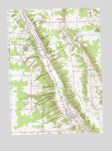
Holland, NY USGS Topographic Map
Click on map above to begin viewing in our Map Viewer.

This topographic map contains these locations and features:
Feature Name Type Latitude Longitude GNIS ID View Map
Aurora Mobile Home ParkPopulated PlaceN42.7375°W78.5979°2714974View Map
BlakeleyPopulated PlaceN42.7356°W78.5953°944216View Map
Circle B Courts Mobile Home ParkPopulated PlaceN42.6932°W78.5698°2715001View Map
Colden Fire DistrictBuildingN42.6505°W78.6223°2701220View Map
ColegravePopulated PlaceN42.7362°W78.5547°972333View Map
East Aurora High SchoolSchoolN42.7358°W78.6244°2713652View Map
Emery ParkParkN42.7145°W78.5953°949635View Map
Field Of Dreams FarmLocaleN42.7056°W78.5444°2517201View Map
First Baptist Church of HollandChurchN42.6435°W78.5450°2713922View Map
Gears GulfValleyN42.6369°W78.5381°950965View Map
Goodleberg CemeteryCemeteryN42.7141°W78.5376°951329View Map
Gow SchoolSchoolN42.7081°W78.5834°951428View Map
Harold O Brumsted Elementary SchoolSchoolN42.6466°W78.5398°2713667View Map
HollandPopulated PlaceN42.6412°W78.5417°952987View Map
Holland CemeteryCemeteryN42.6542°W78.5515°952990View Map
Holland Census Designated PlaceCensusN42.6375°W78.5518°2389944View Map
Holland Fire District Station 1BuildingN42.6750°W78.5152°2700870View Map
Holland High SchoolSchoolN42.6447°W78.5409°2713671View Map
Holland Hills Country ClubLocaleN42.6313°W78.6054°2715042View Map
Holland Middle SchoolSchoolN42.6518°W78.5528°2713672View Map
Holland Post OfficePost OfficeN42.6508°W78.5516°2713471View Map
Holland Town HallBuildingN42.6429°W78.5422°2715054View Map
Holland United Methodist ChurchChurchN42.6508°W78.5531°2713993View Map
Holland Volunteer Fire DepartmentBuildingN42.6421°W78.5427°2701181View Map
Holmes Hill CemeteryCemeteryN42.7353°W78.5533°953014View Map
Humphrey CemeteryCemeteryN42.6768°W78.5604°953435View Map
Hunter Creek CemeteryCemeteryN42.6955°W78.5154°953474View Map
Hunters Creek Bible Baptist ChurchChurchN42.6880°W78.5149°953475View Map
Kingdom Hall of Jehovah's WitnessesChurchN42.6415°W78.5386°2714030View Map
Kramer FarmsLocaleN42.6267°W78.5714°2703339View Map
Mountain Meadow Park Sewage Treatment PlantLocaleN42.6507°W78.5489°2715067View Map
Neischel CemeteryCemeteryN42.6762°W78.5955°958355View Map
New York State Police Troop A Zone 2 Holland StationBuildingN42.6429°W78.5422°2780746View Map
Poplar CornersLocaleN42.7267°W78.6228°960930View Map
Saint Joseph CemeteryCemeteryN42.6575°W78.5532°963698View Map
Saint Joseph Roman Catholic ChurchChurchN42.6415°W78.5434°2714204View Map
South WalesPopulated PlaceN42.7089°W78.5781°965885View Map
South Wales Post OfficePost OfficeN42.7074°W78.5758°2713485View Map
South Wales Presbyterian ChurchChurchN42.7093°W78.5797°2714278View Map
South Wales Volunteer Fire CompanyBuildingN42.7100°W78.5783°2700934View Map
Town of HollandCivilN42.6495°W78.5216°979070View Map
Town of WalesCivilN42.7371°W78.5213°979591View Map
Vermont HillSummitN42.6628°W78.5292°968490View Map
WGR-FM (Buffalo)TowerN42.7184°W78.5631°977698View Map
WGRZ-TV (Buffalo)TowerN42.7184°W78.5631°977851View Map
WKBW-TV (Buffalo)TowerN42.6376°W78.6197°977853View Map

Note: Coordinates in the location and feature list above are referenced to NAD83 datum.


Copyright (C) 2008-2025 Ryan Niemi / Sunset Dynamics ... All Rights Reserved