TopoQuest Logo
Do you find TopoQuest useful?
Help keep TopoQuest running and adding new maps/features by donating!
Bitcoin:  19c7KJd3qBynnjoSw5npx9KScwjBe4ifkT
Litecoin:  LXs6TkuXGGXo1vDsWCkWVdjQX94eUKd6ui
Home View Maps Find Maps Find Places Resources & Links


Springville, New York Topographic Map

USGS Map Title: Springville, NY
USGS Map MRC: 42078E6
DRG (GeoTIFF) Download: o42078e6.tif


Neighboring USGS Topographic Map Quads:


  Hamburg, NY  
42078F7
 

  Colden, NY  
42078F6
 

  Holland, NY  
42078F5
 

  Langford, NY  
42078E7
 

  Springville, NY  
42078E6
 

  Sardinia, NY  
42078E5
 

  Collins Center, NY  
42078D7
 

  Ashford Hollow, NY  
42078D6
 

  West Valley, NY  
42078D5


Map MRC Location:

N43°
W79°
N43°
W78°
H8 H7 H6 H5 H4 H3 H2 H1
G8 G7 G6 G5 G4 G3 G2 G1
F8 F7 F6 F5 F4 F3 F2 F1
E8 E7 E6 E5 E4 E3 E2 E1
D8 D7 D6 D5 D4 D3 D2 D1
C8 C7 C6 C5 C4 C3 C2 C1
B8 B7 B6 B5 B4 B3 B2 B1
A8 A7 A6 A5 A4 A3 A2 A1
N42°
W79°
N42°
W78°

Springville, NY USGS 1:24K Topographic Map Preview:
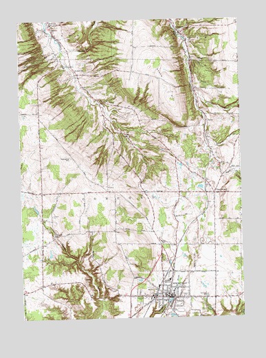
Springville, NY USGS Topographic Map
Click on map above to begin viewing in our Map Viewer.

This topographic map contains these locations and features:
Feature Name Type Latitude Longitude GNIS ID View Map
Bertrand Chaffee HospitalHospitalN42.5092°W78.6587°946339View Map
Bertrand Chaffee Hospital HeliportAirportN42.5084°W78.6578°978318View Map
Ciszak AirportAirportN42.5124°W78.7337°978319View Map
Cobble Hill CemeteryCemeteryN42.6213°W78.7312°946968View Map
ConcordPopulated PlaceN42.5353°W78.7309°947255View Map
Concord CemeteryCemeteryN42.5431°W78.7325°947256View Map
Concord Crest Golf CourseLocaleN42.5482°W78.6559°2714998View Map
Concord Public LibraryBuildingN42.5105°W78.6657°2715099View Map
Crump BrookStreamN42.6106°W78.6539°947877View Map
East ConcordPopulated PlaceN42.5520°W78.6403°949046View Map
East Concord Post OfficePost OfficeN42.5497°W78.6400°2713463View Map
East Concord Volunteer Fire DepartmentBuildingN42.5516°W78.6410°2700842View Map
Fairview CemeteryCemeteryN42.5316°W78.6710°949831View Map
Faith Church CemeteryCemeteryN42.6237°W78.7285°964094View Map
Fiddlers Green Manor Nursing HomeBuildingN42.5083°W78.6741°2715516View Map
First Presbyterian ChurchChurchN42.5098°W78.6677°2713947View Map
FootesPopulated PlaceN42.5851°W78.6445°972487View Map
FowlervillePopulated PlaceN42.6023°W78.7167°950549View Map
GlenwoodPopulated PlaceN42.6192°W78.6578°951233View Map
Glenwood Post OfficePost OfficeN42.6167°W78.6543°2713468View Map
Graff BrookStreamN42.5753°W78.6439°951456View Map
Griffith Institute High SchoolSchoolN42.5161°W78.6672°951823View Map
Griffith Institute Middle SchoolSchoolN42.5157°W78.6550°2667569View Map
Halls Tree FarmLocaleN42.5964°W78.7369°2517203View Map
Hayes HollowValleyN42.6206°W78.6609°970197View Map
Hills Christmas Tree FarmLocaleN42.5175°W78.7067°2517205View Map
Kingdom Hall of Jehovah's WitnessesChurchN42.5079°W78.6430°2714027View Map
Landon BrookStreamN42.6126°W78.7256°942096View Map
League for the Handicapped Preschool Learning CenterSchoolN42.5181°W78.6504°2713679View Map
Maplewood CemeteryCemeteryN42.5073°W78.6836°956470View Map
Millers Dairy FarmsLocaleN42.5544°W78.6375°2703344View Map
New Life Fellowship ChurchChurchN42.5102°W78.6714°2714089View Map
Our Saviour Lutheran ChurchChurchN42.5020°W78.6876°2714116View Map
Saint Aloysius Regional SchoolSchoolN42.5099°W78.6698°2713701View Map
Saint Aloysius Roman Catholic ChurchChurchN42.5099°W78.6694°2714159View Map
Saint Paul's Episcopal ChurchChurchN42.5078°W78.6450°2714232View Map
Salem Lutheran ChurchChurchN42.5091°W78.6708°2714264View Map
Sibley CemeteryCemeteryN42.5896°W78.6959°965204View Map
South HillSummitN42.5909°W78.6634°970628View Map
Spencer BrookStreamN42.5753°W78.6439°965981View Map
Sprague BrookStreamN42.5945°W78.6511°966036View Map
SpringvillePopulated PlaceN42.5084°W78.6672°966106View Map
Springville Assembly of God ChurchChurchN42.5132°W78.6876°2713801View Map
Springville Elementary SchoolSchoolN42.5176°W78.6545°2713709View Map
Springville First United Methodist ChurchChurchN42.5090°W78.6498°2713956View Map
Springville Post OfficePost OfficeN42.5100°W78.6658°2713487View Map
Springville Volunteer Fire Company Station 1BuildingN42.5099°W78.6653°2700944View Map
Springville Volunteer Fire DepartmentBuildingN42.5096°W78.6822°2735268View Map
Town of ConcordCivilN42.5450°W78.7075°978857View Map
Townsend HillSummitN42.5670°W78.7211°967723View Map
Village of SpringvilleCivilN42.5084°W78.6696°2391156View Map
Watermans Greenhouse And Garden CenterLocaleN42.5419°W78.6400°2517223View Map
Wendels Poultry FarmLocaleN42.5378°W78.6422°2517225View Map

Note: Coordinates in the location and feature list above are referenced to NAD83 datum.


Copyright (C) 2008-2025 Ryan Niemi / Sunset Dynamics ... All Rights Reserved