TopoQuest Logo
Do you find TopoQuest useful?
Help keep TopoQuest running and adding new maps/features by donating!
Bitcoin:  19c7KJd3qBynnjoSw5npx9KScwjBe4ifkT
Litecoin:  LXs6TkuXGGXo1vDsWCkWVdjQX94eUKd6ui
Home View Maps Find Maps Find Places Resources & Links


Colden, New York Topographic Map

USGS Map Title: Colden, NY
USGS Map MRC: 42078F6
DRG (GeoTIFF) Download: o42078f6.tif


Neighboring USGS Topographic Map Quads:


  Buffalo SE, NY  
42078G7
 

  Orchard Park, NY  
42078G6
 

  East Aurora, NY  
42078G5
 

  Hamburg, NY  
42078F7
 

  Colden, NY  
42078F6
 

  Holland, NY  
42078F5
 

  Langford, NY  
42078E7
 

  Springville, NY  
42078E6
 

  Sardinia, NY  
42078E5


Map MRC Location:

N43°
W79°
N43°
W78°
H8 H7 H6 H5 H4 H3 H2 H1
G8 G7 G6 G5 G4 G3 G2 G1
F8 F7 F6 F5 F4 F3 F2 F1
E8 E7 E6 E5 E4 E3 E2 E1
D8 D7 D6 D5 D4 D3 D2 D1
C8 C7 C6 C5 C4 C3 C2 C1
B8 B7 B6 B5 B4 B3 B2 B1
A8 A7 A6 A5 A4 A3 A2 A1
N42°
W79°
N42°
W78°

Colden, NY USGS 1:24K Topographic Map Preview:
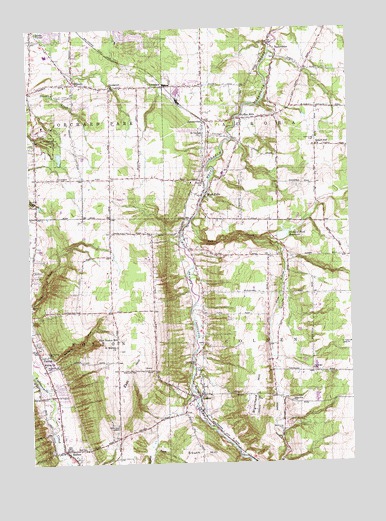
Colden, NY USGS Topographic Map
Click on map above to begin viewing in our Map Viewer.

This topographic map contains these locations and features:
Feature Name Type Latitude Longitude GNIS ID View Map
Anthony GulfValleyN42.6551°W78.7410°942502View Map
Aurora Waldorf SchoolSchoolN42.7085°W78.6742°2713630View Map
Berean Free Presbyterian ChurchChurchN42.6536°W78.7445°2667500View Map
Blanchard HillSummitN42.6387°W78.6634°944225View Map
BostonPopulated PlaceN42.6289°W78.7375°944470View Map
Boston ChurchChurchN42.6537°W78.7448°944471View Map
Boston Emergency SquadBuildingN42.6521°W78.7449°2719166View Map
Boston Free LibraryBuildingN42.6262°W78.7328°2714982View Map
Boston Post OfficePost OfficeN42.6383°W78.7388°2713449View Map
Boston Town HallBuildingN42.6526°W78.7452°2714984View Map
Boston Volunteer Fire Company Station 1BuildingN42.6284°W78.7385°2700865View Map
ColdenPopulated PlaceN42.6442°W78.6847°947089View Map
Colden Elementary SchoolSchoolN42.6417°W78.6880°2713646View Map
Colden Fire DepartmentBuildingN42.6528°W78.6850°2701212View Map
Colden Post OfficePost OfficeN42.6480°W78.6867°2713458View Map
Colden United Methodist ChurchChurchN42.6439°W78.6863°2713868View Map
Duells CornerPopulated PlaceN42.7470°W78.7484°948764View Map
East Boston HillSummitN42.6603°W78.7164°948987View Map
East HillSummitN42.6545°W78.7073°949116View Map
EllicottPopulated PlaceN42.7345°W78.7314°949512View Map
Ellicott Road Elementary SchoolSchoolN42.7427°W78.7427°2713658View Map
Emmanuel United Methodist ChurchChurchN42.7336°W78.7178°949638View Map
Enos HollowValleyN42.6896°W78.6627°949672View Map
Faith United Church of ChristChurchN42.6491°W78.7416°2713914View Map
Gospel Hall ChurchChurchN42.7164°W78.6375°951406View Map
Griffins MillsPopulated PlaceN42.7239°W78.6672°951821View Map
Hillcrest Fire CompanyBuildingN42.7339°W78.7276°2701103View Map
Hilltop AirportAirportN42.6644°W78.6706°2443576View Map
JewettvillePopulated PlaceN42.7237°W78.6814°954027View Map
LovelandPopulated PlaceN42.7334°W78.6989°972741View Map
Maple Wood CemeteryCemeteryN42.6536°W78.7442°956454View Map
New York State Police Troop A Zone 2 Boston StationBuildingN42.6515°W78.7421°2780740View Map
Orchard Heights Assisted Living FacilityBuildingN42.7441°W78.7498°2715525View Map
Orchard Park ReservoirReservoirN42.6898°W78.6534°959442View Map
Our Lady of the Sacred HeartChurchN42.6451°W78.6829°2714112View Map
Partridge CemeteryCemeteryN42.6520°W78.6403°959954View Map
PatchinPopulated PlaceN42.6578°W78.7475°959974View Map
Patchin Fire CompanyBuildingN42.6641°W78.7160°2700844View Map
Patchin Fire CompanyBuildingN42.6579°W78.7458°2701209View Map
Pipe CreekStreamN42.6948°W78.6875°960622View Map
Redeemer Lutheran ChurchChurchN42.6451°W78.6838°2714140View Map
Saint George ChurchChurchN42.7201°W78.6820°963521View Map
Saint John the Baptist Roman Catholic ChurchChurchN42.6303°W78.7363°2714193View Map
Saint Johns CemeteryCemeteryN42.6287°W78.7423°963605View Map
Saint Martin's Lutheran ChurchChurchN42.6585°W78.7165°963859View Map
Saint Paul's Lutheran Church of West FallsChurchN42.7230°W78.6670°2714236View Map
Sprague Mobile Home ParkPopulated PlaceN42.6598°W78.7471°2715093View Map
TaylorshirePopulated PlaceN42.7453°W78.6559°967106View Map
Town of AuroraCivilN42.7382°W78.6373°978698View Map
Town of ColdenCivilN42.6508°W78.6385°978849View Map
Union ChurchChurchN42.7059°W78.6825°968180View Map
WBUF-FM (Buffalo)TowerN42.6367°W78.7159°977694View Map
Wesleyan Church of OrchardChurchN42.7329°W78.7214°2714329View Map
West FallsPopulated PlaceN42.7014°W78.6822°969219View Map
West Falls Fire CompanyBuildingN42.7049°W78.6808°2701184View Map
West Falls Post OfficePost OfficeN42.7330°W78.6822°2713490View Map
WIVB-TV (Buffalo)TowerN42.6592°W78.6256°977852View Map
WMJQ-FM (Buffalo)TowerN42.6592°W78.6256°977693View Map

Note: Coordinates in the location and feature list above are referenced to NAD83 datum.


Copyright (C) 2008-2025 Ryan Niemi / Sunset Dynamics ... All Rights Reserved