TopoQuest Logo
Do you find TopoQuest useful?
Help keep TopoQuest running and adding new maps/features by donating!
Bitcoin:  19c7KJd3qBynnjoSw5npx9KScwjBe4ifkT
Litecoin:  LXs6TkuXGGXo1vDsWCkWVdjQX94eUKd6ui
Home View Maps Find Maps Find Places Resources & Links


Holton, Indiana Topographic Map

USGS Map Title: Holton, IN
USGS Map MRC: 39085A4
DRG (GeoTIFF) Download: o39085a4.tif


Neighboring USGS Topographic Map Quads:


  Westport, IN  
39085B5
 

  Millhousen, IN  
39085B4
 

  Osgood, IN  
39085B3
 

  Butlerville, IN  
39085A5
 

  Holton, IN  
39085A4
 

  Versailles, IN  
39085A3
 

  Vernon, IN  
38085H5
 

  San Jacinto, IN  
38085H4
 

  Rexville, IN  
38085H3


Map MRC Location:

N40°
W86°
N40°
W85°
H8 H7 H6 H5 H4 H3 H2 H1
G8 G7 G6 G5 G4 G3 G2 G1
F8 F7 F6 F5 F4 F3 F2 F1
E8 E7 E6 E5 E4 E3 E2 E1
D8 D7 D6 D5 D4 D3 D2 D1
C8 C7 C6 C5 C4 C3 C2 C1
B8 B7 B6 B5 B4 B3 B2 B1
A8 A7 A6 A5 A4 A3 A2 A1
N39°
W86°
N39°
W85°

Holton, IN USGS 1:24K Topographic Map Preview:
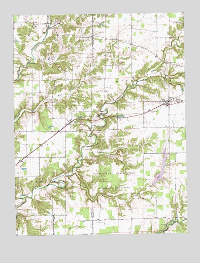
Holton, IN USGS Topographic Map
Click on map above to begin viewing in our Map Viewer.

This topographic map contains these locations and features:
Feature Name Type Latitude Longitude GNIS ID View Map
Bear BranchStreamN39.0881°W85.3883°430614View Map
Brush Creek State Fish and Wildlife AreaParkN39.0667°W85.4989°446871View Map
Falling Timber BranchStreamN39.0453°W85.4508°434381View Map
Finch BranchStreamN39.1014°W85.4850°434482View Map
HoltonPopulated PlaceN39.0751°W85.3872°436345View Map
Holton Elementary SchoolSchoolN39.0726°W85.3880°447137View Map
Holton Police DepartmentBuildingN39.0751°W85.3875°2758251View Map
Hopewell ChurchChurchN39.1081°W85.4139°436455View Map
JacksonPopulated PlaceN39.0651°W85.4414°449042View Map
Leatherwood CreekStreamN39.1178°W85.4736°437713View Map
Leatherwood Lake DamDamN39.1217°W85.4616°447814View Map
Little Arlington CemeteryCemeteryN39.0695°W85.4002°437984View Map
Little Otter CreekStreamN39.0892°W85.3994°438106View Map
Little Otter ForkStreamN39.0359°W85.4577°438108View Map
NebraskaPopulated PlaceN39.0637°W85.4594°439964View Map
Old Hopewell CemeteryCemeteryN39.0964°W85.3863°440571View Map
Old Timber LakeReservoirN39.0308°W85.3925°448699View Map
Old Timber Lake DamDamN39.0284°W85.4000°448698View Map
Old Timbers LodgeParkN39.0048°W85.3905°440604View Map
Old Zenas CemeteryCemeteryN39.1206°W85.4855°440624View Map
Otter Creek CemeteryCemeteryN39.0723°W85.4727°440742View Map
Otter Creek Township Holton Volunteer Fire DepartmentBuildingN39.0743°W85.3870°2625977View Map
Saint Bridget CemeteryCemeteryN39.0592°W85.4536°442507View Map
Sugar CreekStreamN39.1245°W85.4739°444319View Map
Town of HoltonCivilN39.0752°W85.3846°2396998View Map
Township of ColumbiaCivilN39.1218°W85.4928°453241View Map
Township of Otter CreekCivilN39.0932°W85.3879°453698View Map
ZenasPopulated PlaceN39.1201°W85.4750°446431View Map
Zenas CemeteryCemeteryN39.1148°W85.4780°446432View Map
Zenas Elementary SchoolSchoolN39.1203°W85.4758°447491View Map

Note: Coordinates in the location and feature list above are referenced to NAD83 datum.


Copyright (C) 2008-2025 Ryan Niemi / Sunset Dynamics ... All Rights Reserved