TopoQuest Logo
Do you find TopoQuest useful?
Help keep TopoQuest running and adding new maps/features by donating!
Bitcoin:  19c7KJd3qBynnjoSw5npx9KScwjBe4ifkT
Litecoin:  LXs6TkuXGGXo1vDsWCkWVdjQX94eUKd6ui
Home View Maps Find Maps Find Places Resources & Links


Versailles, Indiana Topographic Map

USGS Map Title: Versailles, IN
USGS Map MRC: 39085A3
DRG (GeoTIFF) Download: o39085a3.tif


Neighboring USGS Topographic Map Quads:


  Millhousen, IN  
39085B4
 

  Osgood, IN  
39085B3
 

  Pierceville, IN  
39085B2
 

  Holton, IN  
39085A4
 

  Versailles, IN  
39085A3
 

  Milan, IN  
39085A2
 

  San Jacinto, IN  
38085H4
 

  Rexville, IN  
38085H3
 

  Cross Plains, IN  
38085H2


Map MRC Location:

N40°
W86°
N40°
W85°
H8 H7 H6 H5 H4 H3 H2 H1
G8 G7 G6 G5 G4 G3 G2 G1
F8 F7 F6 F5 F4 F3 F2 F1
E8 E7 E6 E5 E4 E3 E2 E1
D8 D7 D6 D5 D4 D3 D2 D1
C8 C7 C6 C5 C4 C3 C2 C1
B8 B7 B6 B5 B4 B3 B2 B1
A8 A7 A6 A5 A4 A3 A2 A1
N39°
W86°
N39°
W85°

Versailles, IN USGS 1:24K Topographic Map Preview:
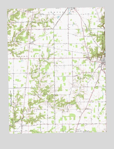
Versailles, IN USGS Topographic Map
Click on map above to begin viewing in our Map Viewer.

This topographic map contains these locations and features:
Feature Name Type Latitude Longitude GNIS ID View Map
Allen CrossingPopulated PlaceN39.1039°W85.3169°430089View Map
Bradshaw CemeteryCemeteryN39.0978°W85.2513°431440View Map
Campfire CreekStreamN39.0139°W85.3577°432089View Map
Cedar CreekStreamN39.0809°W85.2508°432266View Map
Cedar Creek ChurchChurchN39.0959°W85.2677°432269View Map
Coon HollowValleyN39.0380°W85.3347°432933View Map
CorrectPopulated PlaceN39.0087°W85.2863°432992View Map
DabneyPopulated PlaceN39.0901°W85.3469°433280View Map
Francis AirportAirportN39.0862°W85.3684°2677006View Map
Greendale CemeteryCemeteryN39.1248°W85.3072°435432View Map
Holman CemeteryCemeteryN39.0203°W85.2833°436333View Map
Hungry HollowValleyN39.0121°W85.3687°436609View Map
Indiana State Police District 42BuildingN39.0621°W85.2556°2758383View Map
Long BranchStreamN39.1159°W85.3736°438252View Map
New MarionPopulated PlaceN39.0076°W85.3588°440083View Map
New Marion Volunteer Fire DepartmentBuildingN39.0048°W85.3588°2701446View Map
North Fork Graham CreekStreamN39.0303°W85.3363°440251View Map
O'Brien CemeteryCemeteryN39.0748°W85.3519°440384View Map
Otter VillagePopulated PlaceN39.1187°W85.3314°440749View Map
Otter Village CemeteryCemeteryN39.1223°W85.3494°440750View Map
Ripley CountyCivilN39.1035°W85.2624°450385View Map
Sheppard CemeteryCemeteryN39.0128°W85.3708°443359View Map
Southern Ripley County Emergency Life Squad Rescue 69BuildingN39.0783°W85.2744°2719355View Map
Tanglewood ChurchChurchN39.0492°W85.2922°444567View Map
Tanglewood Post Office (historical)Post OfficeN39.0448°W85.2930°453007View Map
Town of VersaillesCivilN39.0639°W85.2565°2397715View Map
VersaillesPopulated PlaceN39.0720°W85.2519°445260View Map
Versailles Elementary SchoolSchoolN39.0717°W85.2555°447138View Map
Versailles Police DepartmentBuildingN39.0707°W85.2520°2758268View Map
Versailles Volunteer Fire DepartmentBuildingN39.0469°W85.2602°2626339View Map

Note: Coordinates in the location and feature list above are referenced to NAD83 datum.


Copyright (C) 2008-2025 Ryan Niemi / Sunset Dynamics ... All Rights Reserved