TopoQuest Logo
Do you find TopoQuest useful?
Help keep TopoQuest running and adding new maps/features by donating!
Bitcoin:  19c7KJd3qBynnjoSw5npx9KScwjBe4ifkT
Litecoin:  LXs6TkuXGGXo1vDsWCkWVdjQX94eUKd6ui
Home View Maps Find Maps Find Places Resources & Links


Honeydew, California Topographic Map

USGS Map Title: Honeydew, CA
USGS Map MRC: 40124B1
DRG (GeoTIFF) Download: o40124b1.tif


Neighboring USGS Topographic Map Quads:


  Buckeye Mountain, CA  
40124C2
 

  Bull Creek, CA  
40124C1
 

  Weott, CA  
40123C8
 

  Shubrick Peak, CA  
40124B2
 

  Honeydew, CA  
40124B1
 

  Ettersburg, CA  
40123B8


  Shelter Cove, CA  
40124A1
 

  Briceland, CA  
40123A8


Map MRC Location:

N41°
W125°
N41°
W124°
H8 H7 H6 H5 H4 H3 H2 H1
G8 G7 G6 G5 G4 G3 G2 G1
F8 F7 F6 F5 F4 F3 F2 F1
E8 E7 E6 E5 E4 E3 E2 E1
D8 D7 D6 D5 D4 D3 D2 D1
C8 C7 C6 C5 C4 C3 C2 C1
B8 B7 B6 B5 B4 B3 B2 B1
A8 A7 A6 A5 A4 A3 A2 A1
N40°
W125°
N40°
W124°

Honeydew, CA USGS 1:24K Topographic Map Preview:
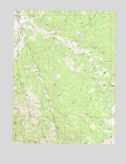
Honeydew, CA USGS Topographic Map
Click on map above to begin viewing in our Map Viewer.

This topographic map contains these locations and features:
Feature Name Type Latitude Longitude GNIS ID View Map
Alder SpringSpringN40.2109°W124.0305°218107View Map
Bear Trap CreekStreamN40.2321°W124.1159°218883View Map
Bearwallow RidgeRidgeN40.1888°W124.1212°218927View Map
Big GulchValleyN40.2310°W124.0745°219193View Map
Buckeye RidgeRidgeN40.2010°W124.0278°220042View Map
Dry CreekStreamN40.2299°W124.0637°222630View Map
Duncan CreekStreamN40.2090°W124.0495°222715View Map
Duncan FlatFlatN40.1938°W124.0417°222716View Map
Duncan Pre-emptionSummitN40.2021°W124.0134°1658445View Map
East Fork Honeydew CreekStreamN40.2057°W124.1209°222887View Map
Fire HillSummitN40.1271°W124.1195°223516View Map
Fourmile CreekStreamN40.1993°W124.0664°223752View Map
Fox SpringSpringN40.1655°W124.0814°223793View Map
Gilham CreekStreamN40.2129°W124.0412°224166View Map
Grindstone CreekStreamN40.1751°W124.0128°224621View Map
Grindstone OpeningsFlatN40.1788°W124.0042°224622View Map
Harrow CreekStreamN40.1763°W124.0223°224973View Map
HoneydewPopulated PlaceN40.2443°W124.1228°1658771View Map
Honeydew CreekStreamN40.2365°W124.1170°225518View Map
Honeydew PitMineN40.2478°W124.1206°2677937View Map
Honeydew Post OfficePost OfficeN40.2435°W124.1236°2760066View Map
Honeydew Volunteer Fire Company Trower StationBuildingN40.1978°W124.1014°2622154View Map
Hunter PlacePopulated PlaceN40.1793°W124.0153°1658800View Map
Jewett CreekStreamN40.1285°W124.0153°226229View Map
Jewett RidgeRidgeN40.1315°W124.0367°226231View Map
King PeakSummitN40.1568°W124.1242°226592View Map
Lightning TrailTrailN40.1646°W124.1117°227087View Map
Middle CreekStreamN40.2285°W124.0473°228584View Map
Middle RidgeRidgeN40.1982°W124.0245°228615View Map
Mud SpringSpringN40.1919°W124.0126°229258View Map
North Fork Bear CreekStreamN40.1263°W124.0625°229641View Map
Phronies FlatFlatN40.1976°W124.0311°230613View Map
Pringle RidgeRidgeN40.2215°W124.0598°231061View Map
Rail Pile RidgeRidgeN40.1929°W124.0228°231172View Map
Saddle MountainSummitN40.1257°W124.1006°234600View Map
Scott PlacePopulated PlaceN40.2065°W124.0334°1659613View Map
Sholes CreekStreamN40.1882°W124.0359°233044View Map
South Fork Bear CreekStreamN40.1263°W124.0628°234968View Map
Stewart RidgeRidgeN40.2382°W124.0353°235467View Map
Westlund CreekStreamN40.2282°W124.0414°237556View Map
Westlund PlacePopulated PlaceN40.2338°W124.0173°1660153View Map
Wilder RidgeRidgeN40.1849°W124.0889°237809View Map

Note: Coordinates in the location and feature list above are referenced to NAD83 datum.


Copyright (C) 2008-2024 Ryan Niemi / Sunset Dynamics ... All Rights Reserved