TopoQuest Logo
Do you find TopoQuest useful?
Help keep TopoQuest running and adding new maps/features by donating!
Bitcoin:  19c7KJd3qBynnjoSw5npx9KScwjBe4ifkT
Litecoin:  LXs6TkuXGGXo1vDsWCkWVdjQX94eUKd6ui
Home View Maps Find Maps Find Places Resources & Links


Shubrick Peak, California Topographic Map

USGS Map Title: Shubrick Peak, CA
USGS Map MRC: 40124B2
DRG (GeoTIFF) Download: o40124b2.tif


Neighboring USGS Topographic Map Quads:


  Petrolia, CA  
40124C3
 

  Buckeye Mountain, CA  
40124C2
 

  Bull Creek, CA  
40124C1
 

  Cooskie Creek, CA  
40124B3
 

  Shubrick Peak, CA  
40124B2
 

  Honeydew, CA  
40124B1


  Shelter Cove, CA  
40124A1


Map MRC Location:

N41°
W125°
N41°
W124°
H8 H7 H6 H5 H4 H3 H2 H1
G8 G7 G6 G5 G4 G3 G2 G1
F8 F7 F6 F5 F4 F3 F2 F1
E8 E7 E6 E5 E4 E3 E2 E1
D8 D7 D6 D5 D4 D3 D2 D1
C8 C7 C6 C5 C4 C3 C2 C1
B8 B7 B6 B5 B4 B3 B2 B1
A8 A7 A6 A5 A4 A3 A2 A1
N40°
W125°
N40°
W124°

Shubrick Peak, CA USGS 1:24K Topographic Map Preview:
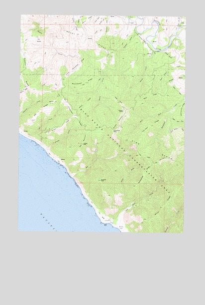
Shubrick Peak, CA USGS Topographic Map
Click on map above to begin viewing in our Map Viewer.

This topographic map contains these locations and features:
Feature Name Type Latitude Longitude GNIS ID View Map
Bear Trap RidgeRidgeN40.2131°W124.1339°218886View Map
Big CreekStreamN40.1568°W124.2112°254616View Map
Big FlatFlatN40.1318°W124.1839°254617View Map
Big Flat CreekStreamN40.1279°W124.1759°219187View Map
Big MountainSummitN40.1804°W124.2003°1658055View Map
Black RockIslandN40.1296°W124.1845°219400View Map
Brushy MountainSummitN40.1921°W124.1720°219953View Map
Bundle PrairieFlatN40.2301°W124.1423°220157View Map
California Department of Forestry and Fire Protection Mattole StationBuildingN40.2378°W124.1324°2621907View Map
Cook RidgeRidgeN40.2482°W124.1884°221483View Map
Fiddle PrairieFlatN40.2010°W124.1764°223481View Map
Green RidgeRidgeN40.1985°W124.2006°224558View Map
Hadley PeakSummitN40.1754°W124.2025°224767View Map
Harris RidgeRidgeN40.2490°W124.1995°224966View Map
Honeydew Volunteer Fire CompanyBuildingN40.2339°W124.1550°2622130View Map
Kendall GulchValleyN40.2401°W124.1634°226490View Map
King Crest TrailTrailN40.1679°W124.1414°226586View Map
King RangeRangeN40.1651°W124.1342°226593View Map
King Range WildernessReserveN40.1597°W124.1691°2760109View Map
Kinsey CreekStreamN40.1718°W124.2309°226619View Map
Kinsey RidgeRidgeN40.1921°W124.2095°254855View Map
Little Moorehead RidgeRidgeN40.2185°W124.2092°227304View Map
Miller FlatFlatN40.1276°W124.1717°228736View Map
Miller RidgeRidgeN40.1407°W124.1400°228747View Map
Moody RidgeRidgeN40.2374°W124.2012°229005View Map
Moorehead RidgeRidgeN40.2101°W124.2031°229028View Map
North Fork Big Flat CreekStreamN40.1425°W124.1639°229643View Map
North Slide PeakSummitN40.1832°W124.1800°1659252View Map
Oat CreekStreamN40.1785°W124.2442°254993View Map
Oat HillSummitN40.1999°W124.2250°229906View Map
Oat RidgeRidgeN40.1932°W124.2367°229911View Map
Pinnacle SpringSpringN40.1950°W124.1723°230741View Map
Rattlesnake RidgeRidgeN40.1590°W124.1559°231271View Map
Shubrick PeakSummitN40.1546°W124.1889°233069View Map
Tan Oak RidgeRidgeN40.1865°W124.1517°236004View Map
Telegraph RidgeRidgeN40.1921°W124.2095°236085View Map
Upper North Fork Honeydew CreekStreamN40.1926°W124.1381°217931View Map
Upper North Fork Mattole RiverStreamN40.2432°W124.1312°236907View Map
West Fork Honeydew CreekStreamN40.1963°W124.1348°237472View Map
Woods CreekStreamN40.2310°W124.1495°238155View Map

Note: Coordinates in the location and feature list above are referenced to NAD83 datum.


Copyright (C) 2008-2024 Ryan Niemi / Sunset Dynamics ... All Rights Reserved